


#PF65
Ca. 1890s
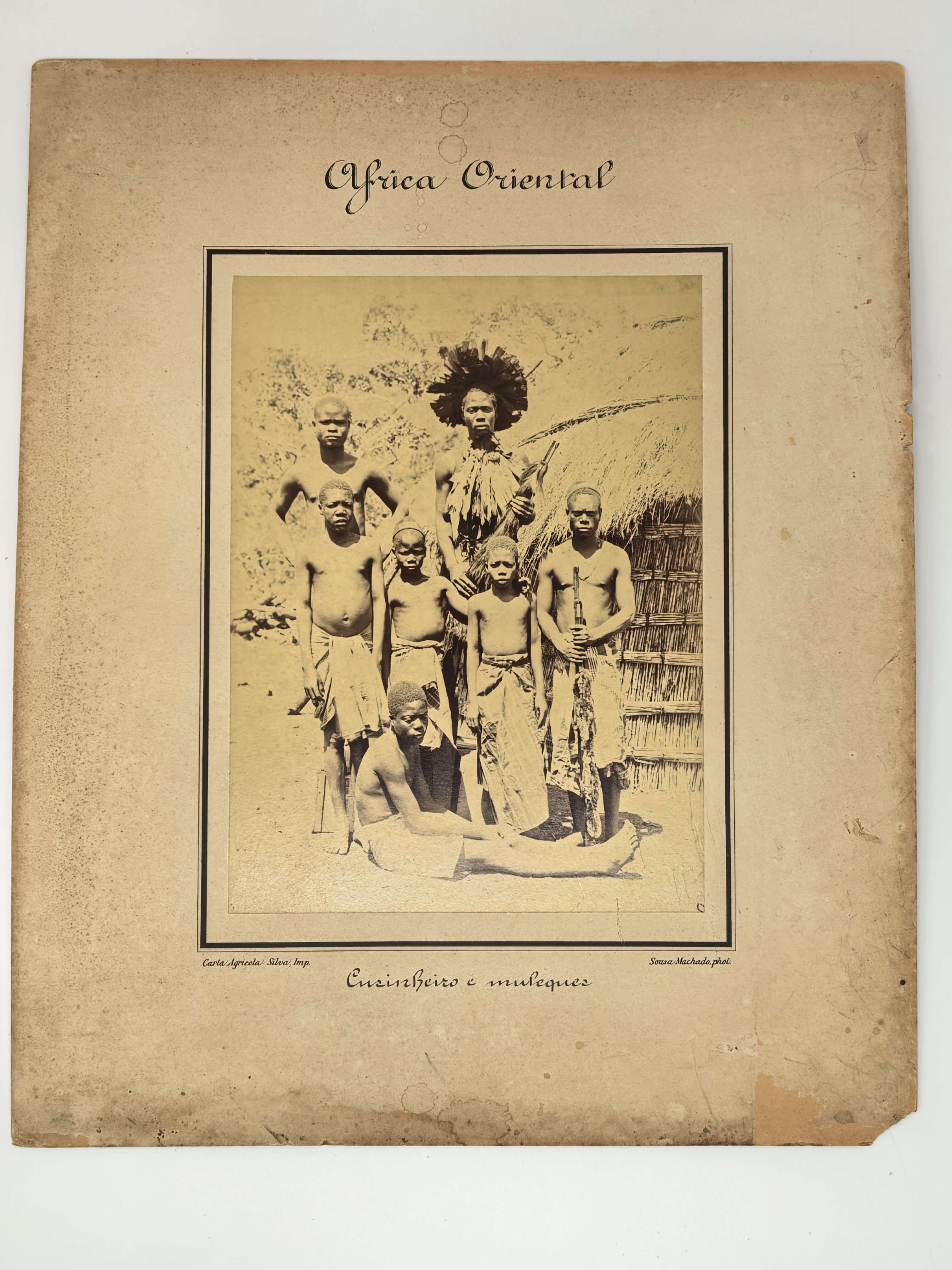
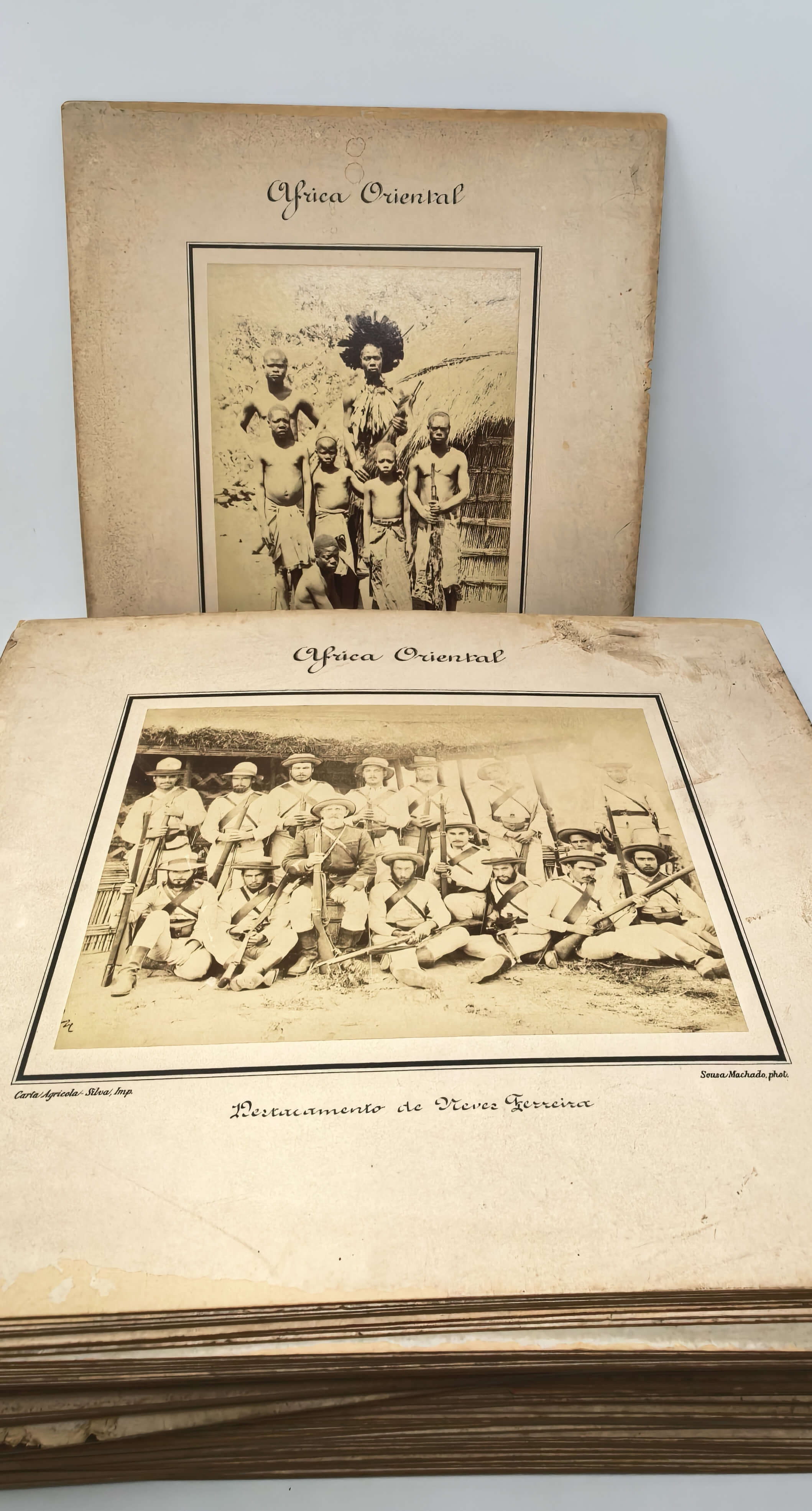
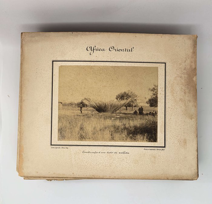
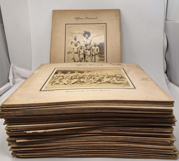
104 original albumen photographs (including eight duplicates), all but two are ca. 15,5x21,5 cm (6 x 8 ¼ in); two smaller images are ca. 11,5x16,5 cm (4 ½ x 6 ½ in). All photos are mounted on original card stock leaves ca. 29,5x36,5 cm (11 ¼ x 14 ¼ in), within printed black borders. All mounts with printed titles (general “Africa Oriental,” all but two smaller images also with specific titles), and credentials of the photographers (“Freire d’Andrade e Serrano, phot.” or “Sousa Machado, phot.”) and of the publishing office (“Carta Agricola-Silva Imp.”). Mounts with different degrees of foxing, about forty with water stains, chipping or damage on the margins, about twenty with losses of corners or parts of margins; Photos with varying degrees of mild to moderate fading; overall a good collection of interesting rare photos.
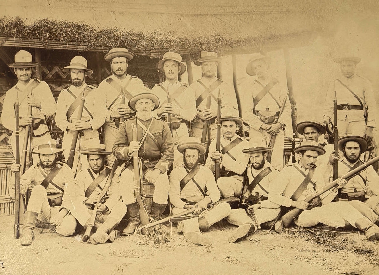
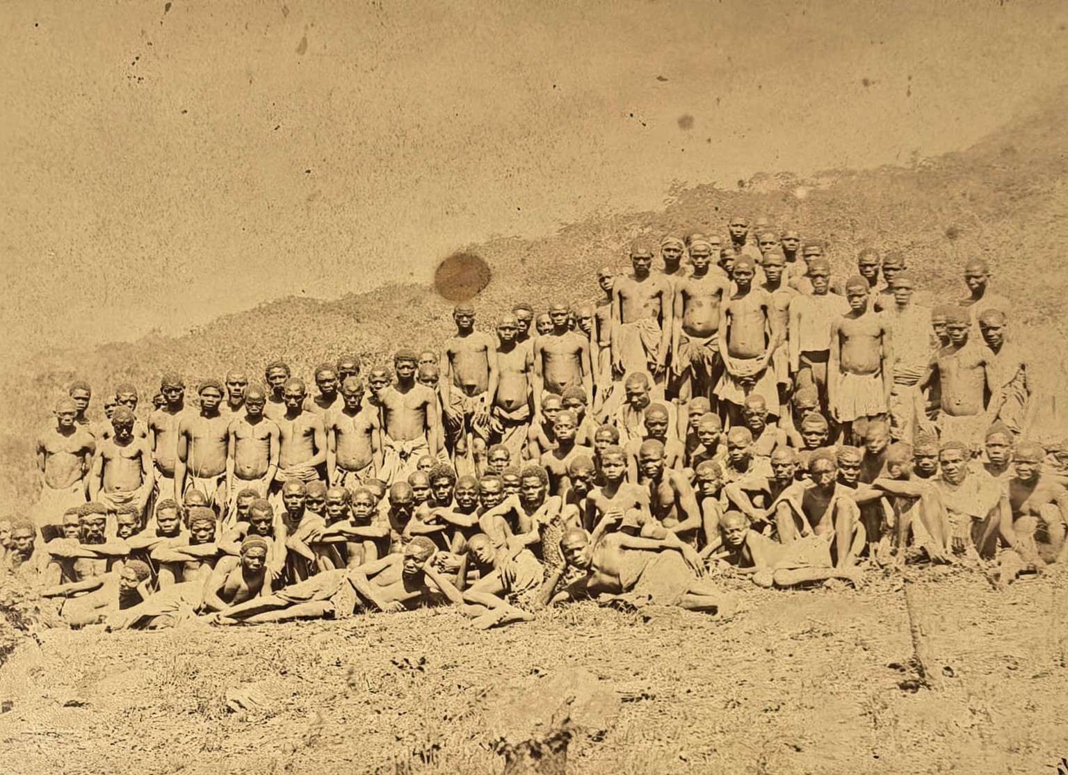
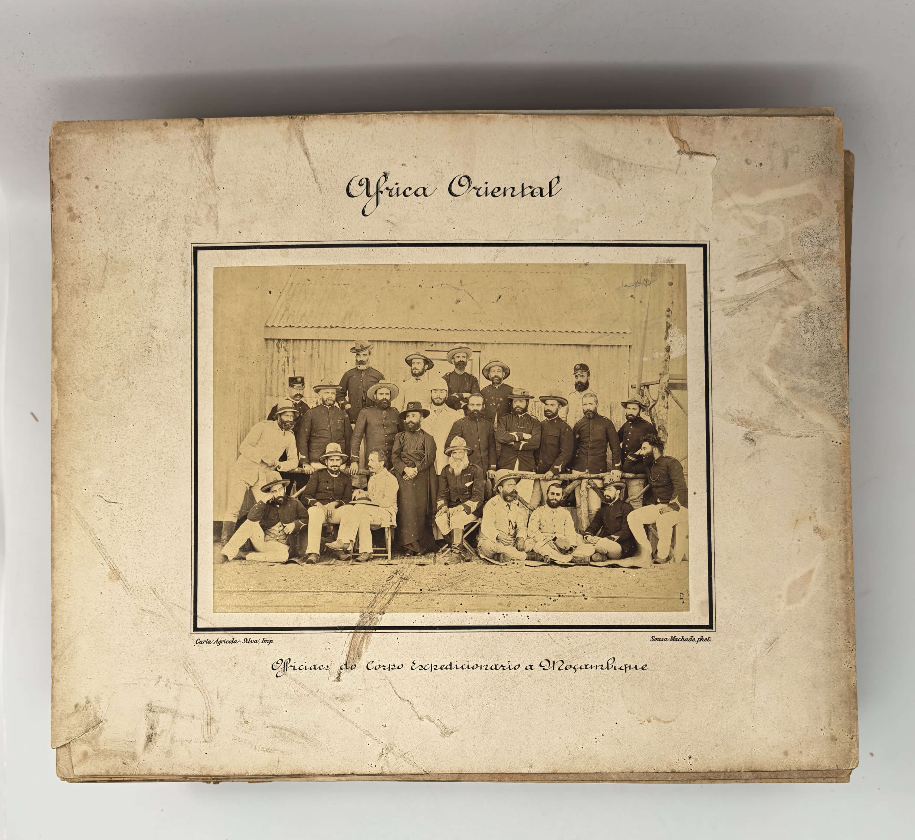
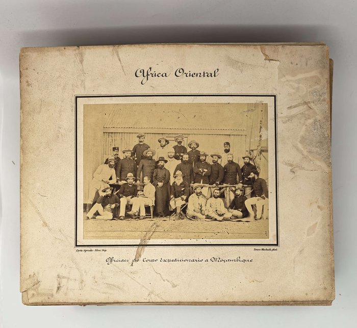
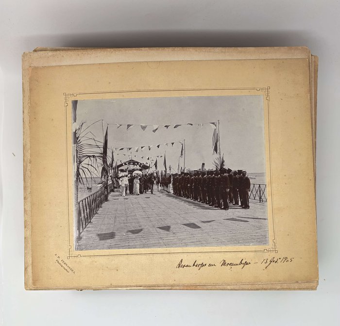
Historically significant extensive collection of 104 large original albumen photographs, documenting Portuguese initiative in the 1890s to solidify the western border of their colony in East Africa (Portuguese Mozambique) – with the Boer Transvaal or South African Republic (modern-day South Africa) and the newly chartered territory of the British South Africa Company, later known as Southern Rhodesia (modern-day Zimbabwe). The tension between Britain and Portugal over their territories in East Africa rose in the late 1880s, after it became obvious that the former was expanding its influence into the new regions of Southern Africa (Matabeleland and Mashonaland), seeking the gateway to the Indian Ocean, which led through the Portuguese possessions between the Zambezi and Limpopo Rivers. The Royal charter to the British South Africa Company in 1889 empowered its founder, Cecil Rhodes, to sign a treaty with Lobengula, one of the chiefs on the Manica borderlands, which encroached on the Portuguese sphere of influence (parts of modern-day Manicaland in Zimbabwe and bordering Manica Province of Mozambique). This led to an armed conflict between Portuguese and BSAF forces in November 1890 – May 1891, which resulted in the British capture of Massi Kessi, a Portuguese fort close to the border. The Anglo-Portuguese boundary treaty, signed on June 11, 1891, had the captured Portuguese territories in the Manica region returned, but permission was granted to the British to construct a railway to the Indian Ocean along the Pungwe River.
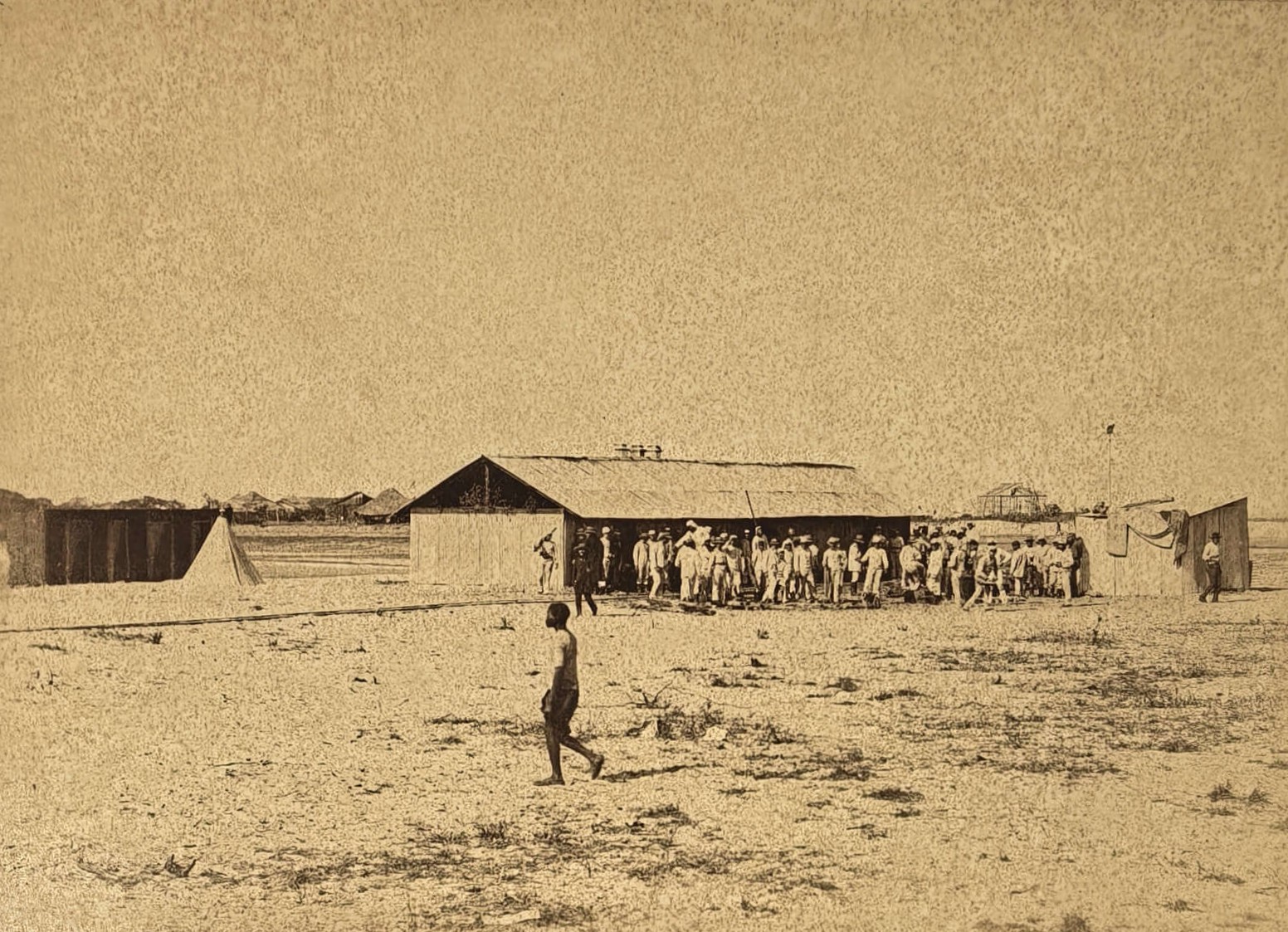
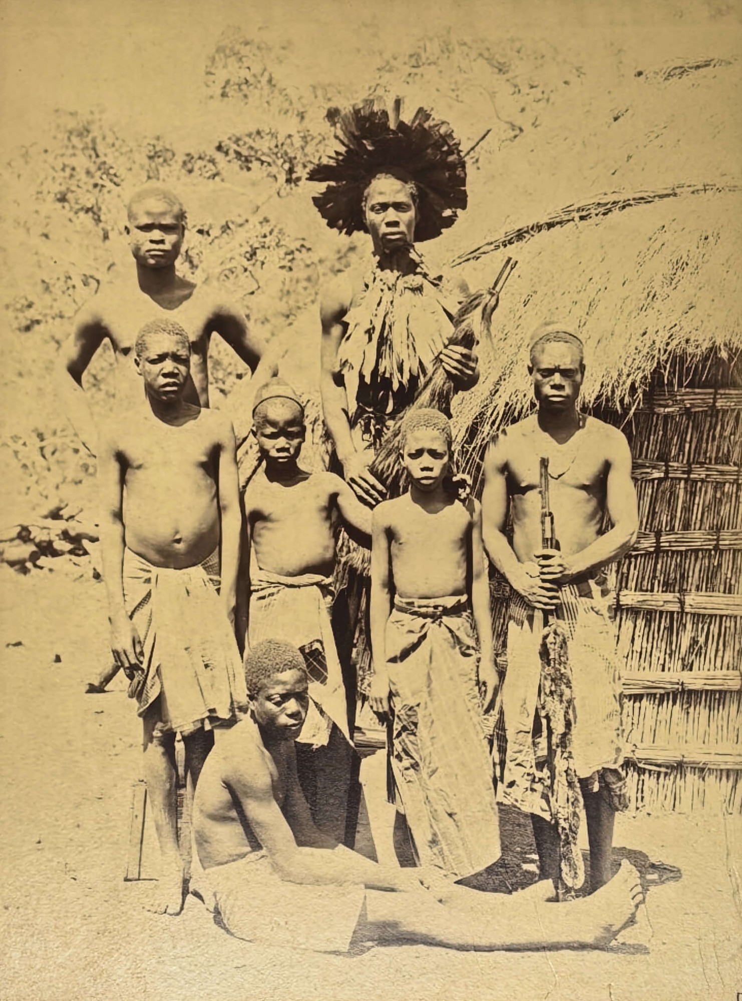
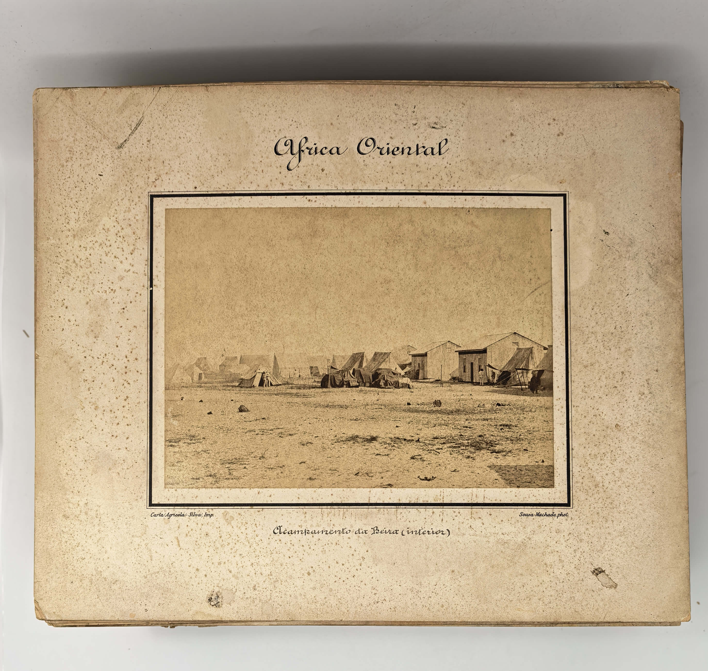
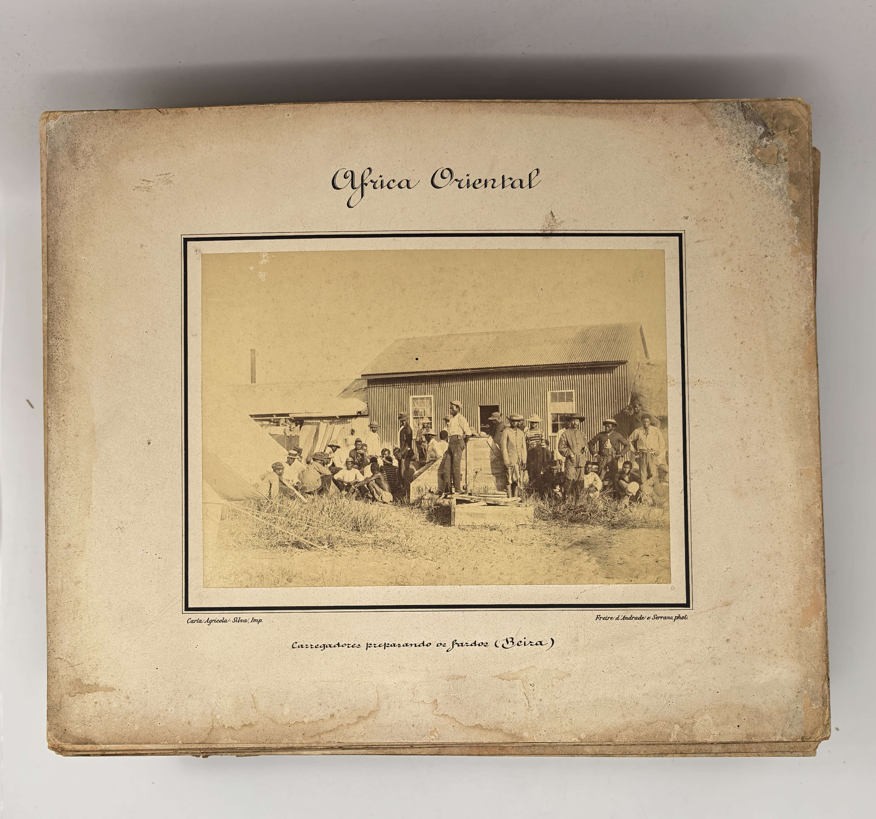
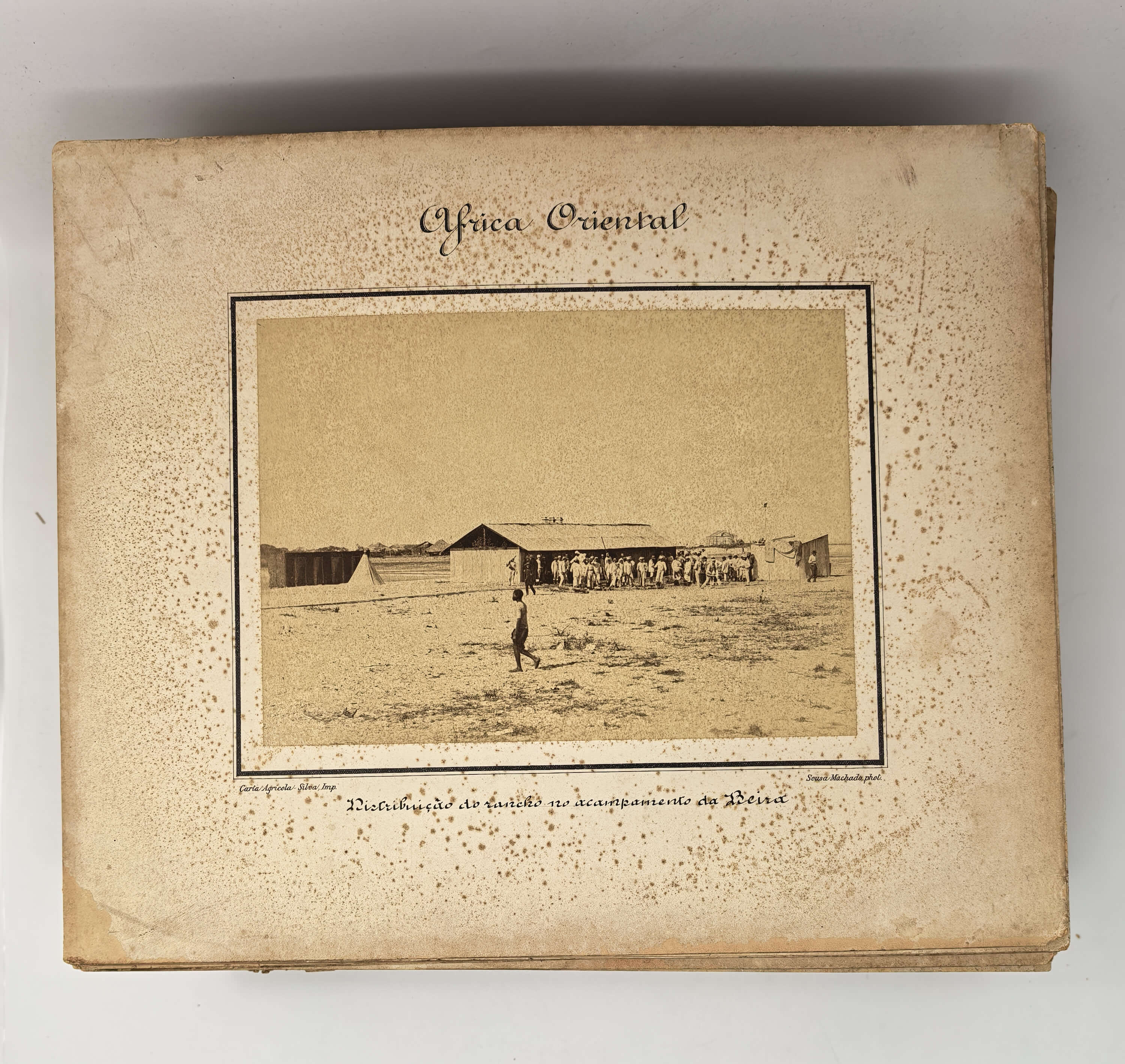
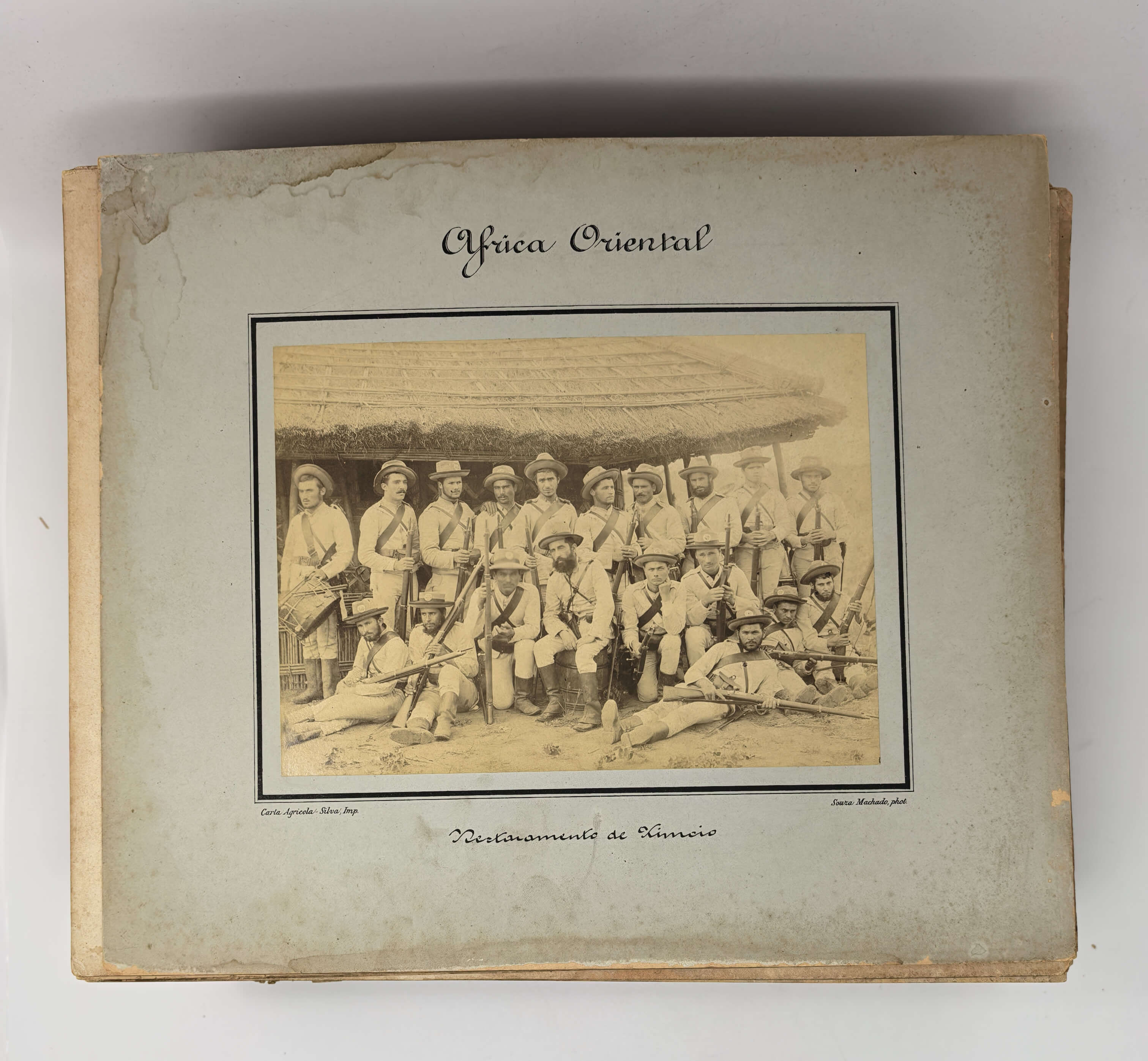
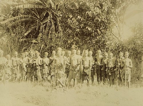
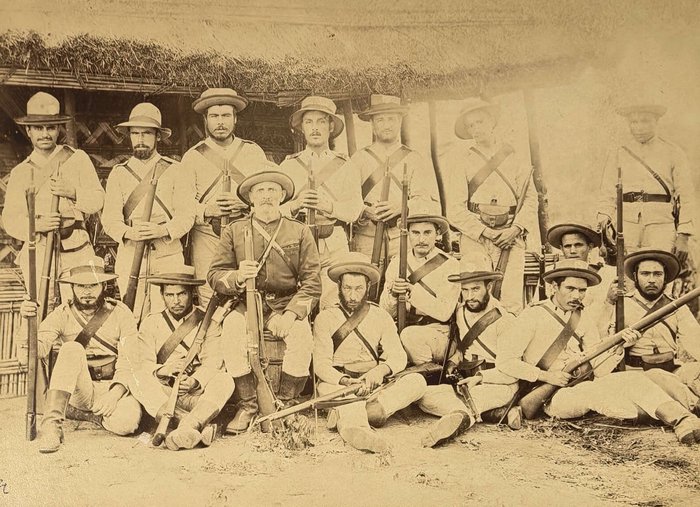
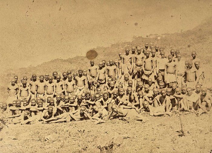
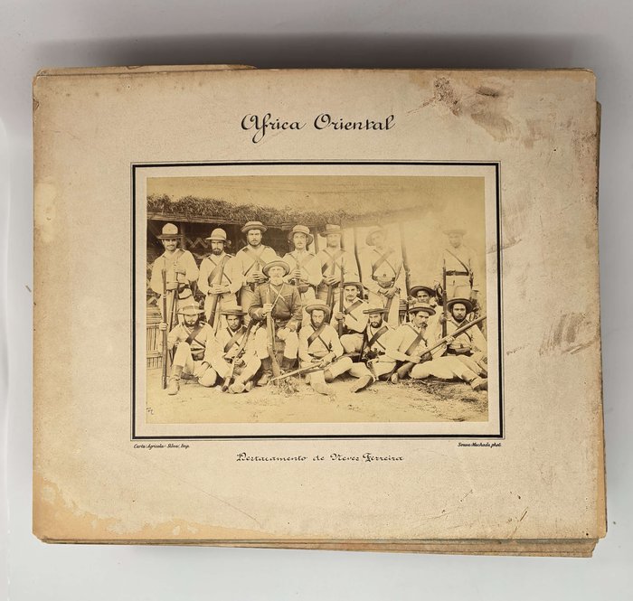
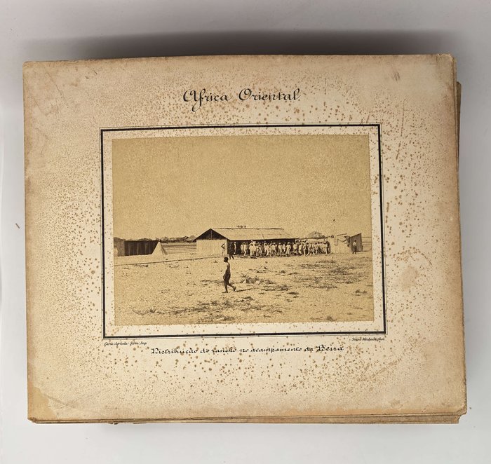
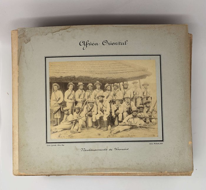
The photographs from the collection date back to the early 1890s – possibly before or shortly after the Anglo-Portuguese conflict in Manicaland. Four photos are group portraits of the commanders and servicemen of the “Corpo Expedicionário a Moçambique,” whose leader, Manuel de Sousa Machado, took a larger part of the photographs from the collection. The images portray “Oficiaes do Corpo Expedicionário a Moçambique” and members of the Corps’ detachments in Neves Ferreira (Pungwe River), Chimoio (the capital of Manica Province) and Massi Kesse.
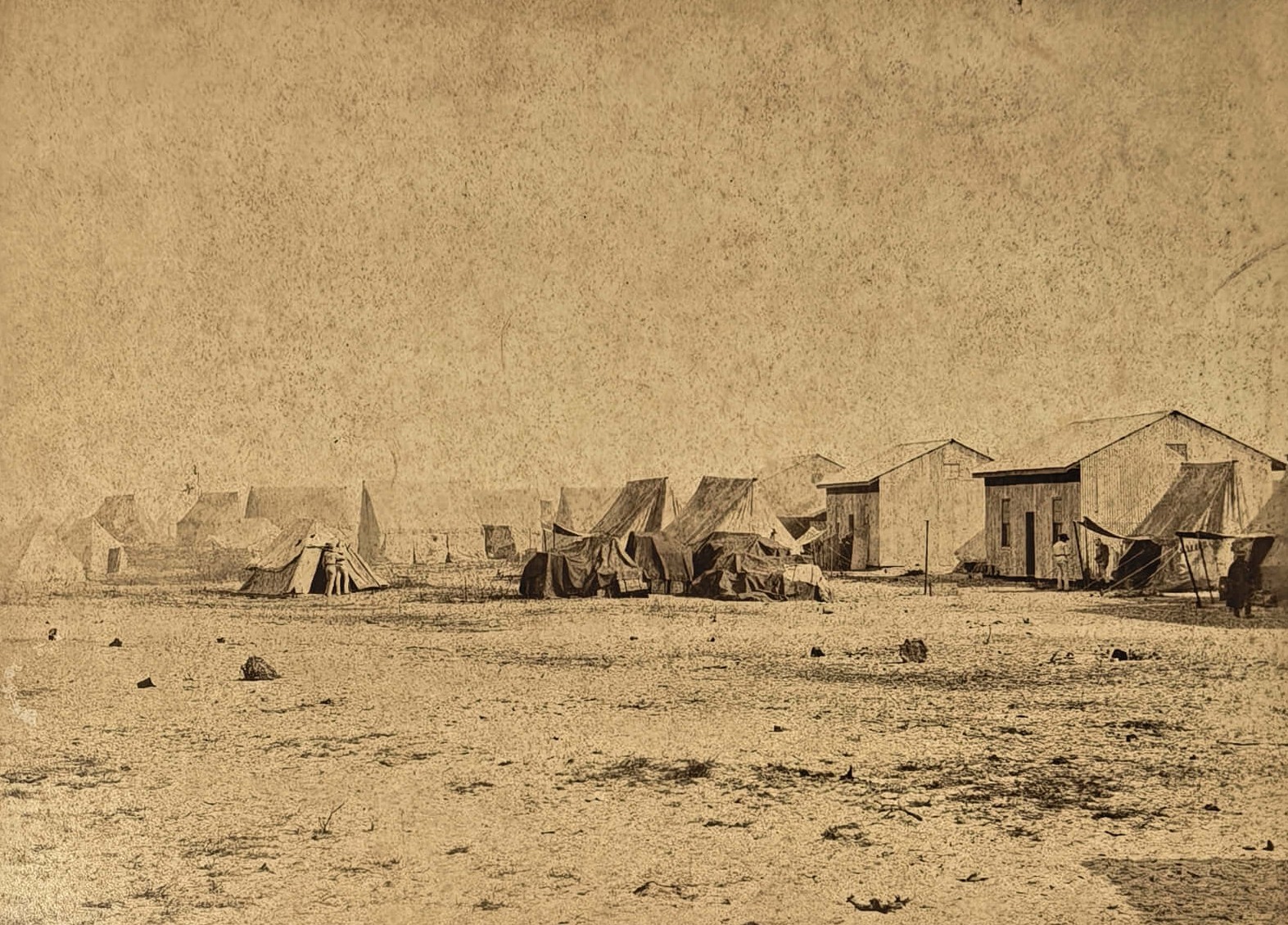
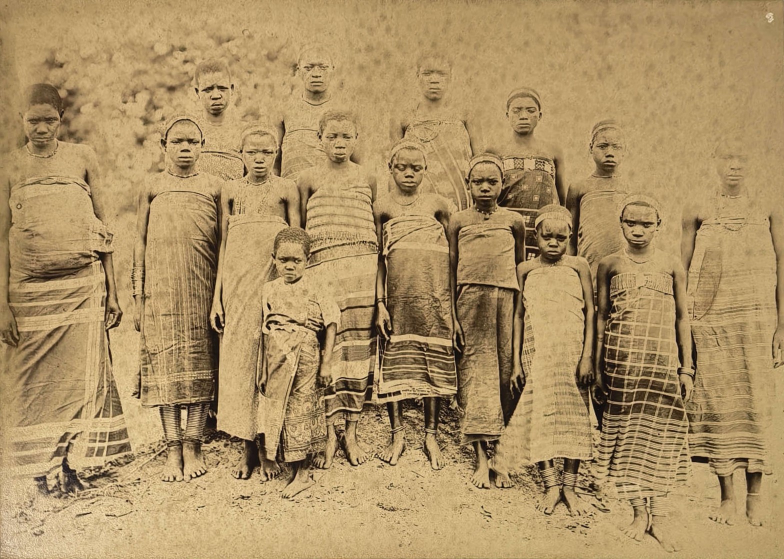
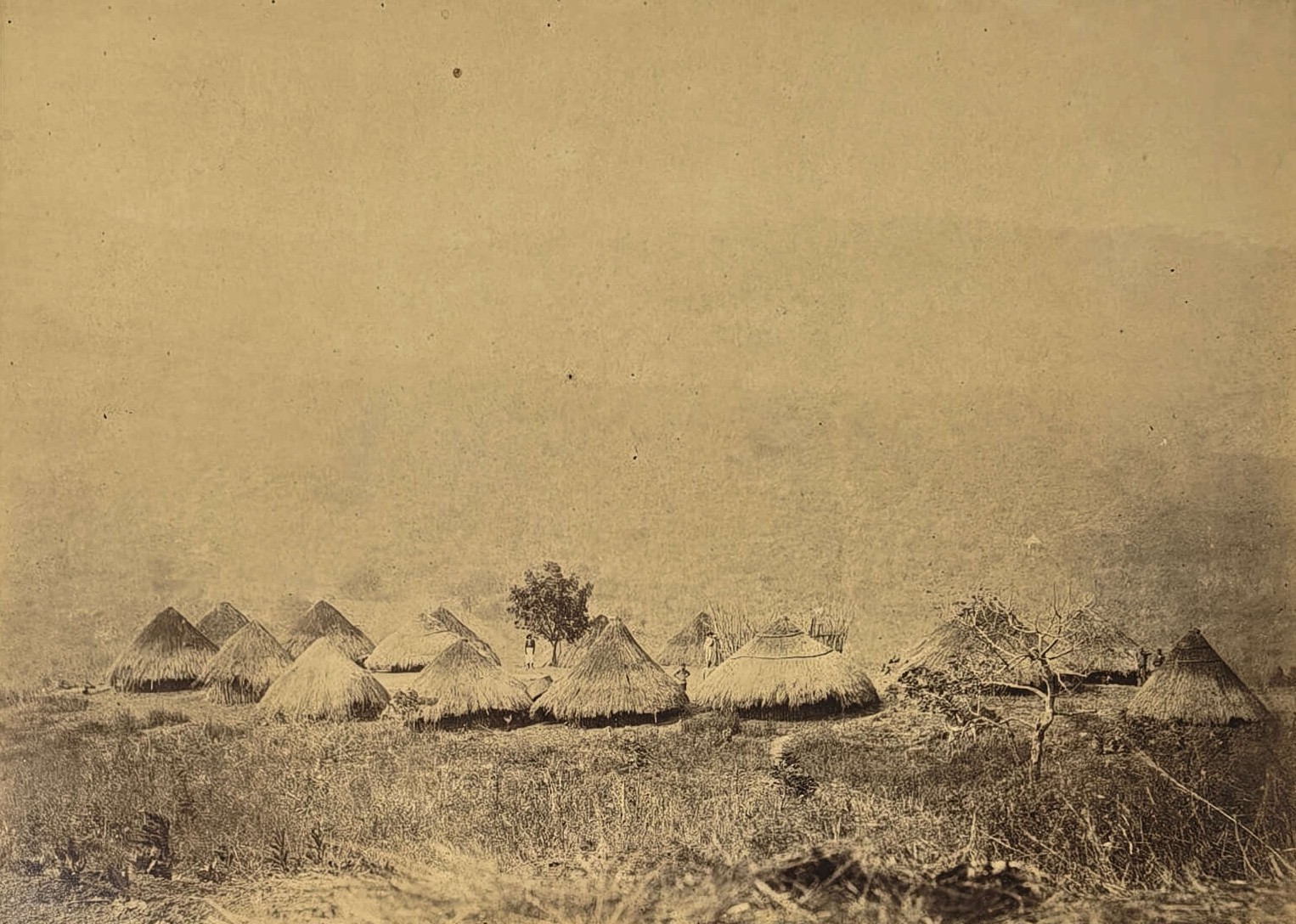
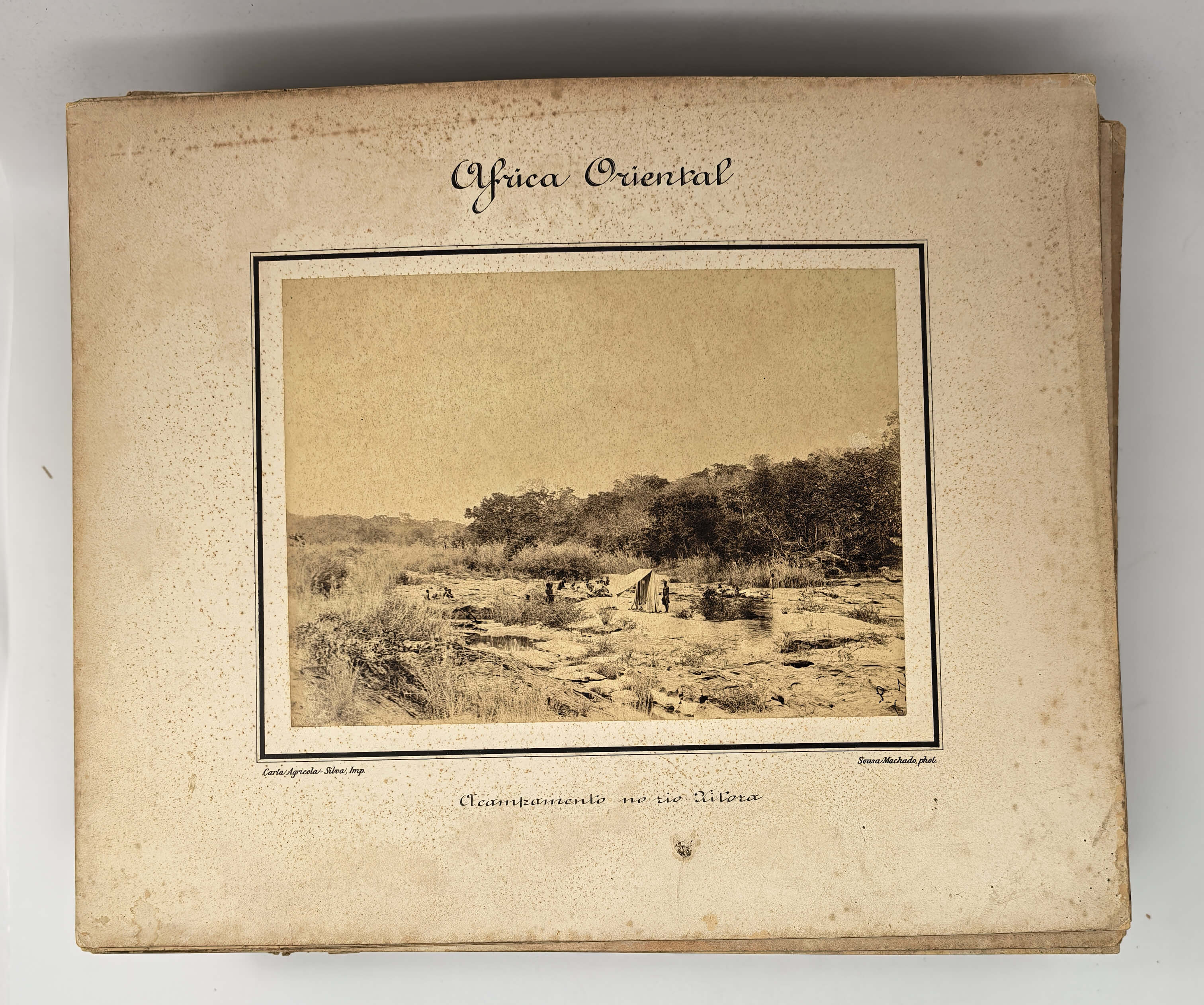
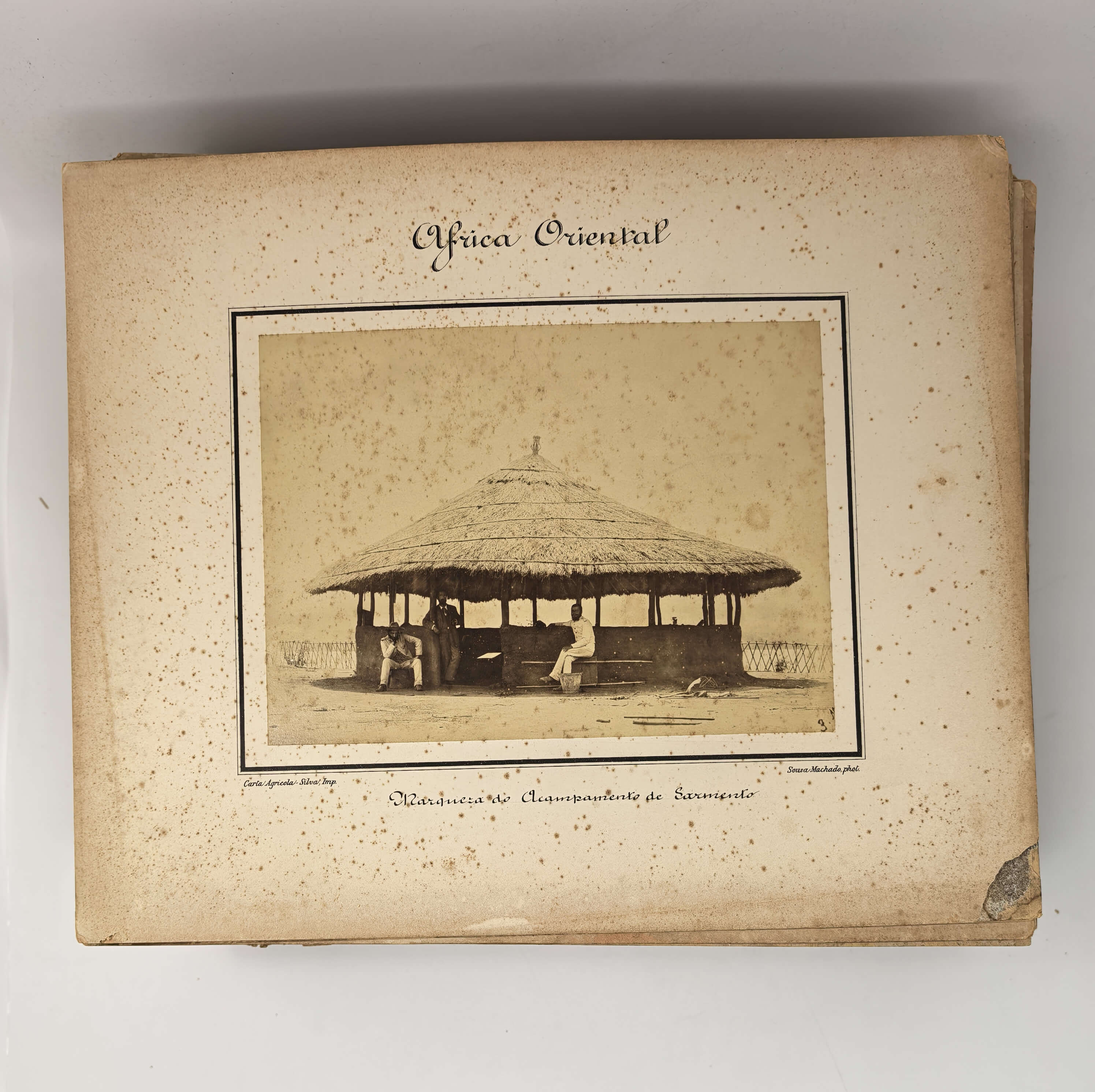
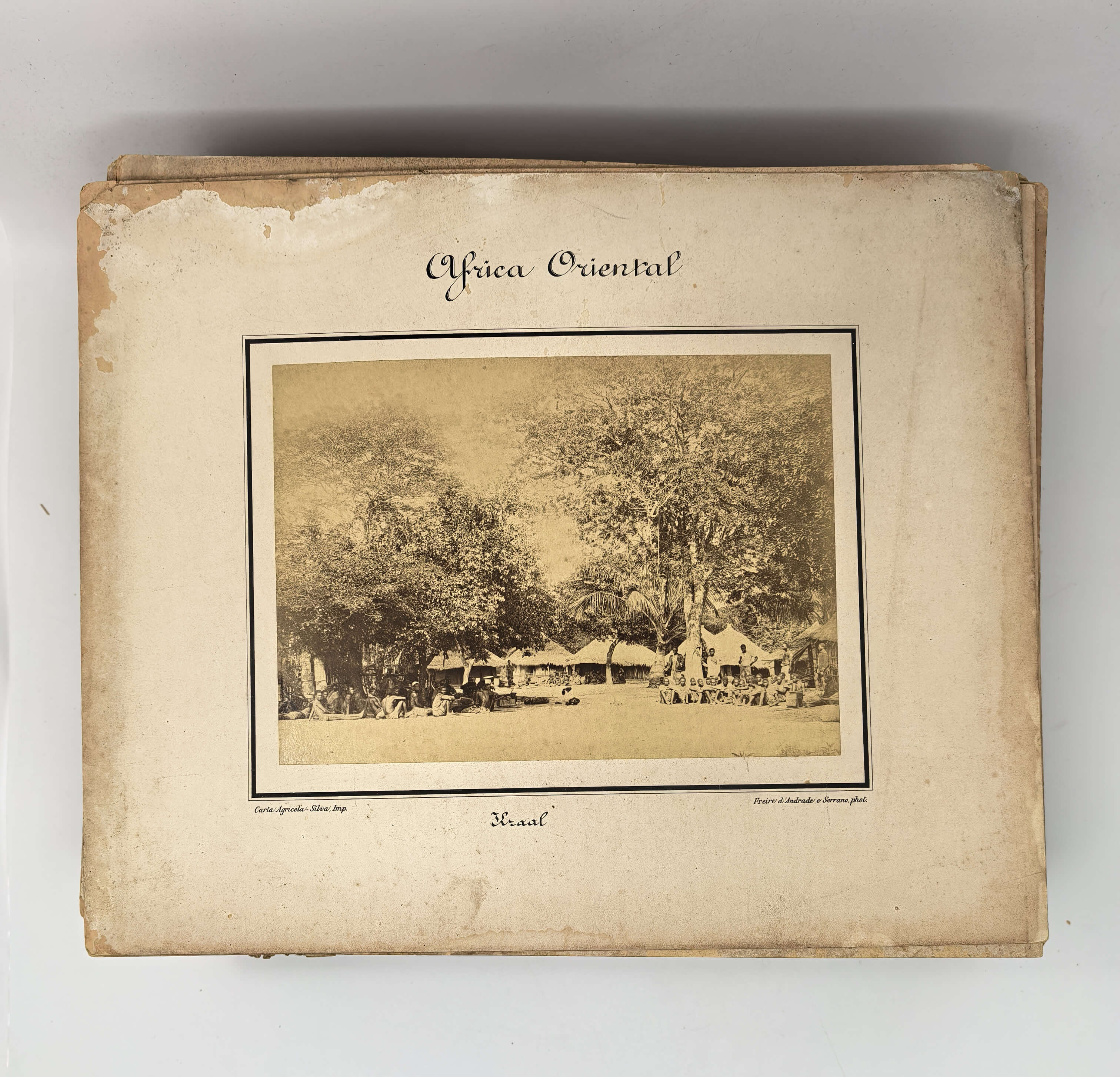
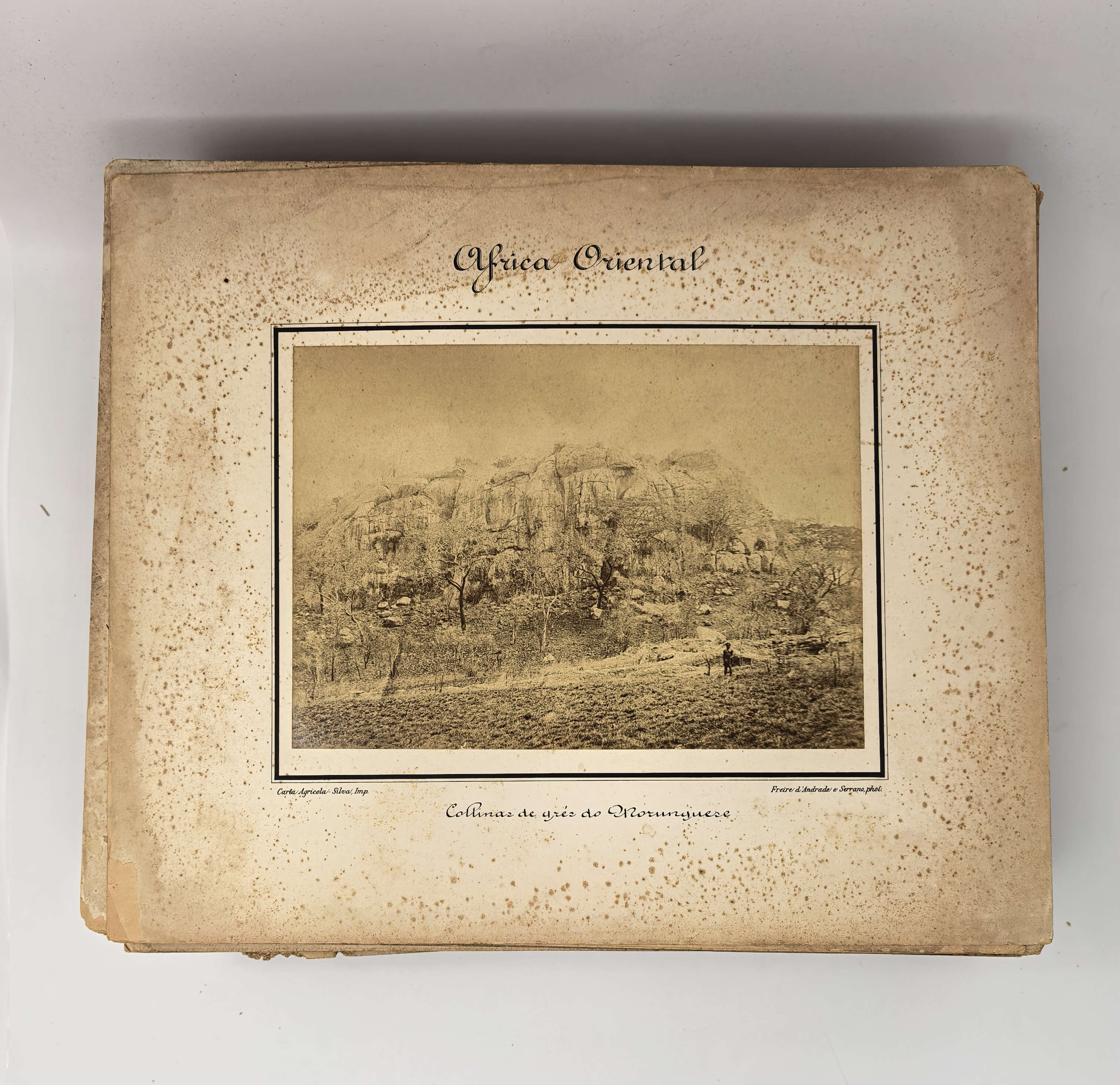
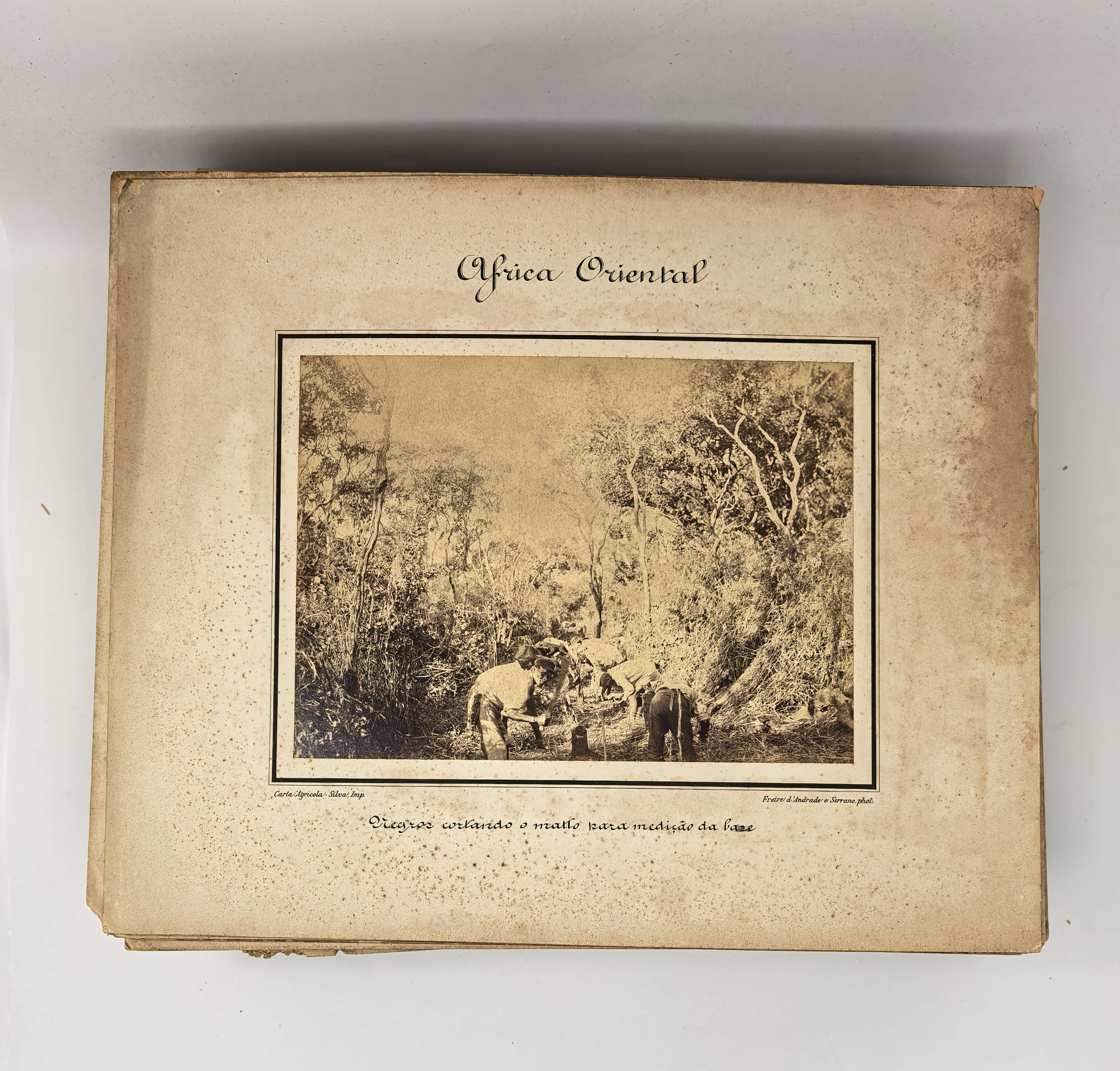
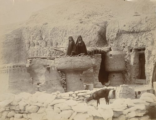
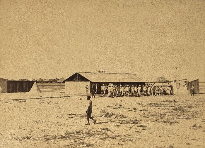
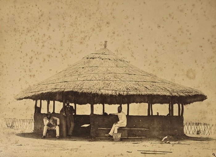
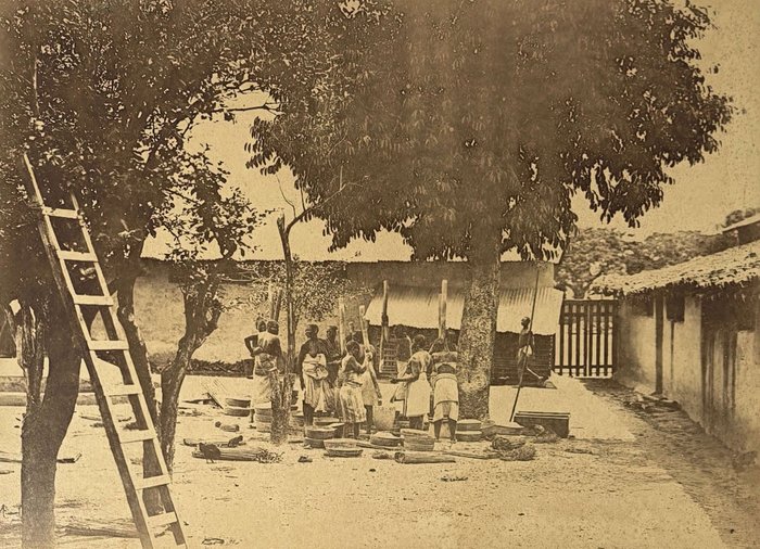
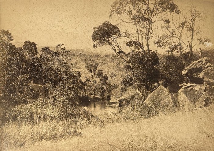
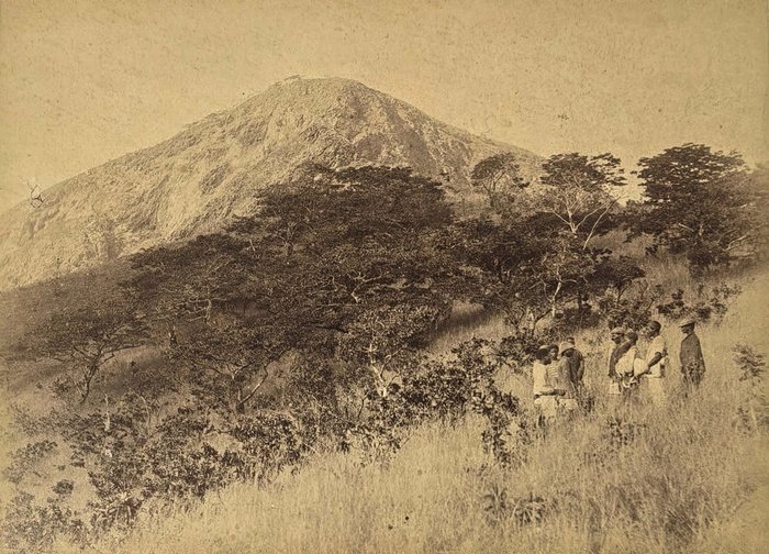
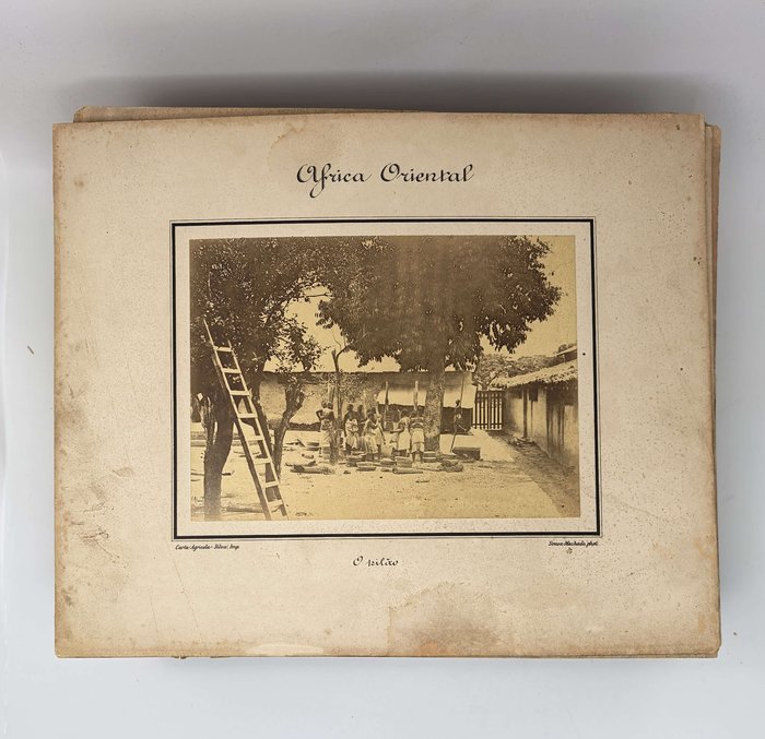
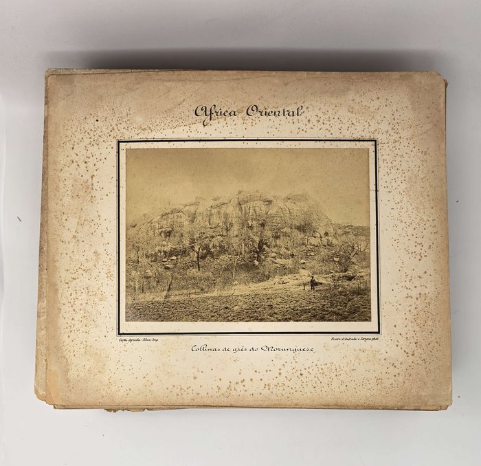
Over forty photographs document the Portuguese survey expedition to the western frontier of the Manica province. The images of Pungwe River and its tributaries (Rio Vunduzi, Rio Xitora/Txatora and Rio Inhamucarara/Inyamkarara), as well as of Buzi River and its tributary Revue River, show river valleys, the town of Sarmento, villages and expedition camps in Neves Ferreira, Sarmento, on Vunduzi, Txatora and Revue Rivers. There are also views of Chimoio and nearby mountains, “Villa de Gouvea” (Catandica, near modern-day border with Zimbabwe), “valle de Menene,” “Rio Zonoe” (Zonue), Chimanimani Mountains (general view, quartz boulders), expedition camps in “Mussurize” (Mossurize district), “Mandanjiva,” on the “Muahira” and “Mussica” Rivers, “kraal de Murivani” (Moribane), “Monte Gorungue,” “Monte Panka” (Panga), Portuguese frontier post in Massi Kessi (general view, customs post, interior of the fort), &c. The photos were evidently intended for official use; identical images were found in the digital collections of the Arquivo Cientifico Tropical in Portugal (see more).
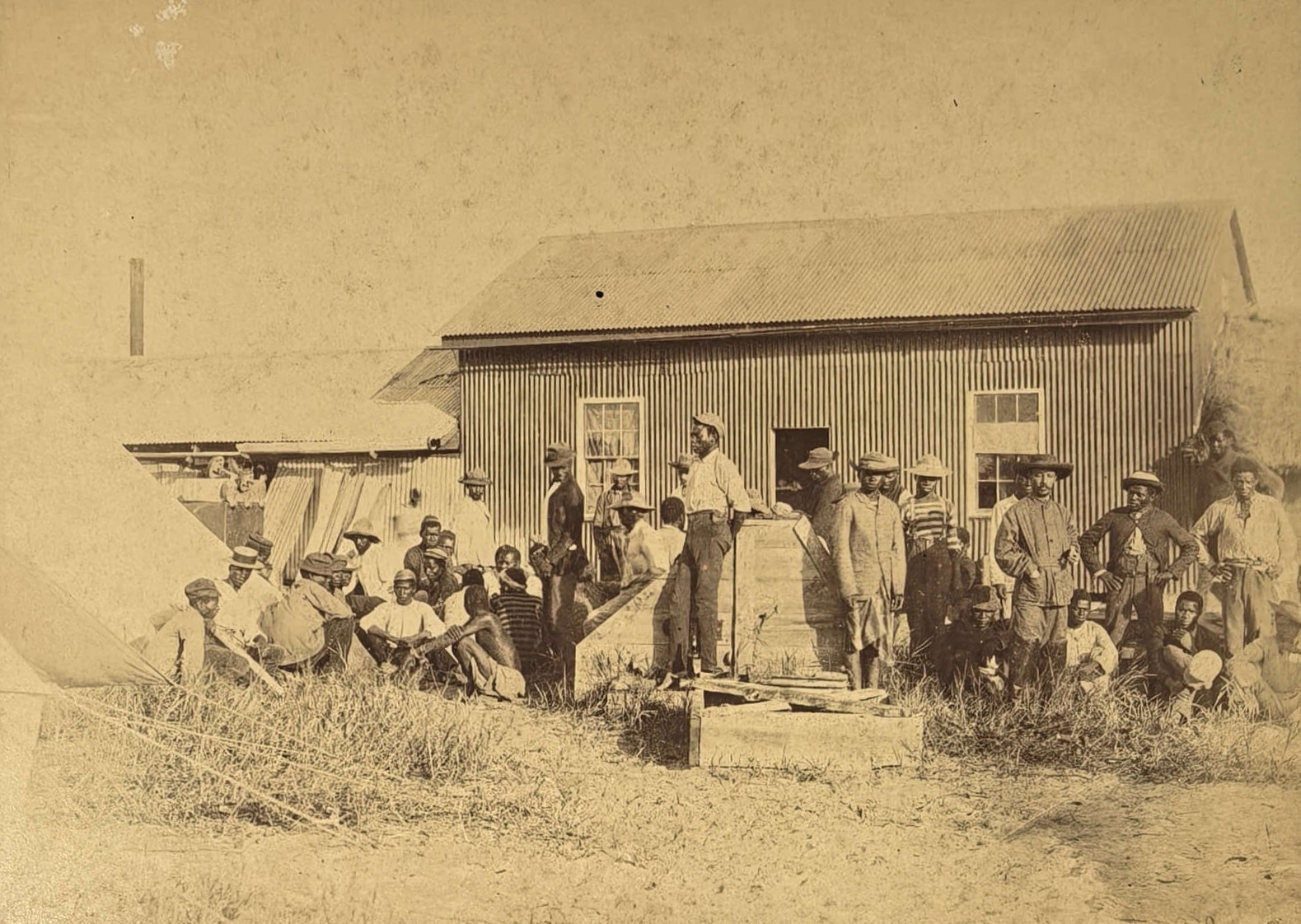
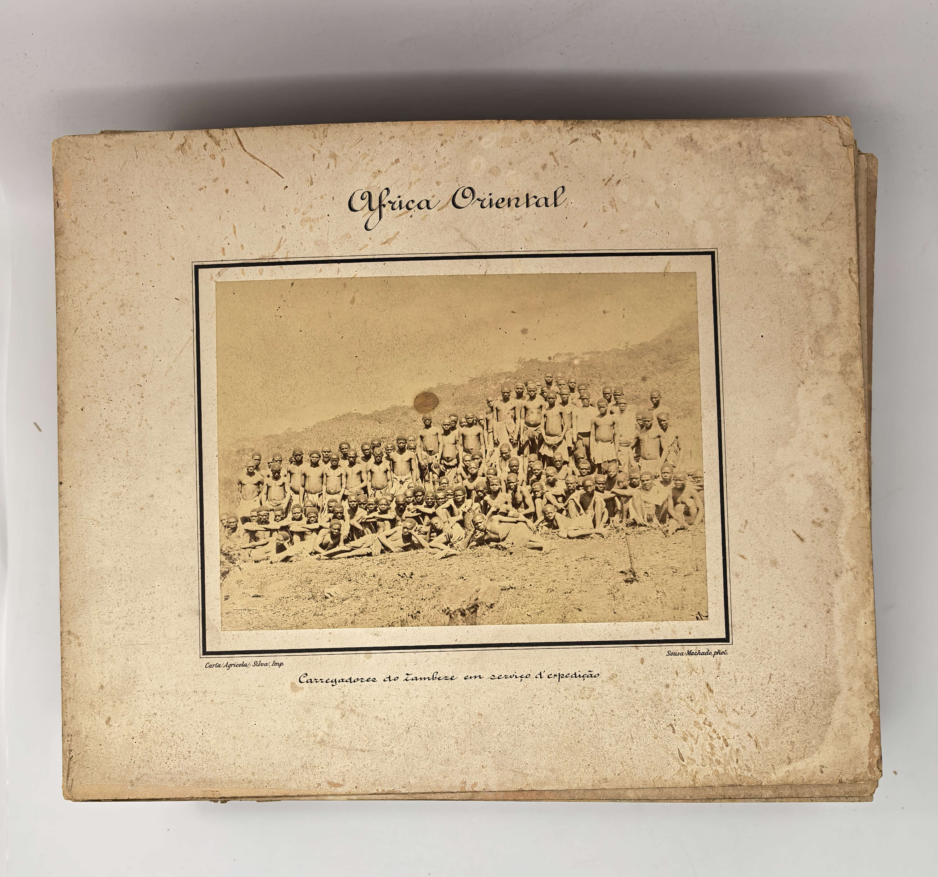
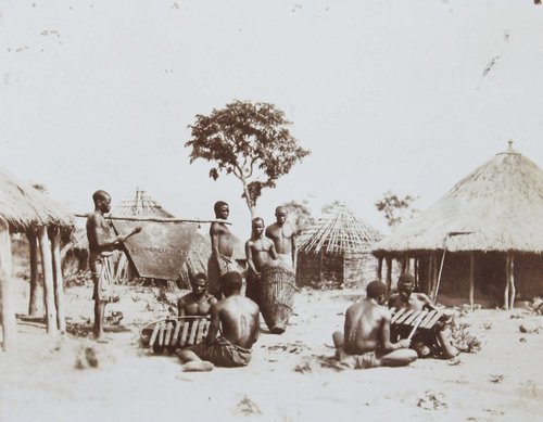
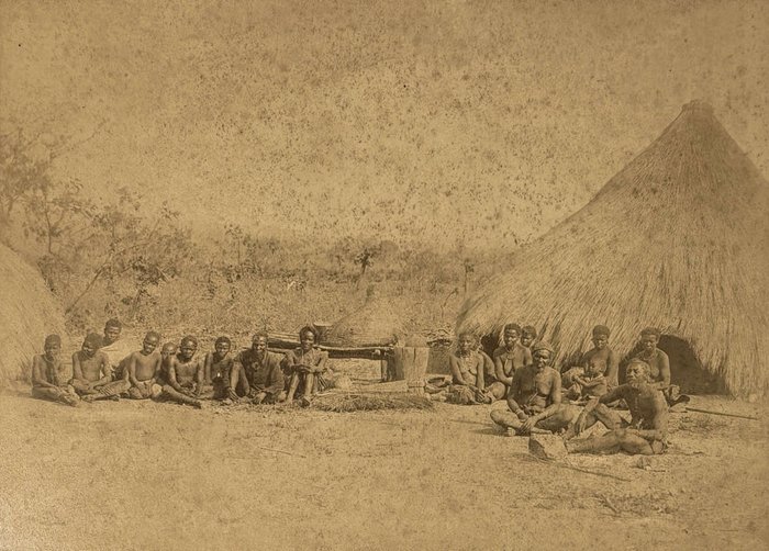
Over a dozen images follow the 1890 expedition of the delimitation commission, headed by Alfredo Freire de Andrade, a Portuguese military officer and future General Governor of Mozambique (in office: 1906-1910), to the border between the Lourenço Marques Province (now Maputo Province) of Mozambique and the Transvaal/South African Republic in 1890. The images show a bridge over the Inkomati/Komati River under construction, Komati’s tributary Save/Sabie River (native porters crossing the river, waterfalls, confluence with its tributary Lundi River); Komati’s tributary Uanetzi River; confluence of the Limpopo River and its tributary Pafuri River (on the border of Portuguese Mozambique, Transvaal and Rhodesia), Pafuri River, expedition camp on the confluence of Limpopo and Pafuri, a baobab, a native guide with a hunted antelope, a group portrait of the expedition members and porters. See the digital copies of the images in the Arquivo Cientifico Tropical (see more).
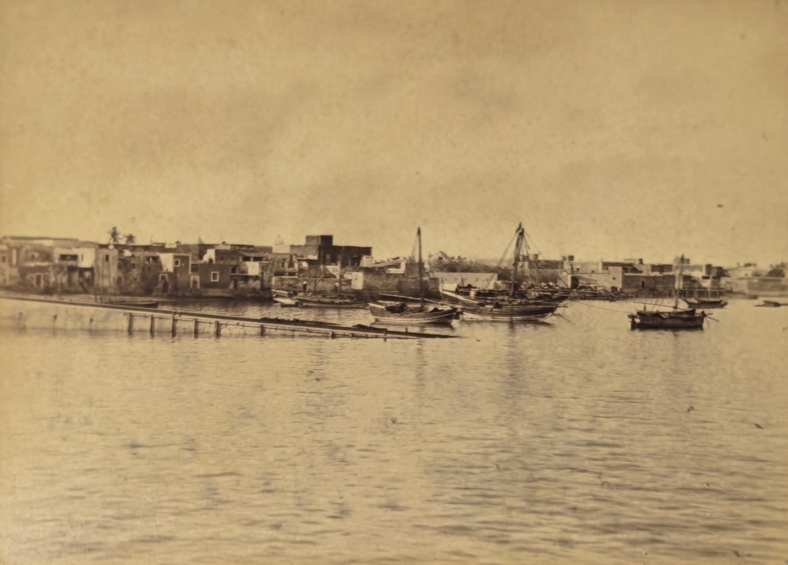
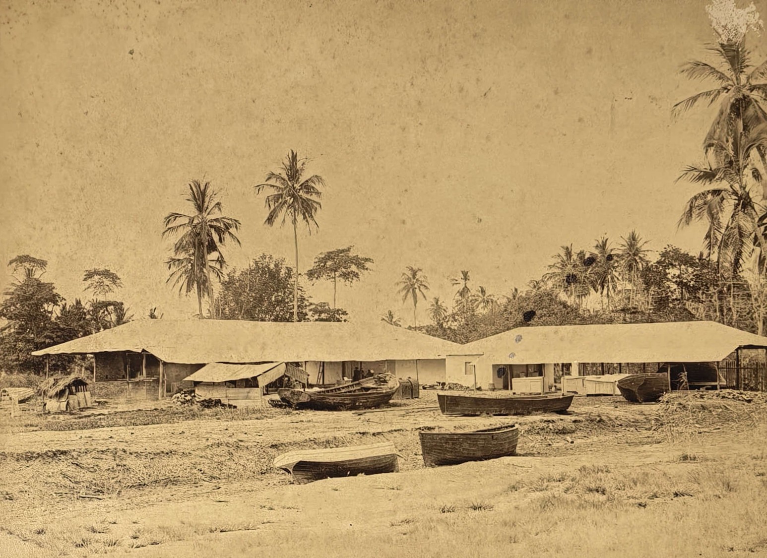
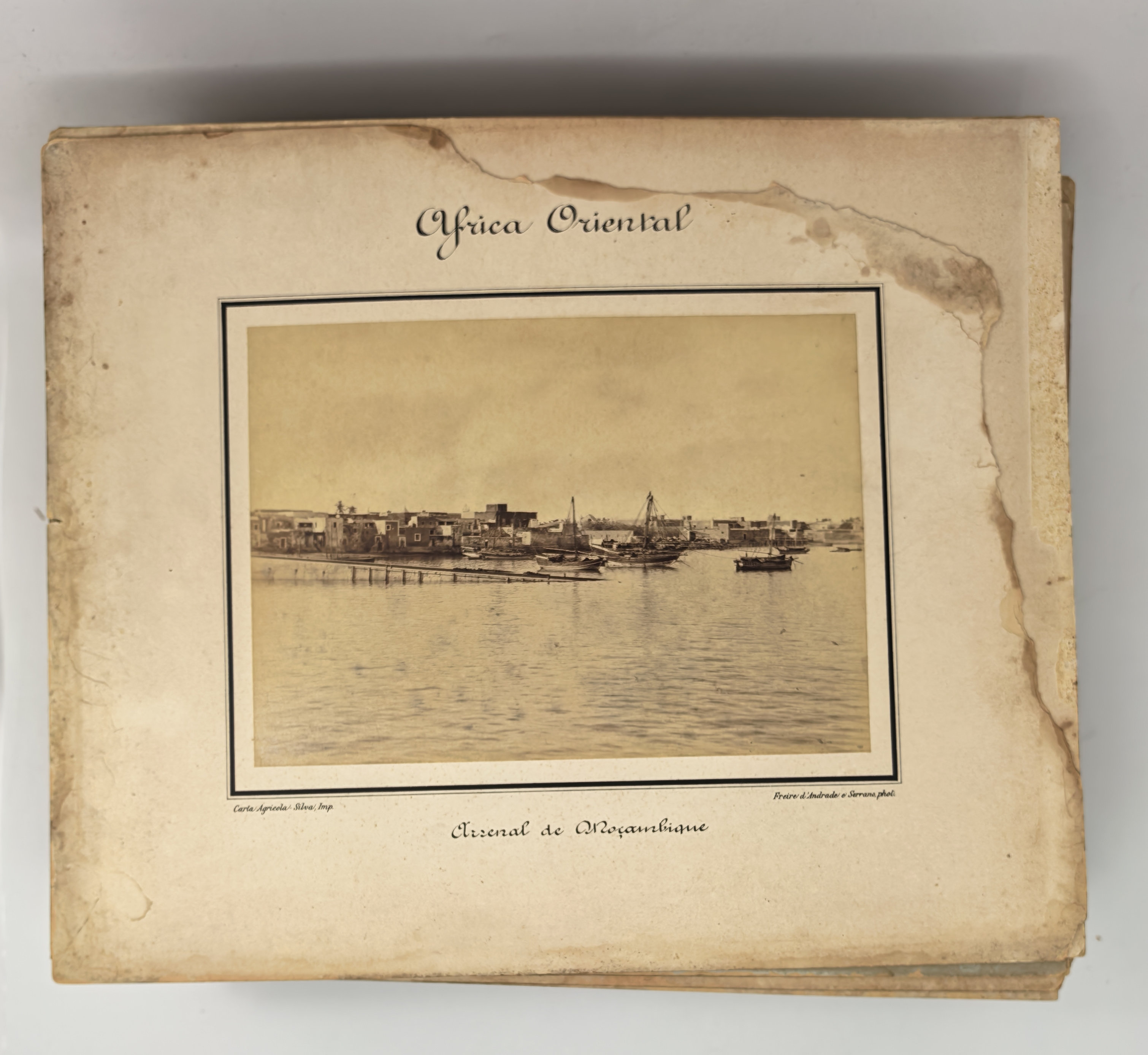
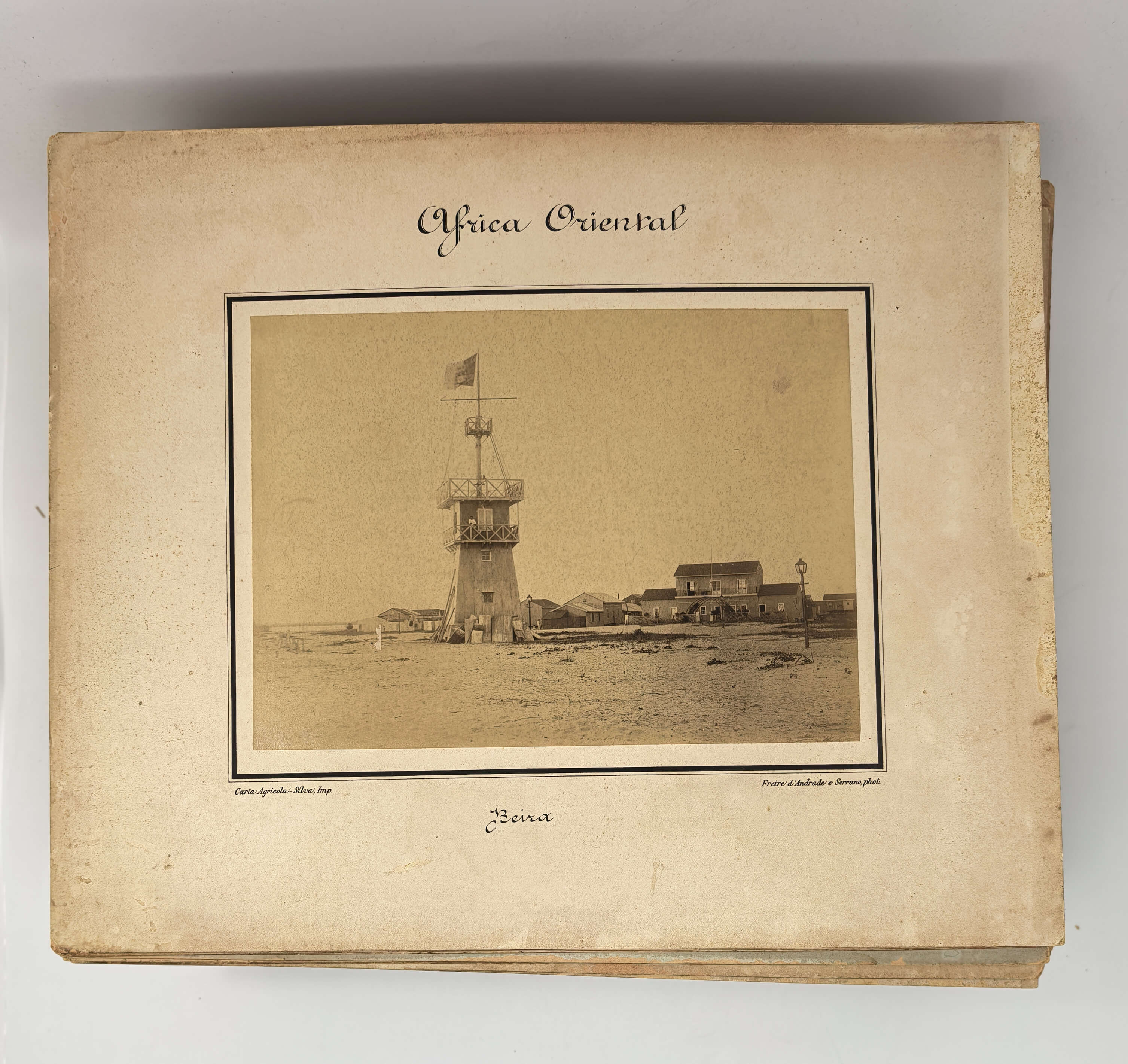
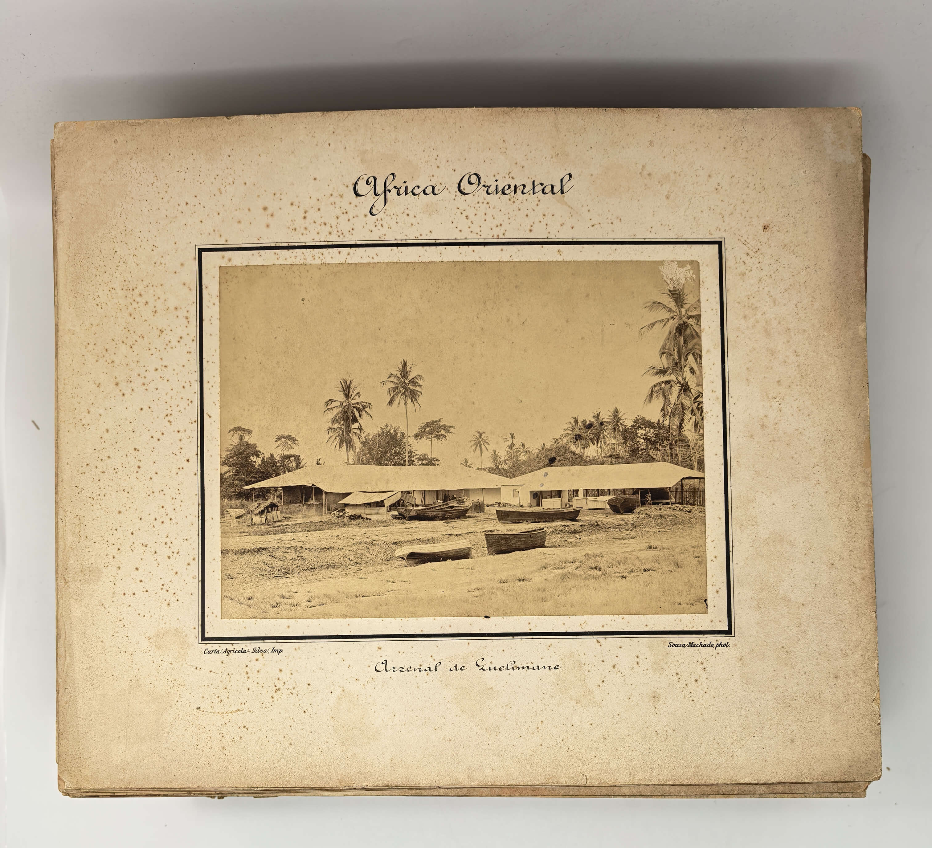
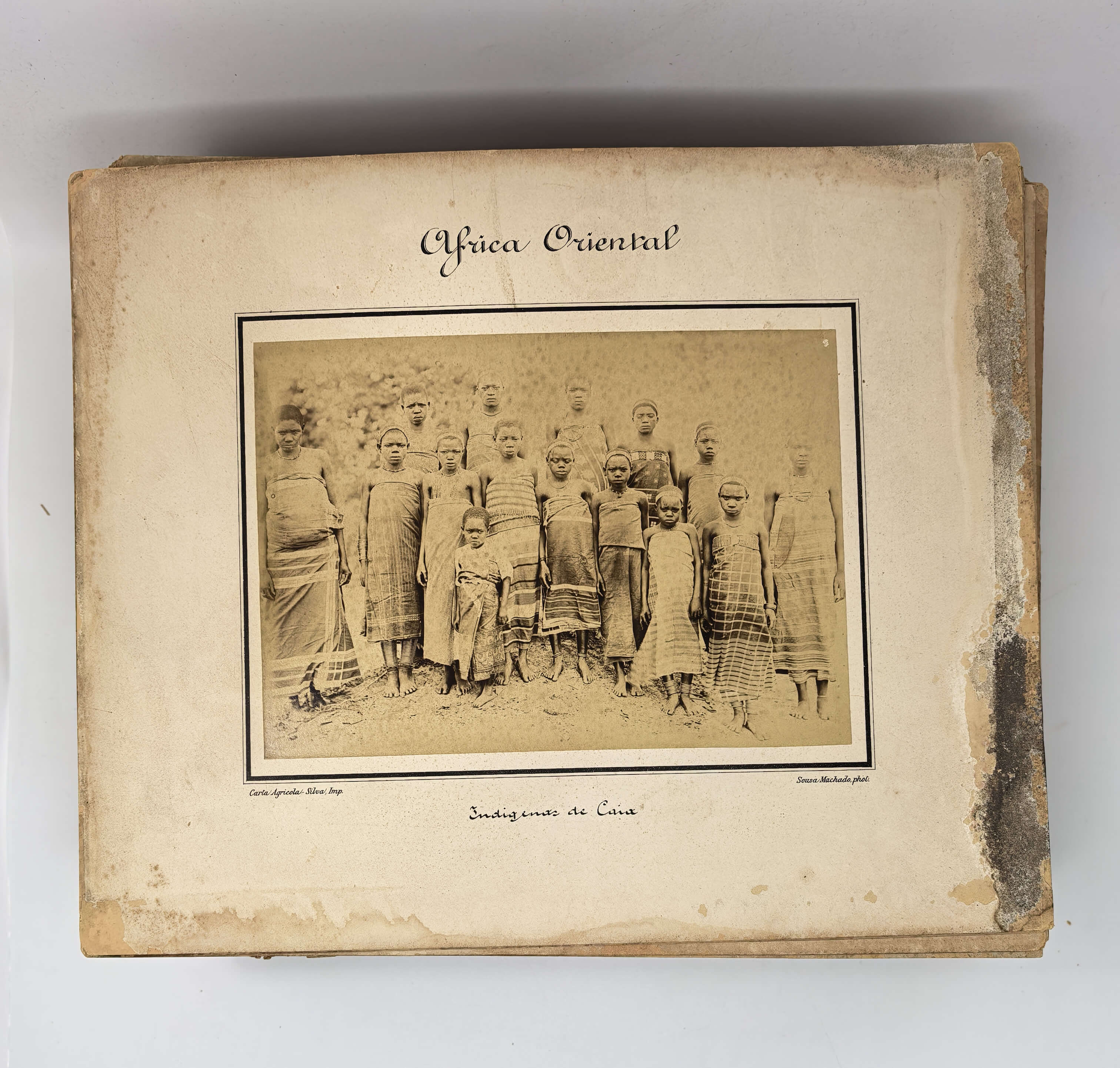
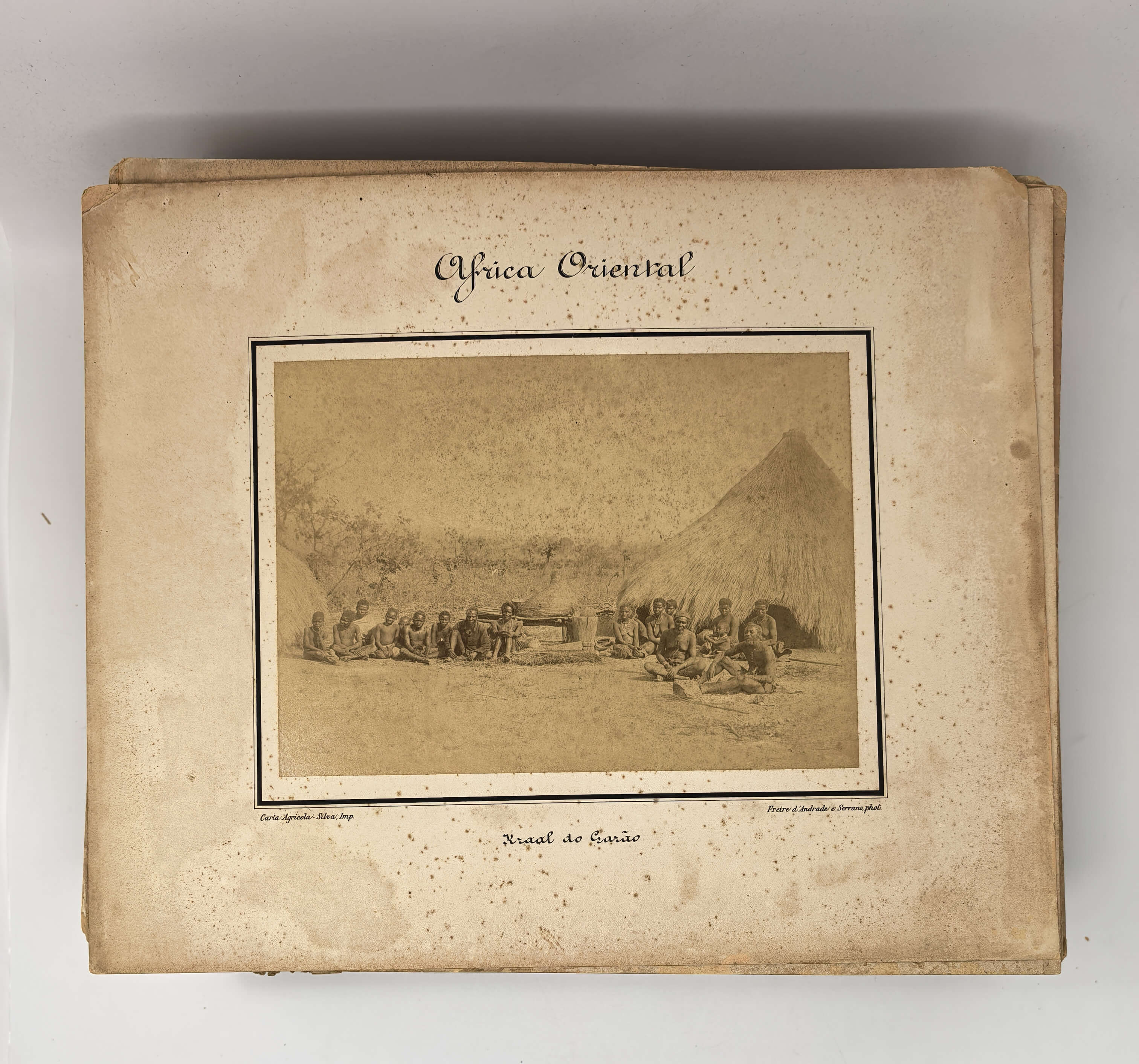
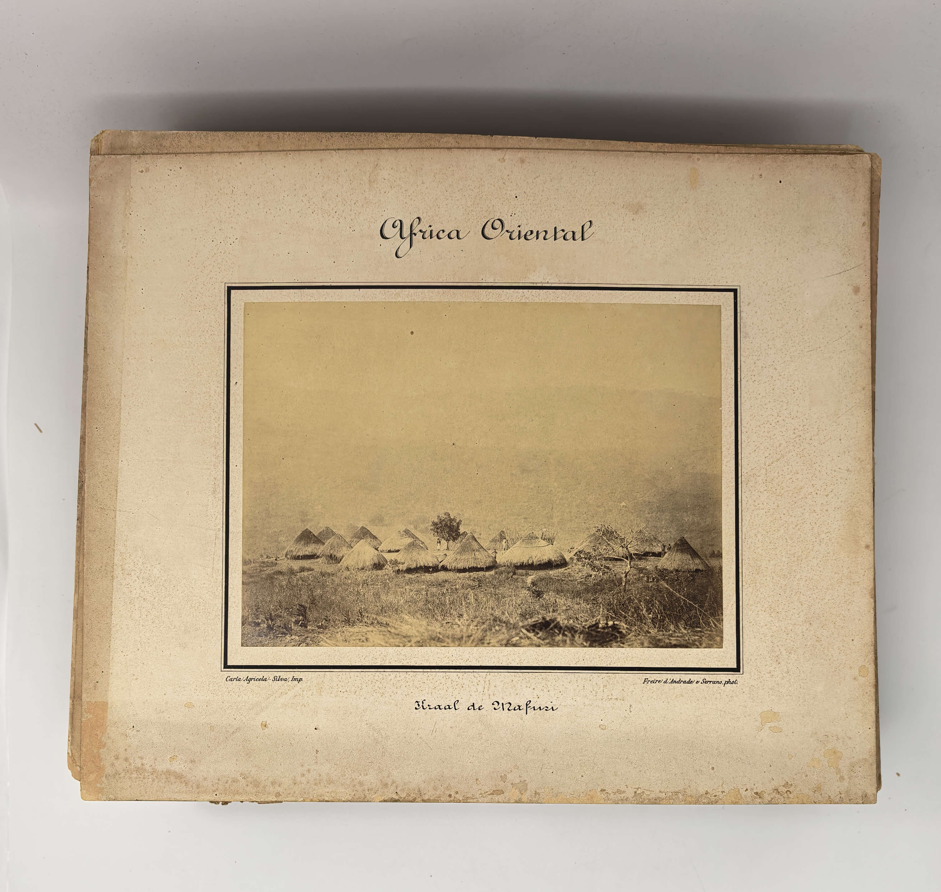
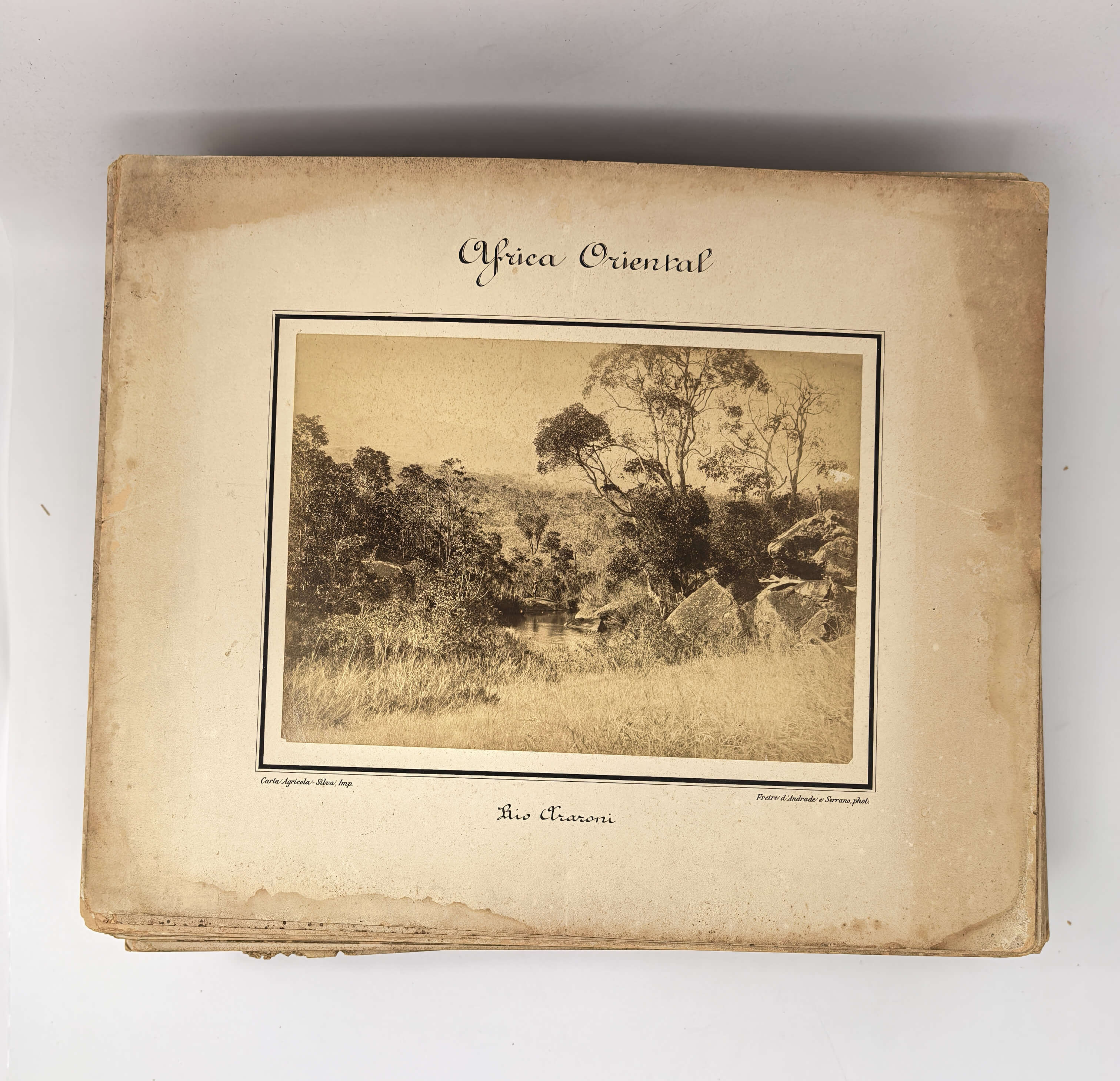
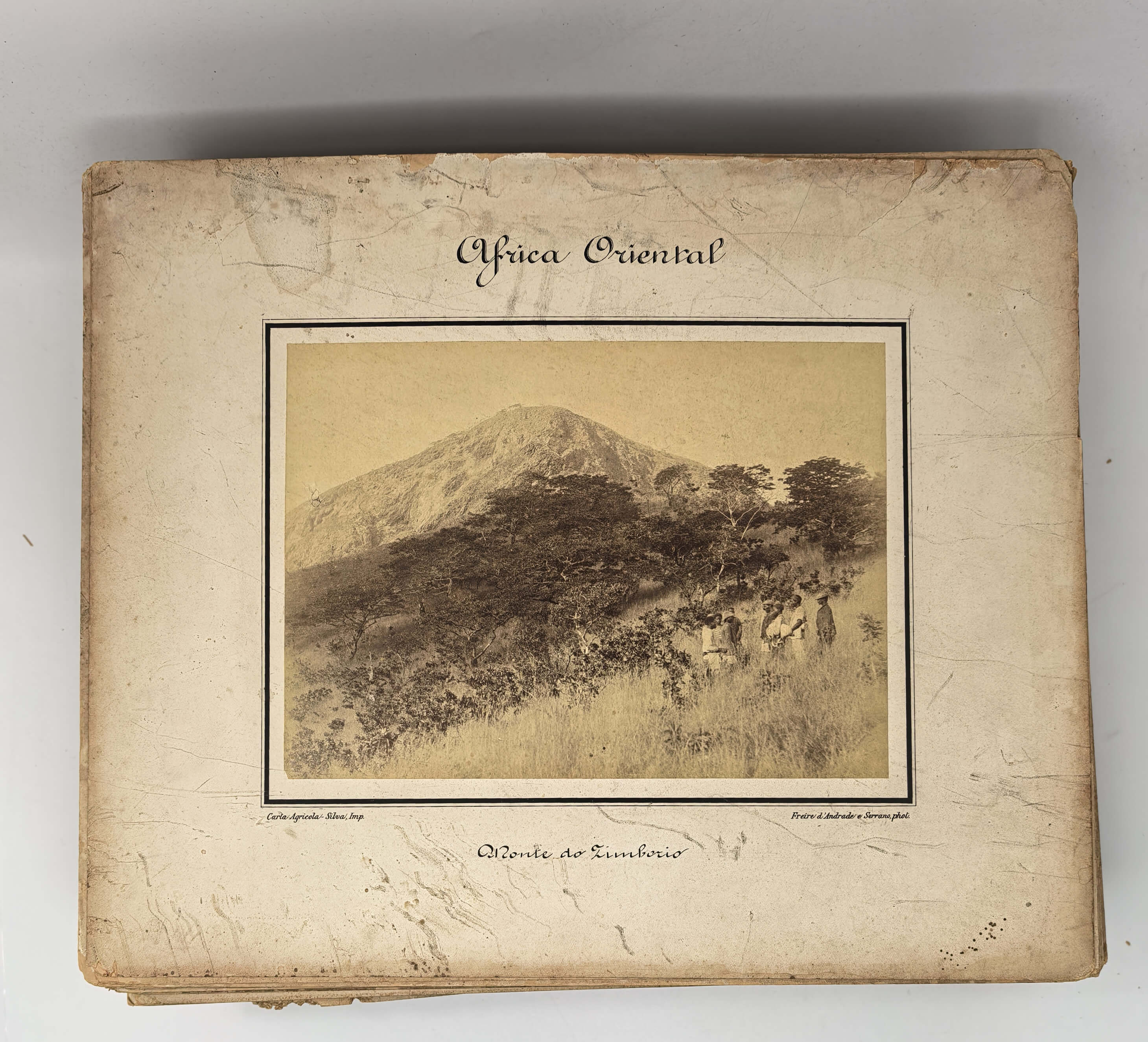
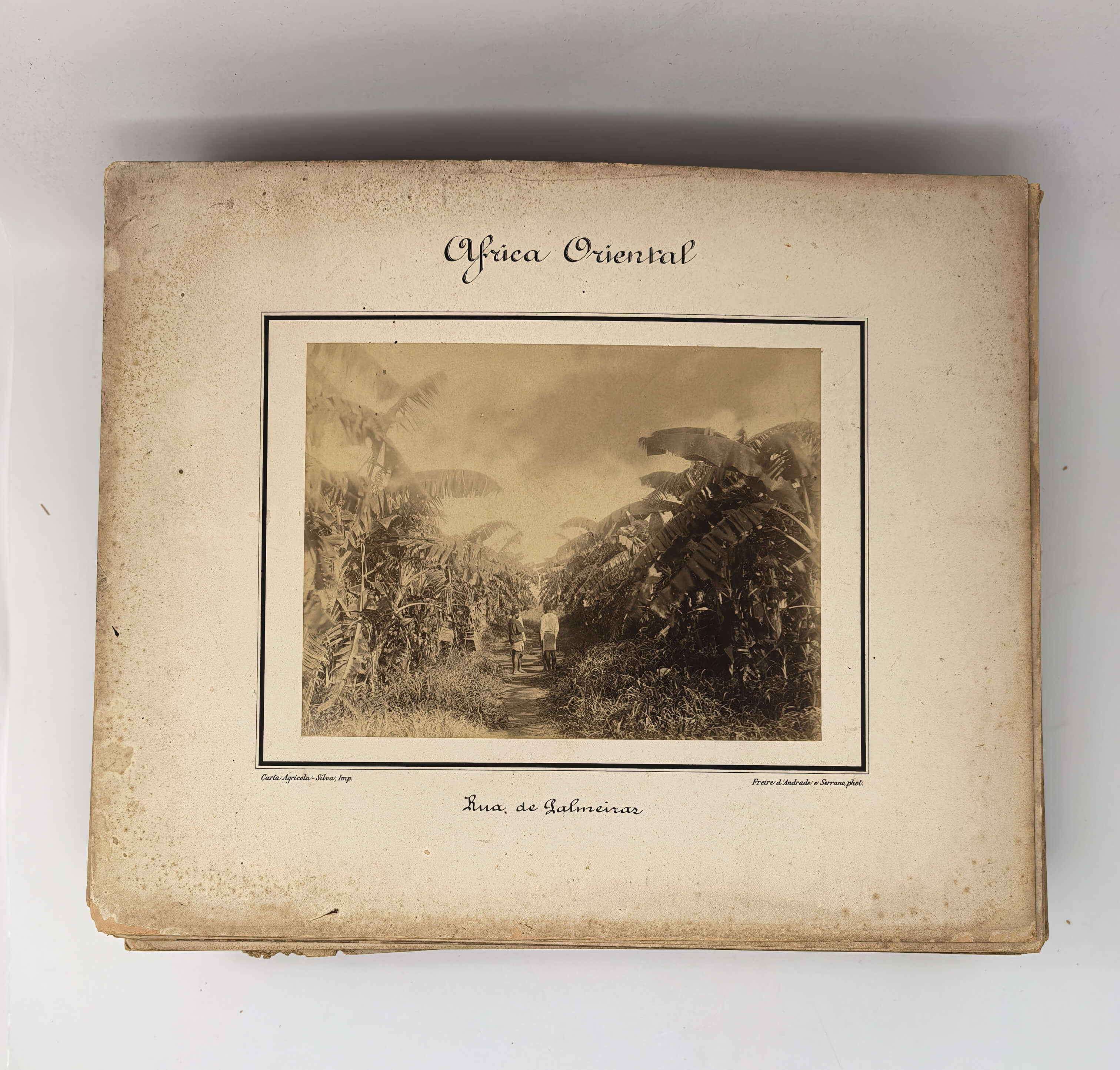
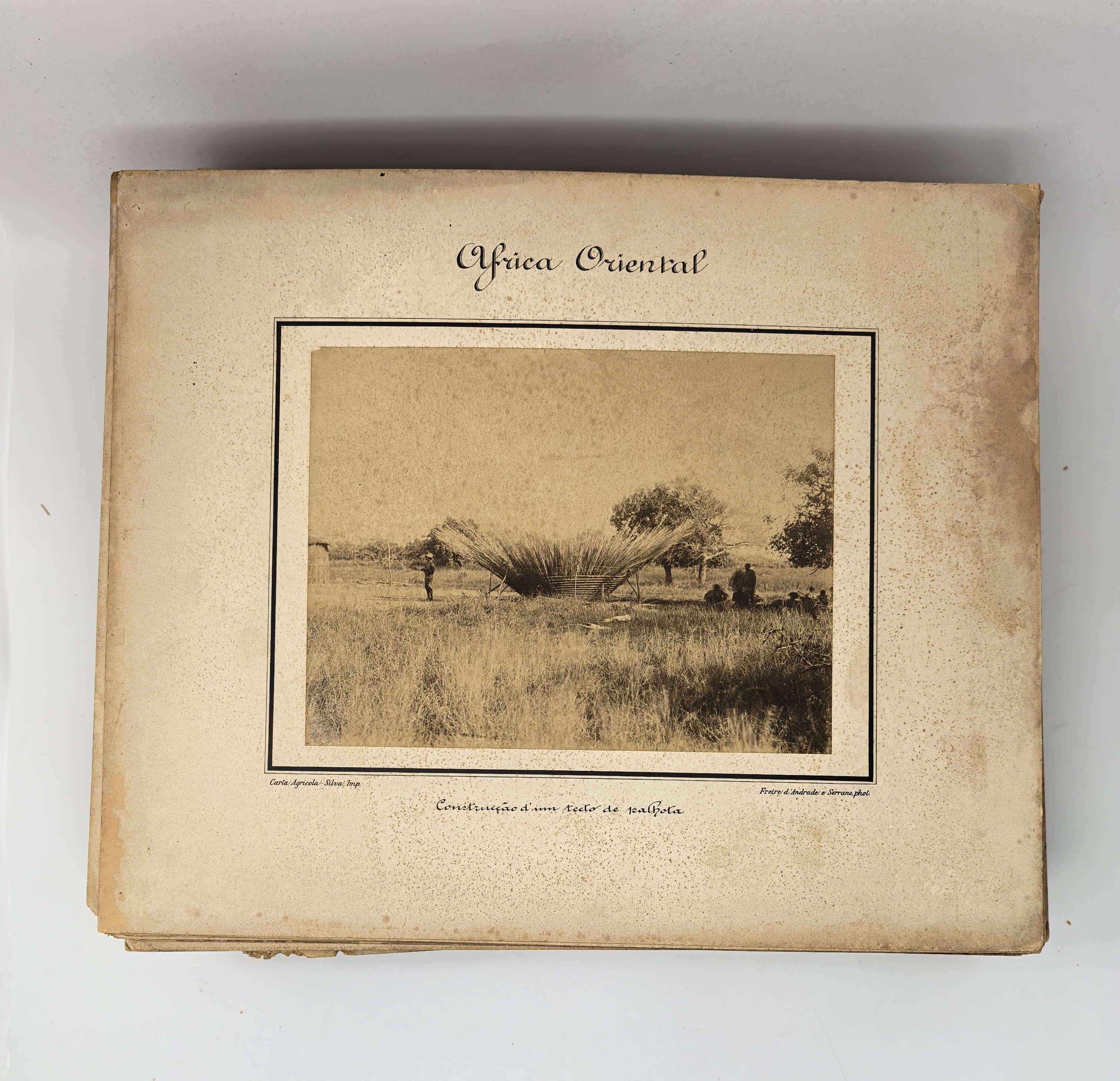
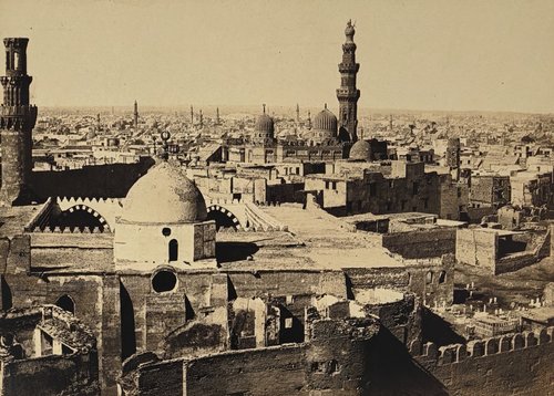
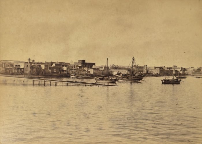
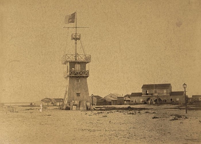
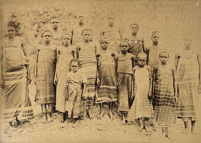
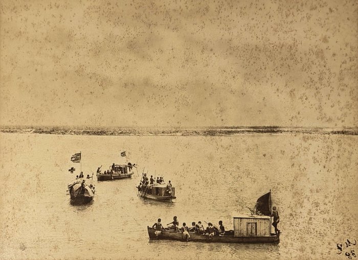
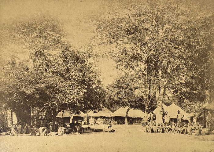
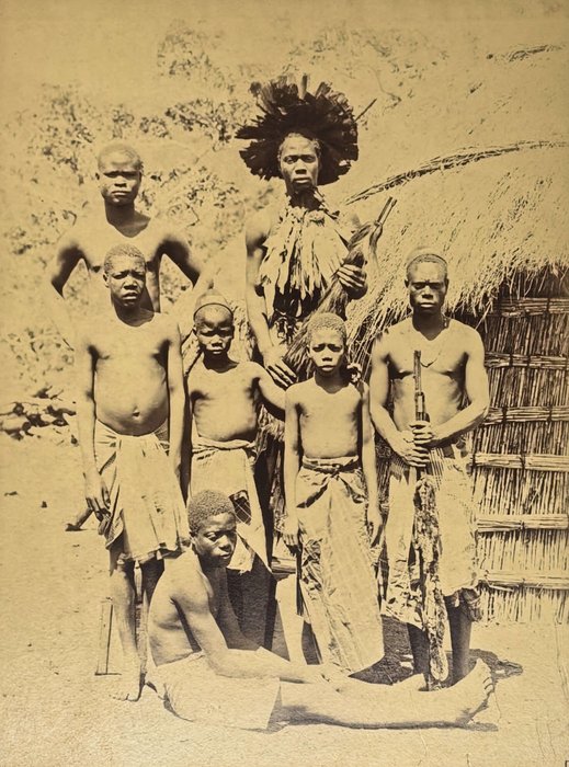
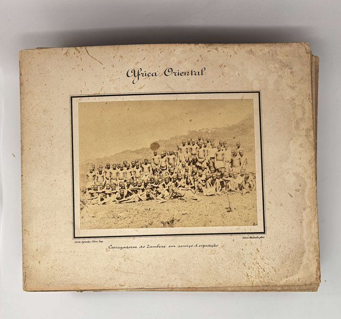
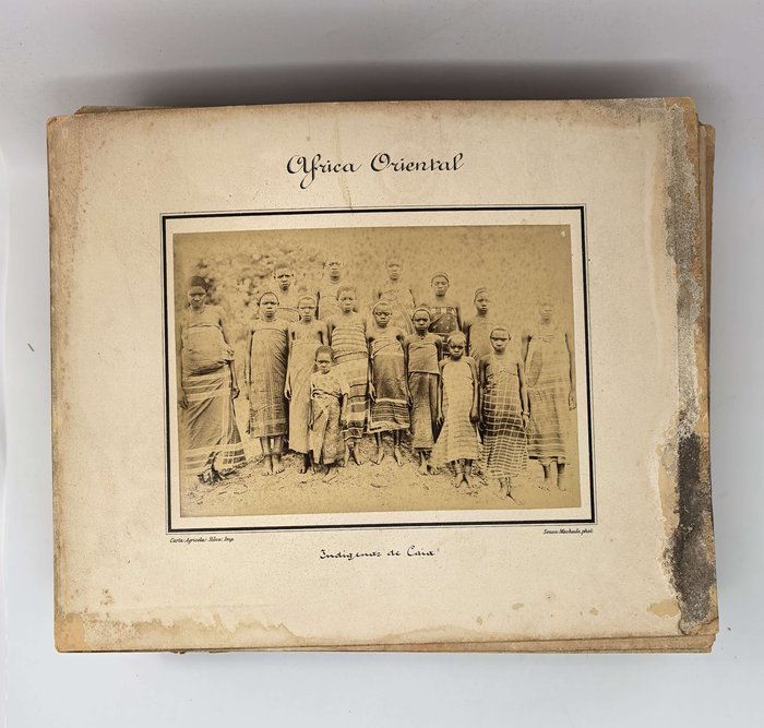
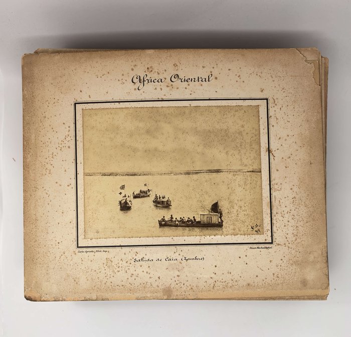
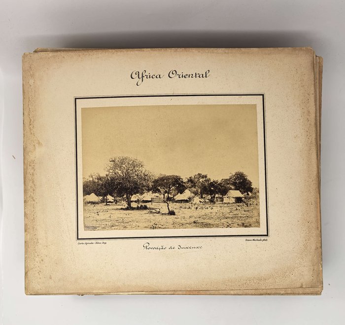
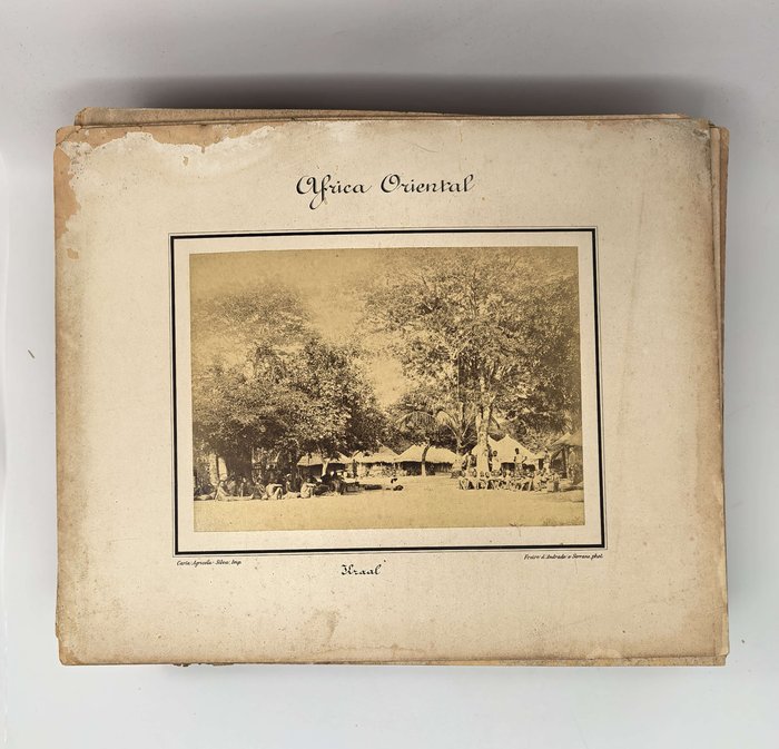
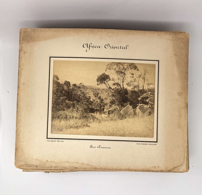
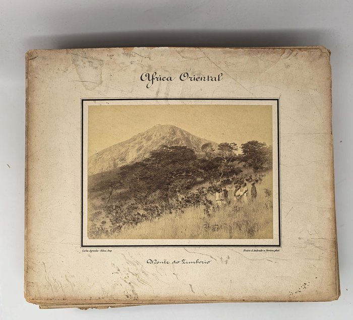
Eight interesting images taken during a Portuguese survey expedition up the Zambezi river show “praia do Vicente,” the town of Sena (Portuguese military post, native quarter, a street), expedition boats on the river near the town of Caia, expedition camp on the “Madziçua” (Maziua) River, native porters and girls from Caia. There are also views of Beira (waterfront street and a tower with a waving flag of Portuguese Mozambique, two views of the expedition camp, native porters), colonial capital “Moçambique”/Cidade de Pedra or Stone Town (“Arcenal de Moçambique,” “Mercado de Moçambique,” “Escavação d’una cisterna em Moçambique”), Quilemane (governor’s residence, “Rua da fabrica,” arsenal), Garvao, Araroni River, “Monte do Zimborio,” “kraal de Mafusi,” “kraal de Garão,” construction of a grass roof to a hut, expedition camps in “Xiden,” “Saranbagera,” “Lagoa Natxanha,” villages of “Cruabumba,” “Inxenxe,” “Vueza,” “Framaja” &c.
Overall an important collection of original rare albumen photographs, taken during Portuguese military survey expeditions to define borders between modern-day Mozambique, South Africa and Zimbabwe in the 1890s.