

#OA57
1860
Last revised edition of the Edo era.
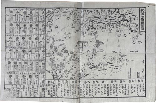
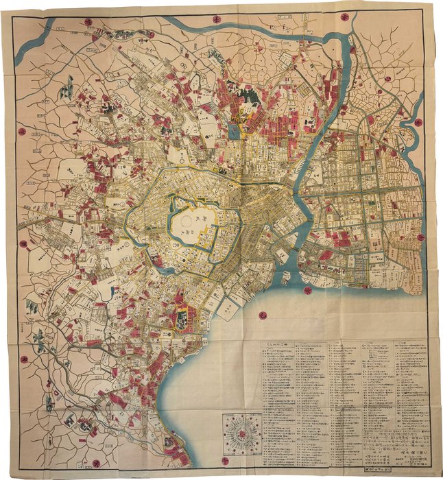
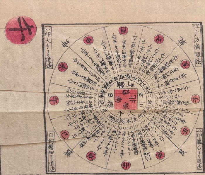
122,4x134,3cm. 1 sheet. Large woodblock-printed folding map, hand-coloured in yellow, pink, and blue. Scale not given. A pencil mark of the price “8£” to the lower left margin. Two tiny burn holes somewhere around Meguro district. Original paper wrappers and original title slip. Missing original envelope. Very good condition. Text in Japanese.
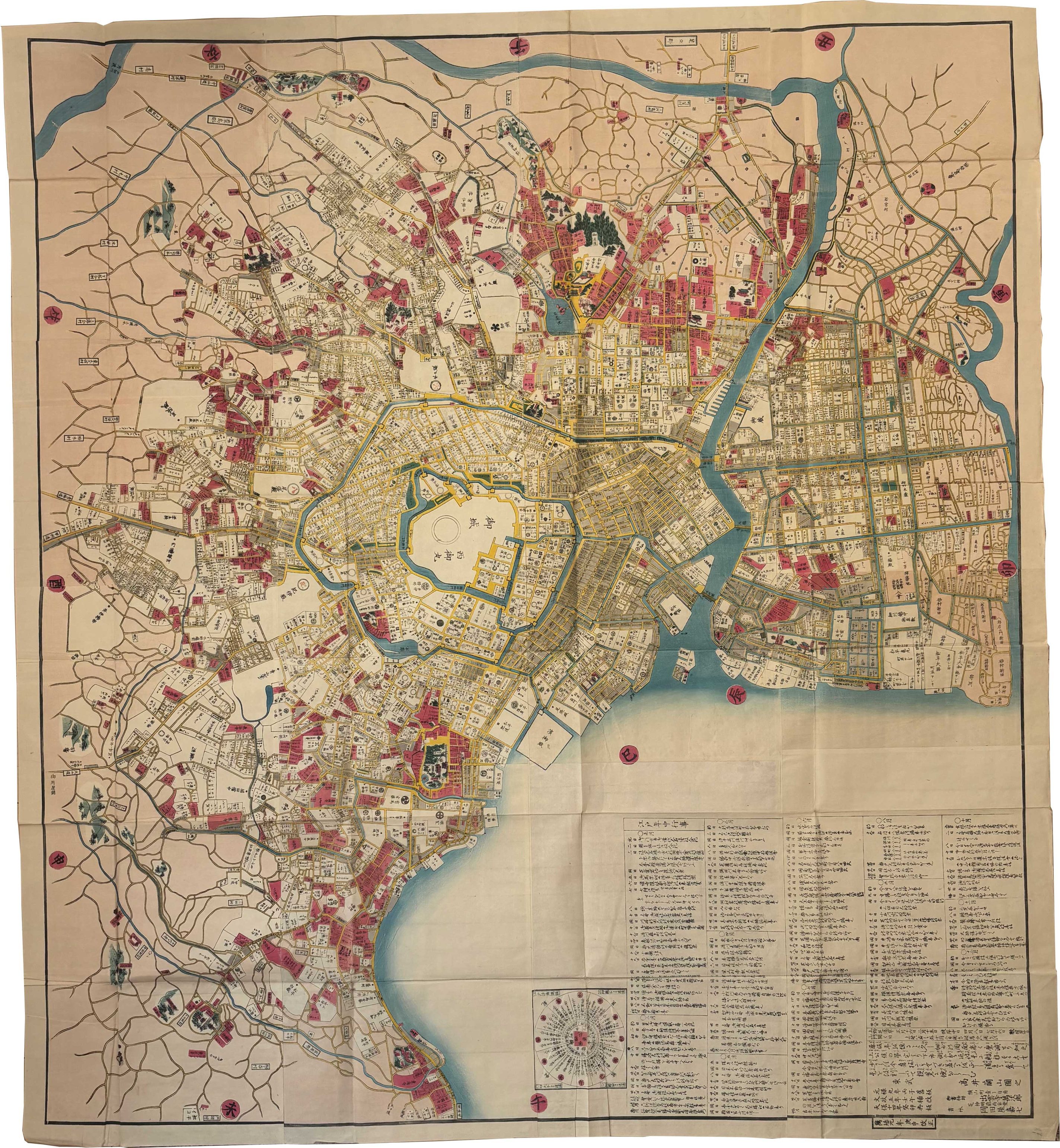
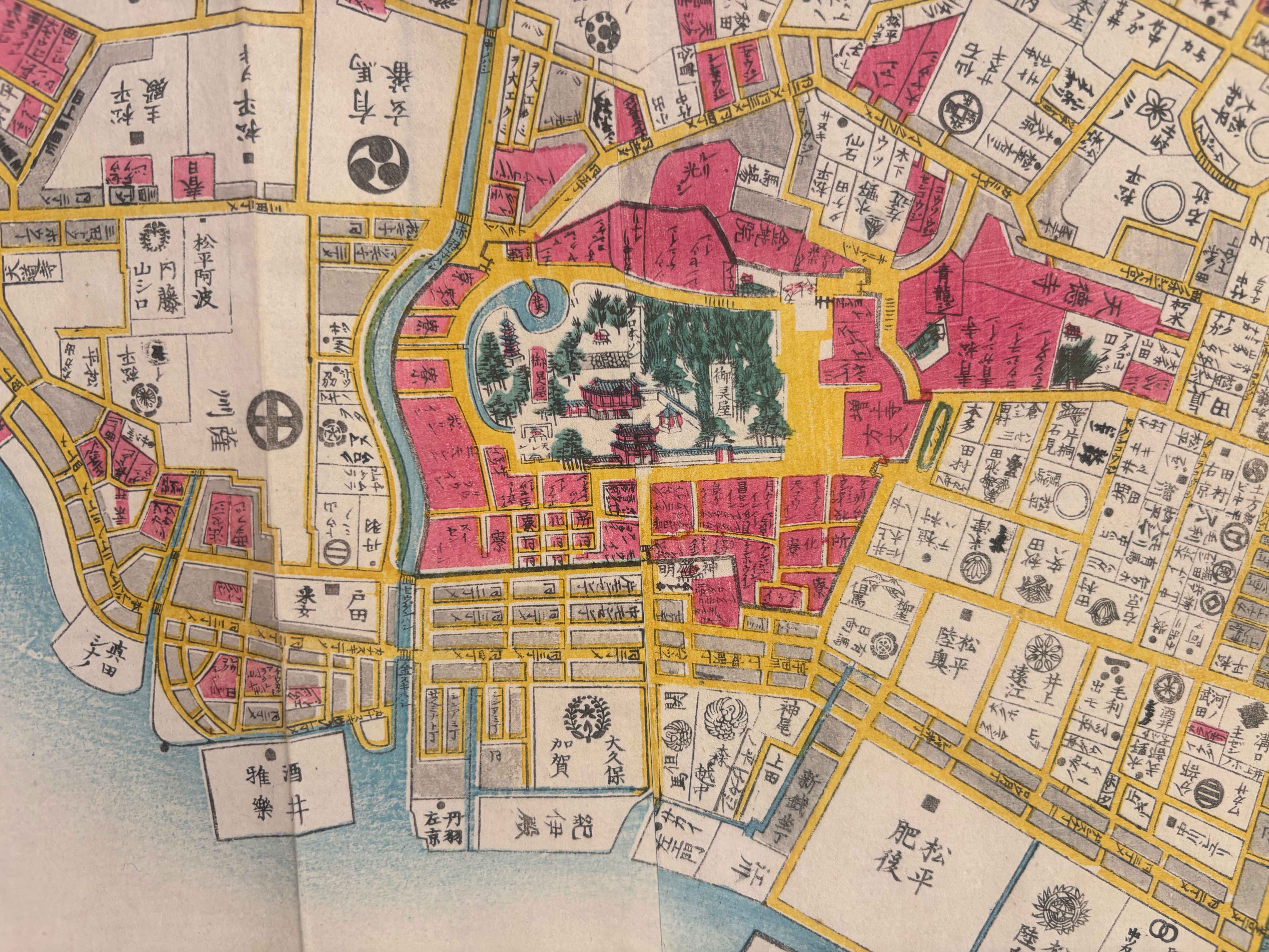
This monumental map of Edo exemplifies Japanese cartographic practice as a form of archival memory. Originally conceived in Genroku 9 (1696) within the publishing venture of Okumura Kihei and edited by Takai Ranzan, it established a canonical spatial model of the shogunal capital. The map continued to circulate for more than a century through successive editorial states, first in a Bunsei 5 (1822) revision and, as in the present example, in a final Man’en-era update of ca. 1860–61. The sheet thus functions as a visual palimpsest: a seventeenth-century urban scheme preserved in woodblocks yet repeatedly reworked to accommodate the realities of a changing nineteenth-century metropolis.
The importance of this state is further underscored by its publisher, Izumo-ji Manjirō, officially appointed bookseller to the Tokugawa shogunate. Through his agency, the map was transformed from the intellectual project of an individual editor into an institutionalised urban record. The survival on the map of the formula Takai Ranzan zu no and Genroku kyūnen kyūban asserts continuity with the 1696 original, while the title slip Man’en kaisei on the cover proclaims this issue as the last pre-Meiji “update” of the Ranzan tradition. These late Edo reissues do not merely document the city; they actively rewrite it, presenting Edo as a layered archive in which Genroku memory, Bunsei revision, and Man’en-era administrative modernity converge at the threshold of the Meiji Restoration.
According to CINII - only one copy exists in the National Diet Library inTokyo.