


#NY006
1941
Oblong Quarto album (ca. 29x38,8 cm). 23 album paper leaves. With 78 mounted original gelatin silver photographs each ca. 14x9 cm . Typewritten captions on every page. Period black full cloth covers with blind-tooled ornaments, fastened with a string; with the gilt-tooled generic title “Photograpas” on the front cover. Covers are slightly beat up, otherwise in very good condition.
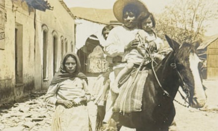
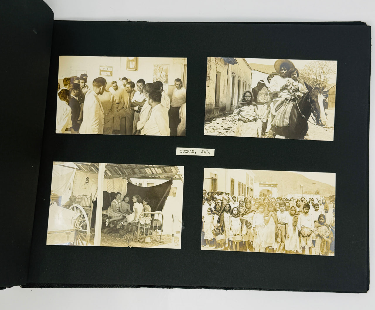
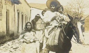
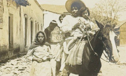
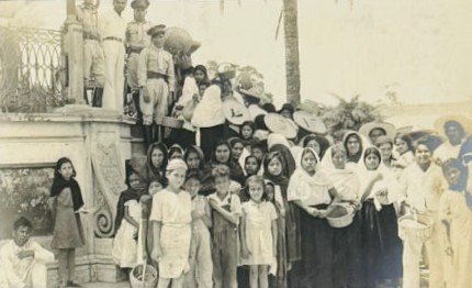
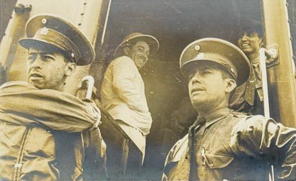
The album is likely was put together for the visit of the president of Mexico Manuel Ávila Camacho (1897-1955) to the region, the album opens with eleven photographs of Camacho surrounded by his delegation and addressing the people.
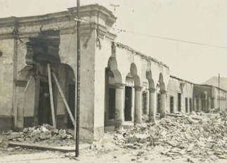
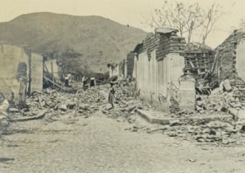
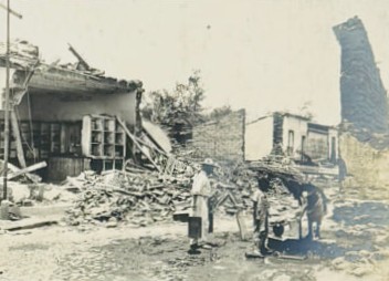
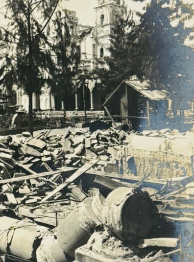
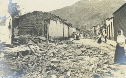
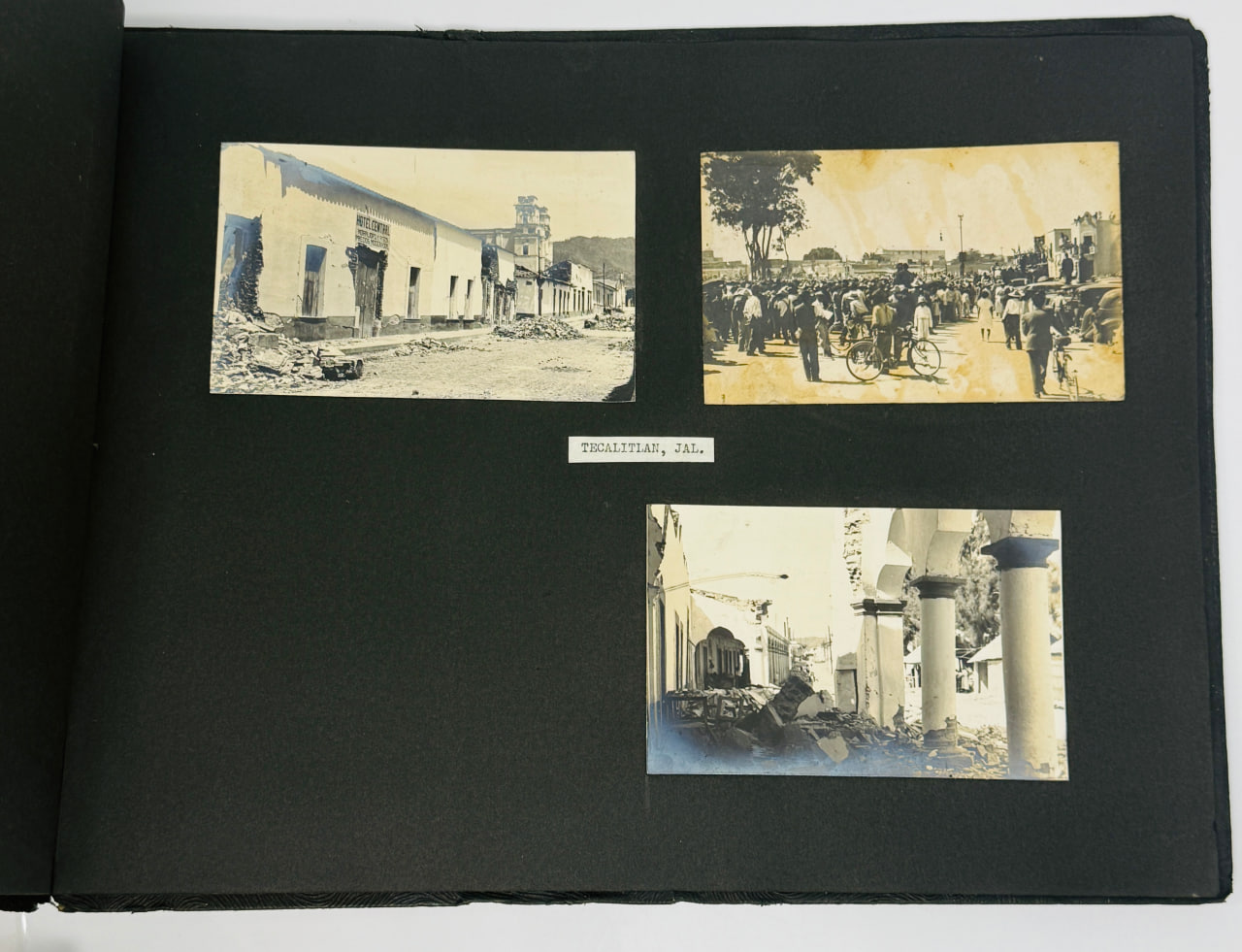
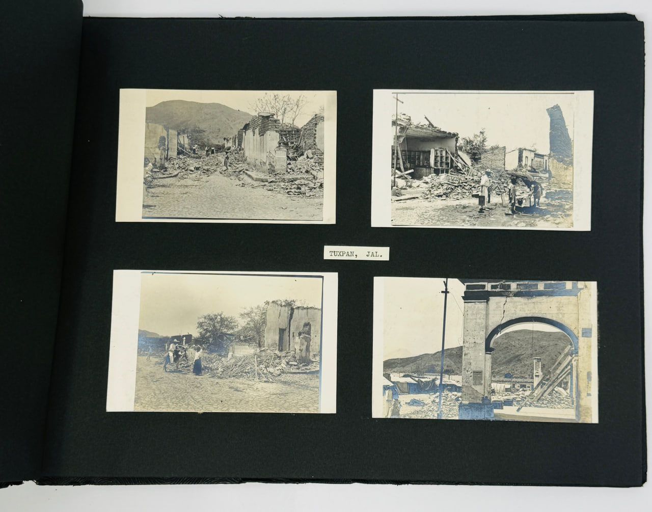
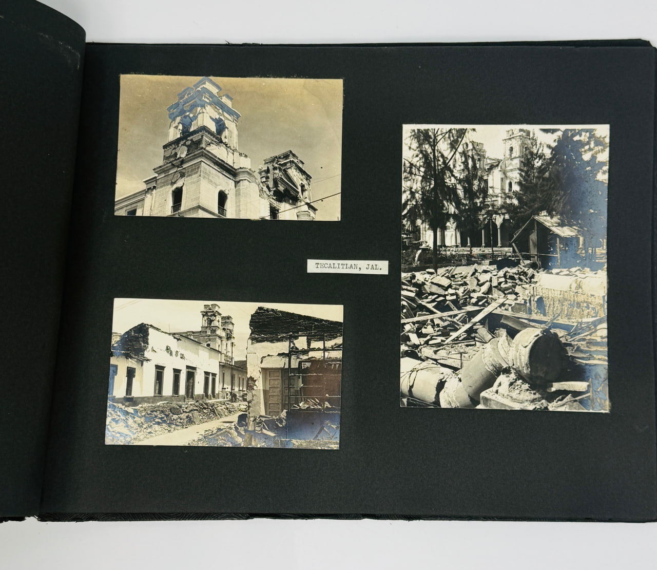
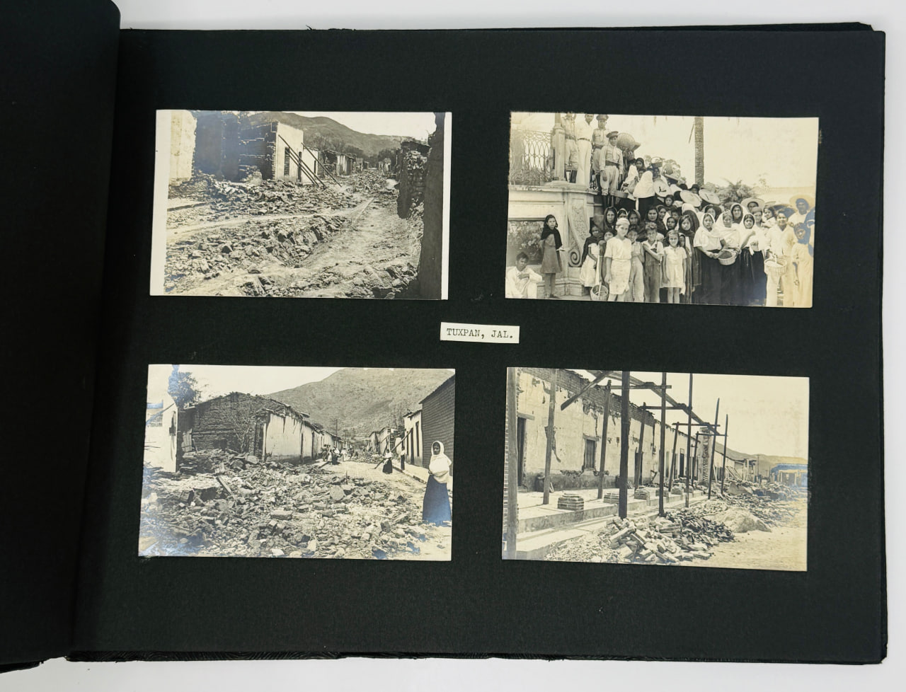
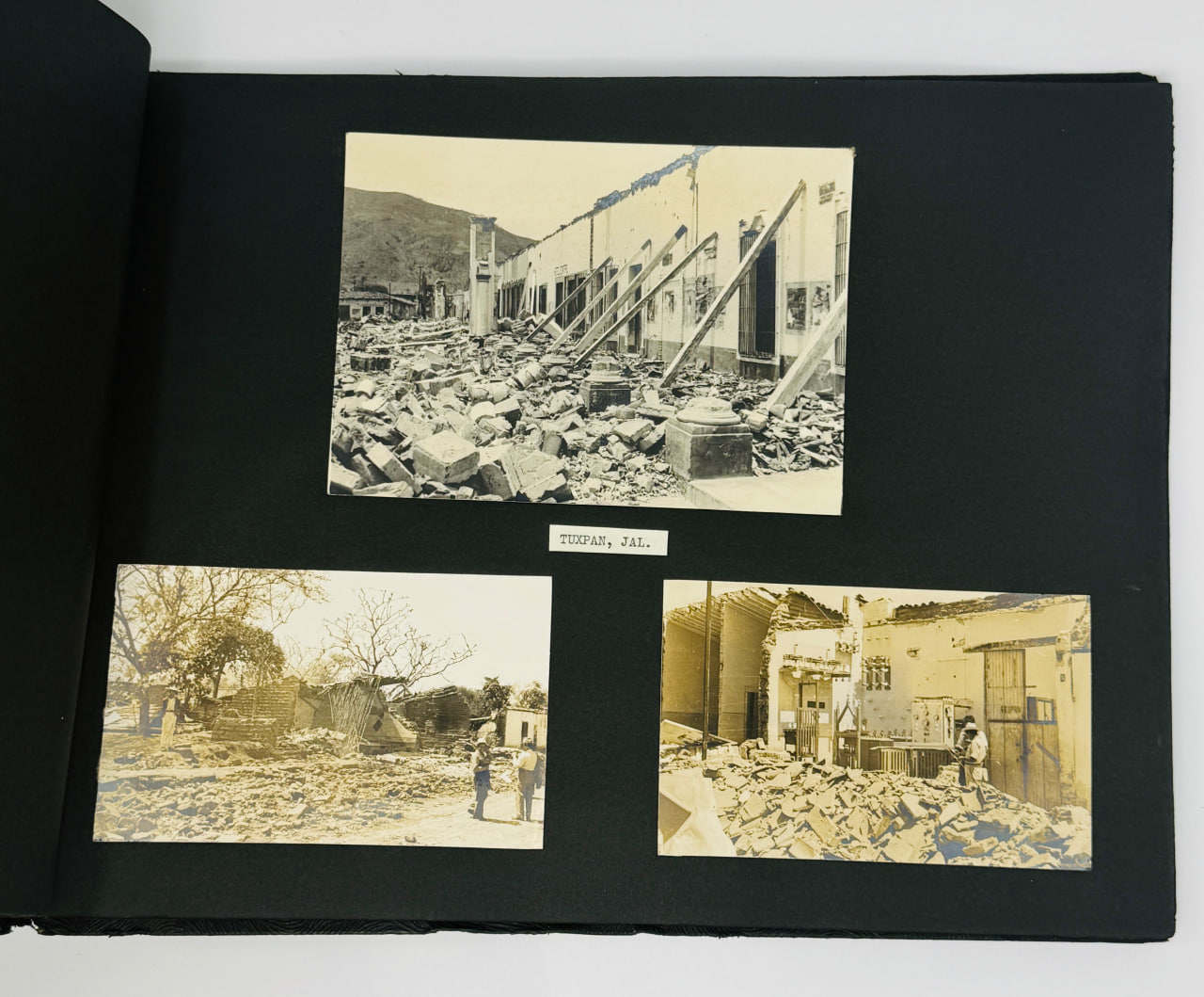
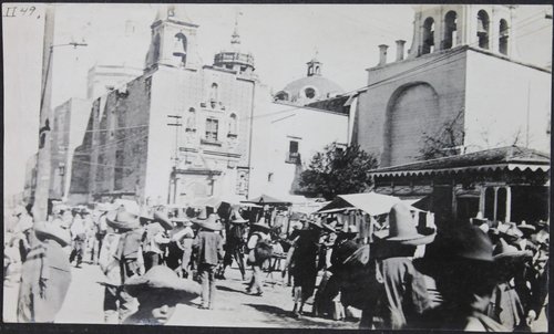
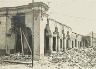
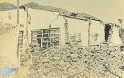
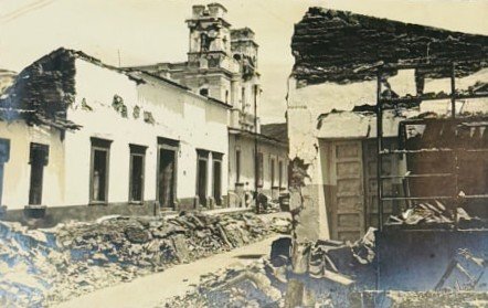
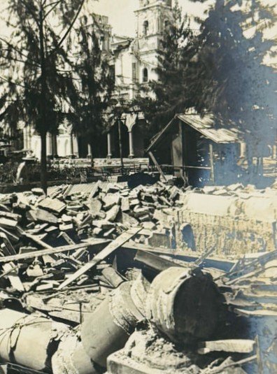
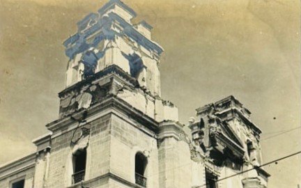
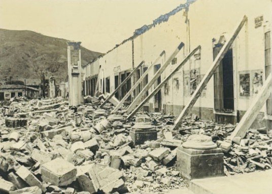
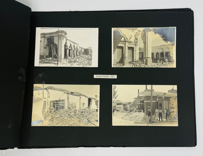
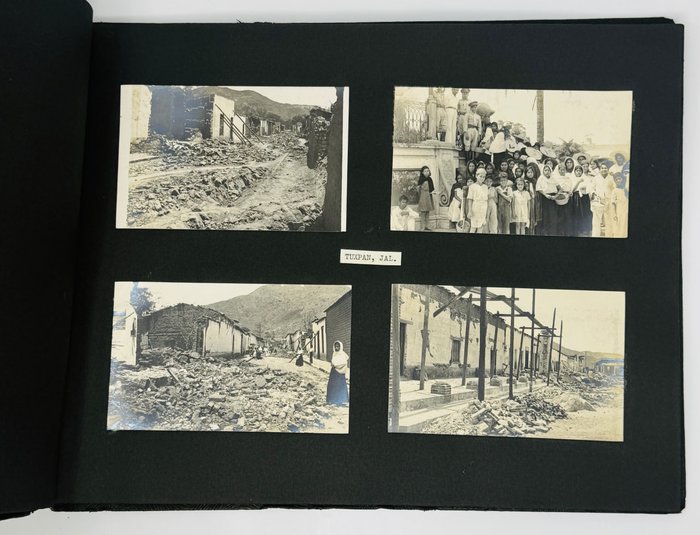
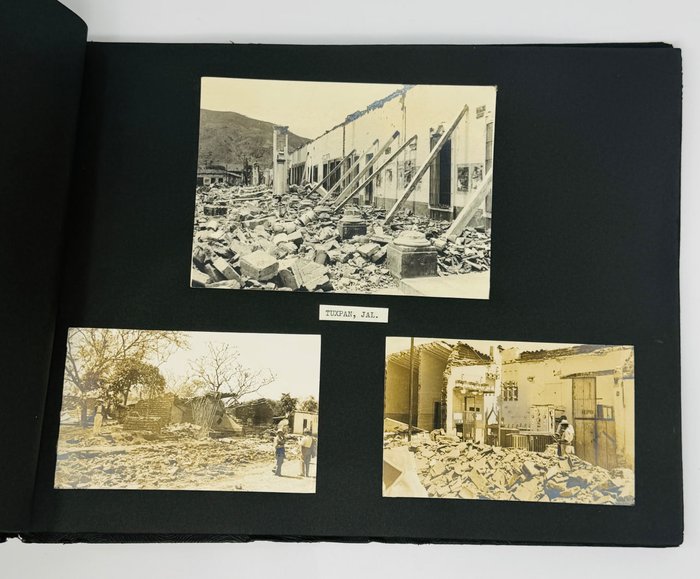
The album includes the photos of streets with debris and remains of the buildings, as well as few photos of ‘before’ the earthquake for comparising. In Jalisco the identifying photos are of the cathedral, the Hotel Central, of Tuxpan - billiard owned by Enrique Ochoa, the rest of the town was more or less in ruins.
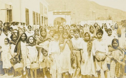
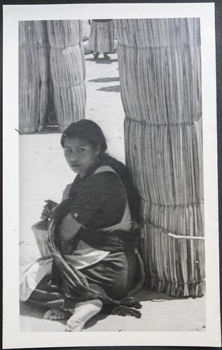
Other photos in the album includes people gathering on the main square right after the earthquake, a nurse applying a gauze bandage to the face of a local woman, people in temporary camps put up after the earthquake, local official explains the emergency protocols in the mayor's office, children of Tuxpan gathered together,
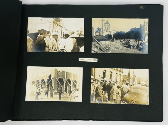
Zapotiltic emerged as an important waystation along the colonial Royal Road (El Camino Real), which connected the highland center of Guadalajara with the Pacific port of Colima. Owing to its strategic location on this principal commercial and administrative artery, the settlement functioned as a resting point for merchants, government officials, and other travelers moving between the interior and the coast. Indigenous inhabitants established roadside stalls where they offered fruit, water, and prepared foods to those in transit. Among the most characteristic local products were the small, sweet tropical fruits known as zapote blanco and zapote negro, which grew in notable abundance in the surrounding region.
The town’s name, Zapotiltic, derives from the Nahuatl elements tzapotl (zapote) and tiltic (place or land associated with), signifying “place of zapotes.” Over time, European settlers were drawn to the site, establishing inns and eating houses that accommodated travelers undertaking journeys of two to three days between the major urban centers. The arrival of Franciscan and Dominican missionaries further transformed the locality, as they erected churches and conventual institutions in and around the settlement. Through these combined commercial, infrastructural, and ecclesiastical developments, what had originated as an informal crossroads gradually assumed the character and recognition of an established town. By the late 1930s, Zapotiltic had become known not only for its fertile agricultural lands and abundant harvests, but also for its mineral resources, particularly calcium-rich deposits such as lime and limestone.
On 14–15 April 1941, a series of powerful earthquakes struck western Mexico, severely affecting communities across the region. The epicenter was located in the state of Michoacán. The principal shock reached a surface-wave magnitude (Ms) of 7.7 and resulted in approximately ninety reported fatalities.
The city of Colima sustained extensive damage. Its cathedral was destroyed, and numerous public structures—including the Federal Palace (Palacio Federal) and the Hidalgo Theater (Teatro Hidalgo)—were seriously impaired. Contemporary newspaper accounts further indicate that in Zapotiltic nearly ninety percent of residential and commercial buildings were destroyed. Among the losses was the parish church, which had long been in a deteriorated condition prior to the disaster and ultimately collapsed as a consequence of the seismic events. Tuxpan was almost completely destroyed as well.