#O95
1852
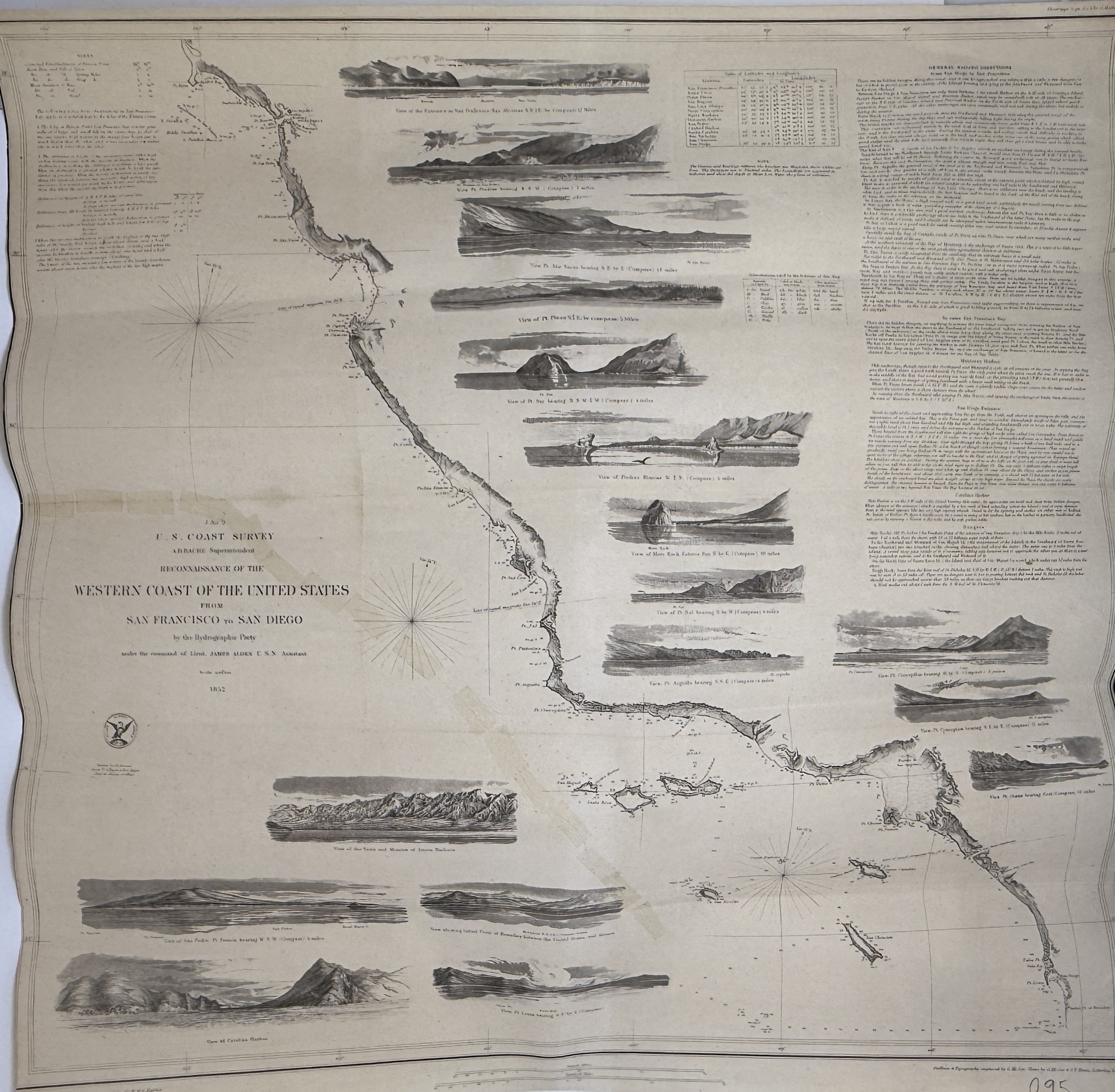
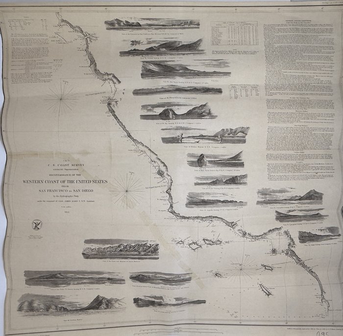
Engraved map ca. 55 x 57,5 cm (22 x 23 inches). Drawn by W.B. Mc Murtrie; Reduction for engraving by W.M.C. Fairfax. Outlines and topography engraved by G. McCoy, Views by G. McCoy & S.V. Hunt, Lettering by W. Smith. Slightly age-toned with a neatly repaired tear, otherwise a very good map.
One of the three maps issued after the first official scientific survey of the US Pacific coast. The map is supplemented with 17 coastal profiles (San Francisco Bay, Pt. Piedras, Pt. Ano Nuevo, Pt. Pinos, Pt. Sur, Pt. Arguilla, Catalina harbor, San Pedro, town and mission of Santa Barbara, point of boundary between the US and Mexico et al); text of "General Sailing directions from San Diego to San Francisco"; observations of tides of the Pacific coast, and a Table of Latitudes and Longitudes.
"This terrific chart delineates the coast and is from the first official scientific reconnaissance of the Pacific coastal areas. It is one of three prepared by Lieutenant James Alden for this important survey. This sheet covers the region from the Mexican boundary to Point Reyes. It outlines the coastal littoral, shows dangerous reefs and shoals, gives offshore bathymetric soundings, plus general and specific harbor sailing instructions. The most impressive feature is the 17 views of entrances and promontories along this rugged coastline - among them Santa Barbara, Catalina Harbor, and the entrance to San Francisco Bay. The map was drawn by W.M. McMurtie and engraved by G. McCoy. Engraving of the views is also by McCoy and S.V. Hunt. This is one of the finest Coast Survey charts produced, and should not be confused with the simpler, and slightly smaller, charts that do not feature the large number of coastal views"(Old World Auctions); Schwartz & Ehrenberg, plt. #174.

