#MC80
1809–1810
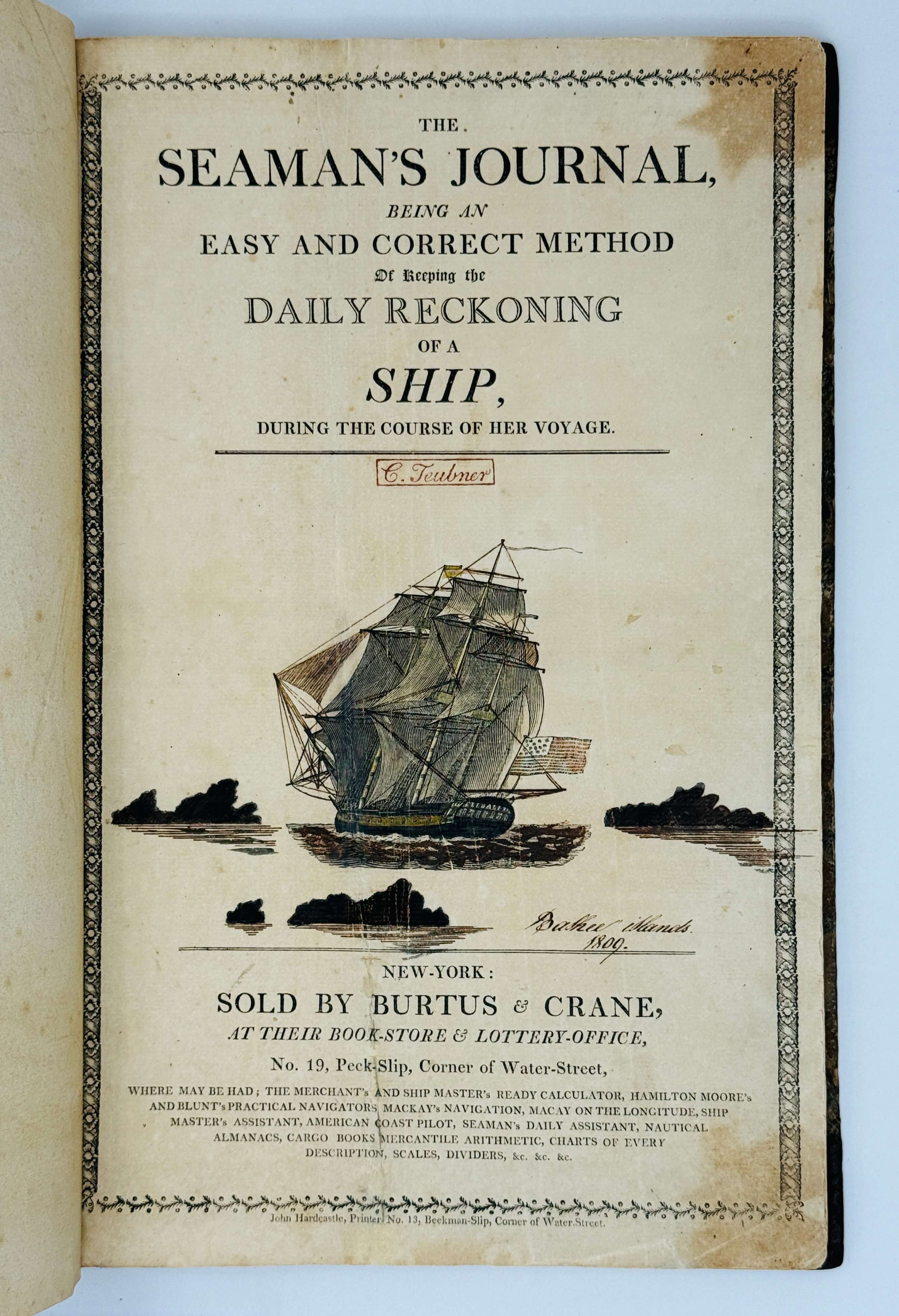
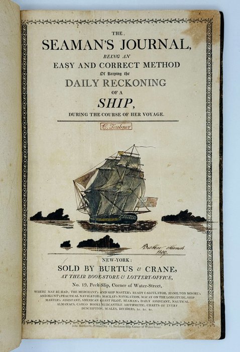
Folio logbook (ca. 38x24,5 cm or 15 x 9 ¾ in). [1 – printed title page], 67, [1 - blank] leaves of watermarked laid paper. A copy of “The Seaman's Journal, Being an Easy and Correct Method of Keeping the Daily Reckoning of a Ship, During the Course of Her Voyage” (New York: Burtus & Crane), with the entries carefully completed in brown ink on recto and verso of the leaves (with a gap of recto of leaf 41, i.e. comprising 133 pp. of text). Title page with a woodcut vignette depicting a sail ship under the American flag, hand coloured and with a period ink title “Bashee Islands, 1809” underneath. Period red ink stamp “C. Teubner” on the title page, watercolour drawing of a maritime signal flag on the front pastedown endpaper. Period brown quarter sheep with marbled papered boards, neatly repaired on hinges and extremities. Paper slightly age-toned, text with occasional stains (leaf 23 and others), but overall a very good logbook, written in a legible hand.
Historically significant original, content-rich logbook with a detailed record of the first trade voyage of a New York East Indiaman “America” from New York to Canton (Guangzhou) and back in June 1809 – June 1810. A namesake of the famous Salem merchant ship and privateer during the War of 1812 (ship “America,” built in 1803-1804, made five privateer cruises in 1812-1815, broken up in 1831), this “America” was built on the New York shipyard of Adam and Noah Brown for the noted local merchant company “Minturn & Champlin” and launched in May 1809, shortly before her first voyage (The United States Gazette, May 15, 1809, p. 3). The ship’s tonnage was 493 tons (Morrison, J.H. History of New York Ship Yards. N.Y., 1909, p. 47). On June 21, 1809 New York authorities cleared “America” for a voyage to Canton under the command of Captain Mather (Evening Post Marine List// The Evening Post. New York, June 21, 1809, p. 3).
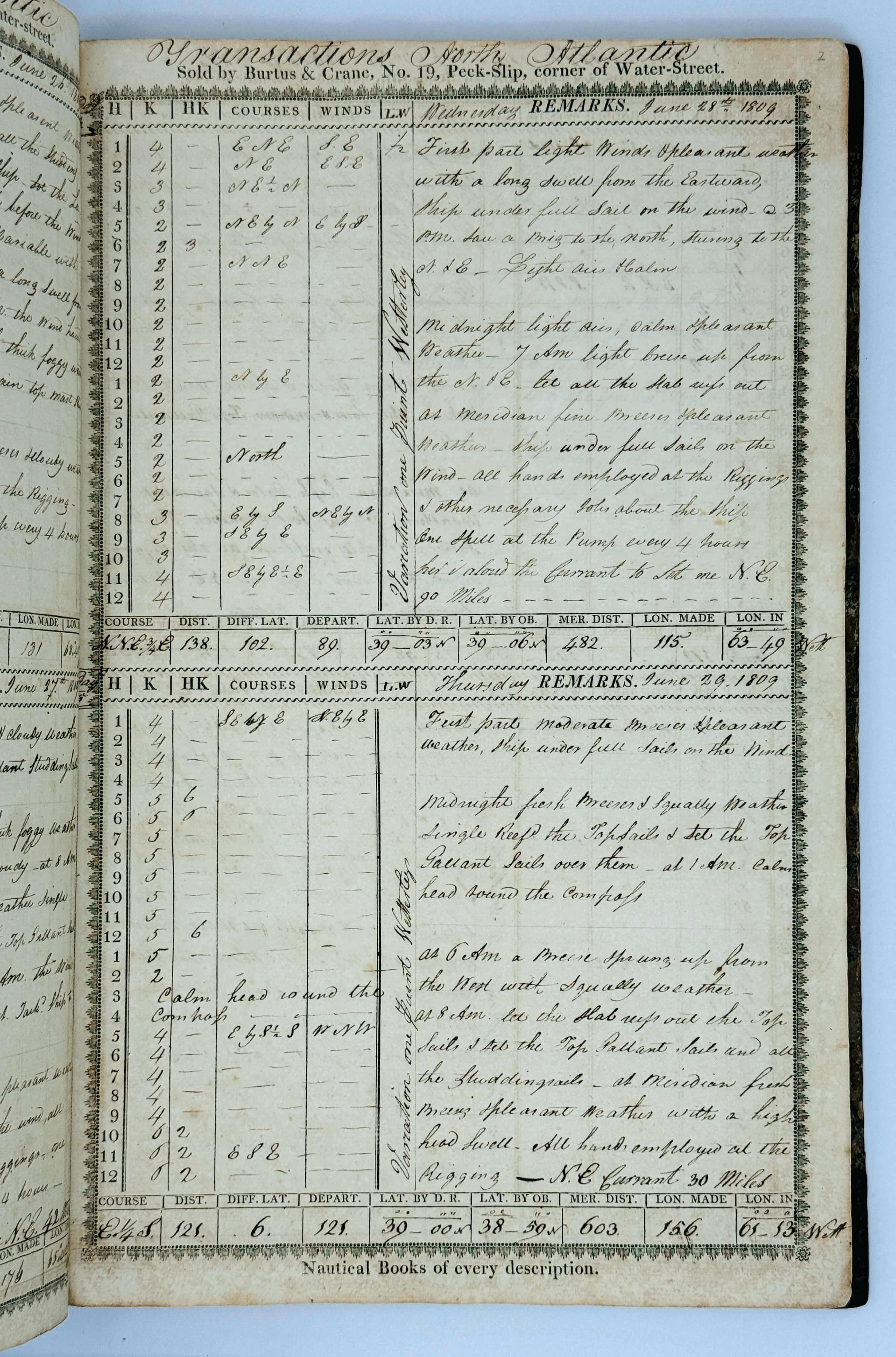
The logbook opens with “America’s” 158-day outbound voyage, starting on June 24, 1809, when the ship discharged the pilot after the passing of the Sandy Hook spit at the south entrance to New York Bay. She passed the Cape of Good Hope on September 12-13, 1809 (without calling at port) and crossed the Indian Ocean, choosing the route to China via the Alas Strait between Lombok and Sumbawa Islands (Lesser Sunda Islands of Indonesia). On October 21-22, “America” anchored near the “Bally Town” (also marked “Laboagee” on some old maps; it is a settlement south of the modern-day town of Selong on the east coast of Lombok) to get fresh water and trade for fresh supplies. A part of the crew went on shore where they were received by a local “king,” who also visited the ship.
“America” then crossed the “Java” (Bali) Sea, proceeded north through the Makassar Strait between Borneo and Sulawesi (crossed on October 26 – November 4) and went across the “Celebean” (Celebes) Sea towards the Pacific Ocean, passing “Sarangaran” (Sarangani) and “Meangis” (Miangas) Islands. On November 11, 1809, while in the “Celebean Sea” east of “Meangis” Island, the compiler saw an island, which “I did not find laid down in any chart, Capt. Mather [“America’s” Captain during the voyage] in ship Aeolus from the Cape of Good Hope bound to China first discovered it on Sunday the 30th of November 1806…”
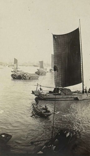
The ship then sailed north in the Western Pacific Ocean along the east coast of the Philippines (November 13-24), crossed the South China Sea, passing “Bashee” (Babyan), “Lemma” (Lamma) and “Ladrones” (Wanshan) Islands, arriving to Macao (Macau) on November 29.
The goal of the voyage was to trade in Canton and quickly return to New York, but “America” stayed there longer than expected. Captain Mather later reported that “all the English & American ships were embargoed at Canton from Jan. 27 to Feb. 22, in consequence of a new difficuly between the English and Chinese, occasioned by a Chinese having been killed by a British seaman; and the English refused to deliver up any one, unless the criminal could be pointed out, which could not be done. It was expected the difficulty would be amicably settled” (National Intelligencer. Washington City, D.C., 18 June 1810, p. 3).
The logbook omits the ship’s almost three-month stay in China and resumes with her departure from Macao on February 24, 1810. On her 104-days return voyage, “America” crossed the South China Sea, sailed through the Gaspar Strait (between Bangka and Belitung Islands east of Sumatra), Java Sea, and Sunda Strait, went across the Indian Ocean and passed Cape of Good Hope (April 25) and St. Helena Island (May 6). The logbook ends at sea south-east of New York Bay, close to the point recorded on the first day of the outbound voyage. New York “Evening Post” newspaper reported that “Arrived at this port on Saturday last the following vessels with valuable cargoes: Ship America, Mather, 105 days from Canton and 44 from the Cape of Good Hope, with teas, nankeens, china, silk and cassia, to Minturn and Champlin, owners” (Evening Post Marine List// The Evening Post. New York, June 11, 1810, p. 3).
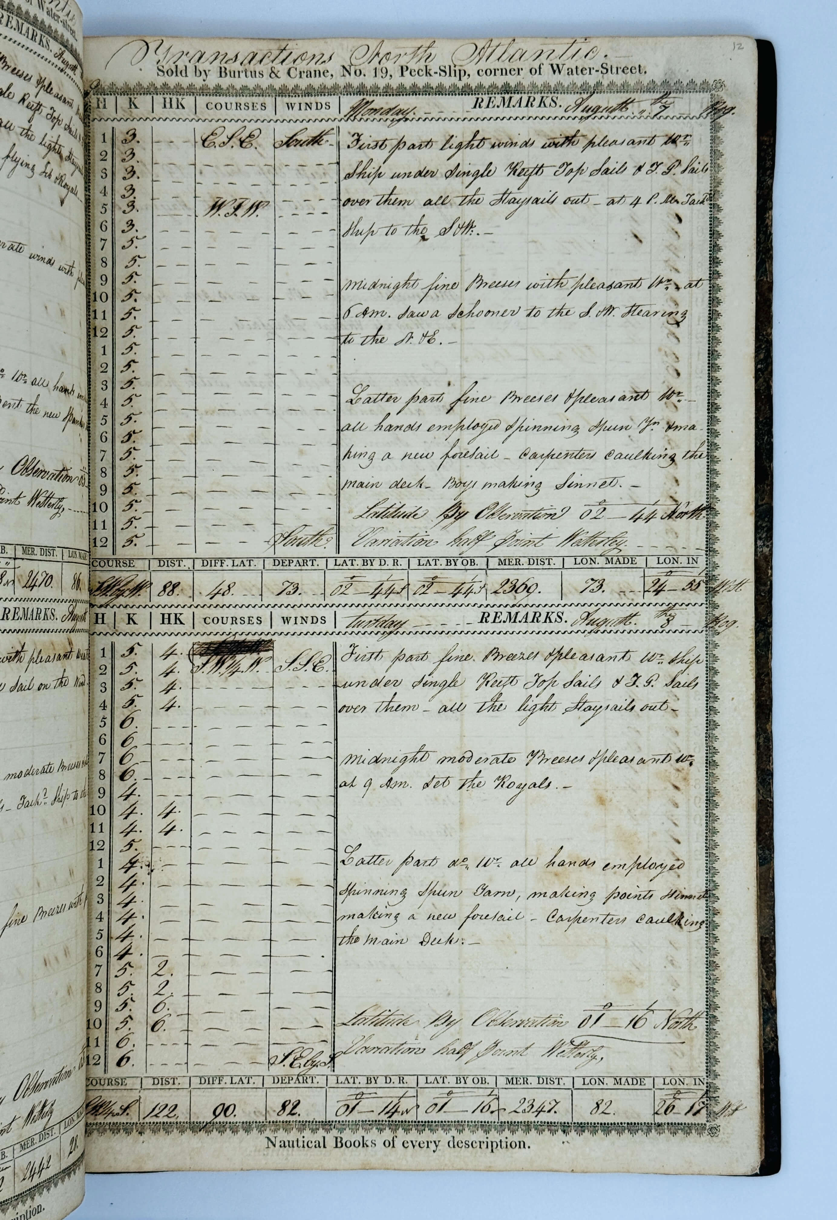
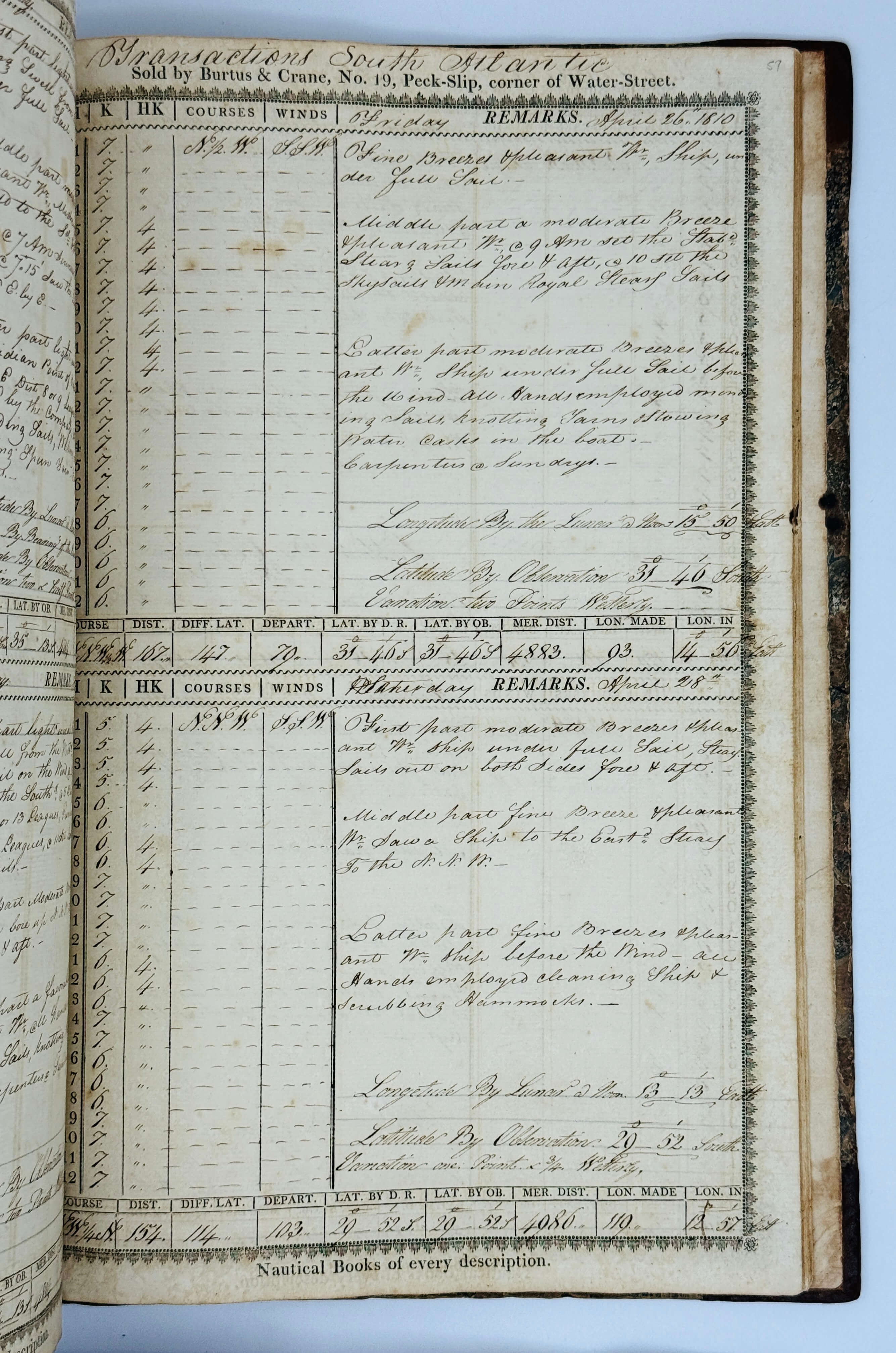
The logbook follows the “America’s” voyage day by day, thoroughly recording the ship’s geographical position and course, weather, winds, currents, operations with sails, sundry works on board and ship’s repairs, geographical objects passed, vessels encountered, termometer readings (in the Strait of Alas and Western Pacific Ocean/ Philippine Sea), the number of the day of the voyage, and various events (comets, caught sharks, fights on board, an incident with a crew member falling overboard, &c.). Very interesting is a lengthy description of interactions with the inhabitants of the “Bally town” on Lombok Island, where an “American ensign” was flying on shore, notes about the sighting of an unknown island in the Western Pacific Ocean, “two large comets” in the Indian Ocean, endured storms, various events on board, names of encountered ships, &c.
Overall, an important content-rich source on the history of early American trade voyages to China at the beginning of the 19th century. One of the latest mentions of the ship “America’s voyage to Canton, still commanded by “Captain Mather” and owned by “Messrs. Minturn & Champlin,” dates back to 1815 (Alexandria Gazette. Alexandria, Virginia, 11 October 1915, p. 1).
Excerpts from the logbook:
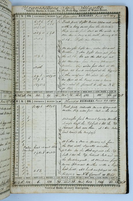
June 24, 1809. Transactions North Atlantic. These 24 hours begins with light winds and pleasant weather, at 4 a.m. got under way with a light breeze from the south west, at 11 a.m. […?] of Sandy Hook discharged the pilot. The wind hauled to the west. Set all the tending sails below and aloft. Several outward bound vessels in company. The America outsailed them all...
July 15, 1809. Transactions North Atlantic. <…> @ 8 a.m. saw a brig to the south and west, stearing [sic!] to the north & east, I took her to be a king’s brig.
August 17, 1809. Transactions North Atlantic. <…> @ 10 a.m. saw an Hermaphrodite Brig to the west steering to the N.W…
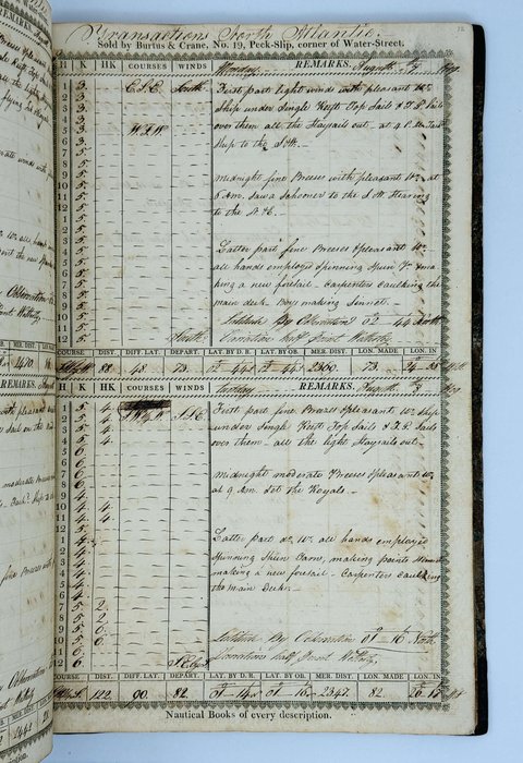
September 25, 1809. Transactions Indian Ocean. <…> All hands employed trimming ship, got some bales of cotton out the fore hold […?] them in the cabin, filled 8 casks with salt water between decks, sailmakers mending sales, carpenters repairing jolly boat.
October 16, 1809. Transactions Indian Ocean. <…> Ship under full sail, all hands employed getting the guns out the main hold & mounting them, carpenters at the boats.
October 21, 1809. Transactions Straits of Alas. <…> @ 5 a.m. made the land, Lombock & Sambawa, western extremity of Sambawa bearing north <…> @ 7 a.m. saw the Peak of Lombock, bearing N. by W. dist. 3 or 4 leagues <…> got to the mouth of the Strait of Alas. At 1 p.m. came too with the small bower in 14 fathoms water, sticky bottom, Bally town bearing N.W. by west dist. 2 miles. Furled all sail & out all boats ready for watering. Saw an American ensign flying on shore at Bally town. At 3 p.m. out all boats mannd [sic!] & arm’d, went on shore to the town of Bally. First & second officers. Treated well by the natives…
The Land at the entrance of the Straits of Alas both on the Lombock & Sambawa sides is very remarkable - there projects from the Island of Lombock, about 100 yards a Rock, resembling much in form a cannon with the mouth planted downwards, as you pass the mouth of the Straits, this Rock sheets in & the little Town of Bally, opens to the view, it consists merely of a few huts belonging to the natives who received us in a friendly manner & immediately commenced trafficking [sic!] their productions wh. consists chiefly of ducks, fowls, cocoa nuts, plantains, & other fruit generally found in these Latitudes, for money, jack knives, looking glasses & particularly rasors [sic!] - they take care however to get the full value of what they dispose of, & are no novices in making a bargain. They demanded 10 dollars or 4 muskets for permission to fill our water, which proved to be very brackish - they however let us have some fine turtle. The inhabitants of this Island are of a copper colour, middling stature & well made, they chew great quantities of Beetle [sic!] nut wh. renders their teeth black & their gums very red. They are all armed with axes & spears & wear nothing but a piece of calico <…> tied around the middle. The King to whom we were introduced was sitting on his throne which was composed of a block of wood, surrounded by his guards who were armed in the manner already described, he received us very graciously and promised to supply us with whatever we stood in need of.
October 22, 1809. Transactions in Bally Roads. First part fresh gales & clear w[eathe]r, at 4 a.m. got the long boat & pinnace out & commenced watering the ship. At 8 a.m. got all the water & stock on board.
Monday, October 23, 1809. First part calm with pleasant weather. At 5 a.m. got the boats in. At 8 a.m. King & a great many of the natives came on board to see the Captain & the ship. Bro’t some fruit off as a present to the Captain, at 10 a.m. got under way with a light breeze from the south…
November 11, 1809. Transactions Celebean Sea. <..> @ 4 a.m. an island in sight, N.W. by W. dist. 6 or 7 leagues* <…> This island I did not find laid down in any chart, Capt. Mather in ship Aeolus from the Cape of Good Hope bound to China first discovered it on Sunday the 30th of November 1806 about 3 p.m. in the bearing N.O. by E ½ E. dist. 5 or 6 leagues. <…>
November 25, 1809. Transactions China Sea. <…> @ 4 p.m. made the Bashee Islands bearing west, dist. 8 or 9 leagues…
November 26, 1809. Transactions China Sea. <…> @ 10 a.m. passed several fishing boats.
November 27, 1809. Transactions China Sea. <…> @ 4 p.m. made the Great Lemma Islands, bearing W.N.W. dist. 5 or 6 leagues, same tie sounded in 28 fathoms water, fine grey mud…
November 28, 1809. Transactions China Sea. <…> @ 6 p.m. the peak of the Great Ladrone bore east ½ south distance 2 leagues…
November 29, 1809. Transactions China Sea. <…> @ 3 p.m. took a pilot for Macao, the peak of the Great Ladrone bearing S.E. by E. 3 miles. <…> @ midnight came too with the small bower anchor in 5 fathoms water. Furled all sail. The compadore went on shore for a pilot, @ 9 a.m. the compadore came off with some fresh provisions & hopes of getting a pilot the next day. <…> We were informed of several Ladrone corsairs being out.
February 24, 1810. Transactions China Sea. <…> @ 6 p.m. discharged the pilots, Macao bearing W. ½ S. dist. 3 or 4 leagues <…> @ 4 a.m. the Middle Island, bore east 2 leagues <…> @ 7 a.m. lost sight of the Frances Henrietta…
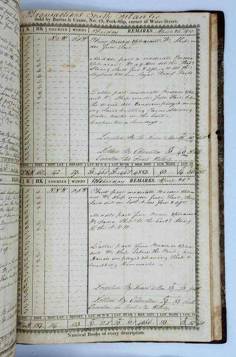
March 9, 1810. Transactions Straits of Gasper. <…> @ 6 p.m. saw the ship Ocean at anchor to the South of us, @ 9 got under sail to the best advantage of the wind, the ship Ocean in company <…> Latter part d[itt]o. wind & w[eathe]r, & Meridian the Brothers bore N.E. 2 leagues, the farthermost point of Sumatra in sight S.W. by W. 7 or 8 leagues. Spoke the ship Ocean & parted with her.
March 11, 1810. Transactions Java Sea. At anchor. @ 10 a.m. was boarded by the Gov. of Batavia boats. Latter part light airs & calm with cloudy wr. @ Meridian South pt. of Cracatau S.W. by W. ½ W., Center of Middle Islands NE. by E. ½ E., Center of Tamarin Island N.W. ½ W…
March 13, 1810. Transactions Straits of Sunda. <…> @ 6 p.m. Java head bore S.E. dist. 12 leagues from which I take my departure, <…> lost sight of the ship Ocean, Capt. McPherson…
April 23, 1810. Transactions Indian Ocean. <…> Caught 2 sharks & two albatrosses. Put the ship’s & Captain’s name with the Lat. & Long. of ship around the neck of one A. & let him go.
April 24, 1810. Transactions Indian Ocean. <…> Saw two large comets the blare of which lasted nearly 5 minutes.
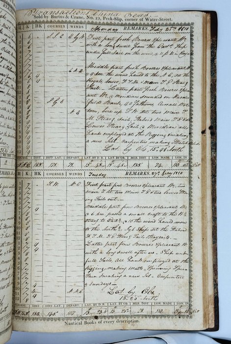
May 11, 1810. Transactions South Atlantic. <…> @ 3 p.m. James Tylee fell overboard, rounded the ship too & lowered the gig, found she was sinking & lowered the jolly boat after her.
June 1, 1810. Transactions Western Ocean. <…> @ 3 p.m. heard a noise on the main deck, went forward & found Henry Lockwood had Mr. Clark, the second officer under him on deck, the Captain & myself parted them.
June 2, 1810. Transactions Western Ocean. <…> @ 5 a.m. saw a sail to the N. & E. standing to the S. & W. @ 6 bore off N.W> by N, @ 10 a.m. spoke & boarded the brig Sally & Eliza, Captn. Bell, 21 days from Alexandria bound to Antigua, all well.