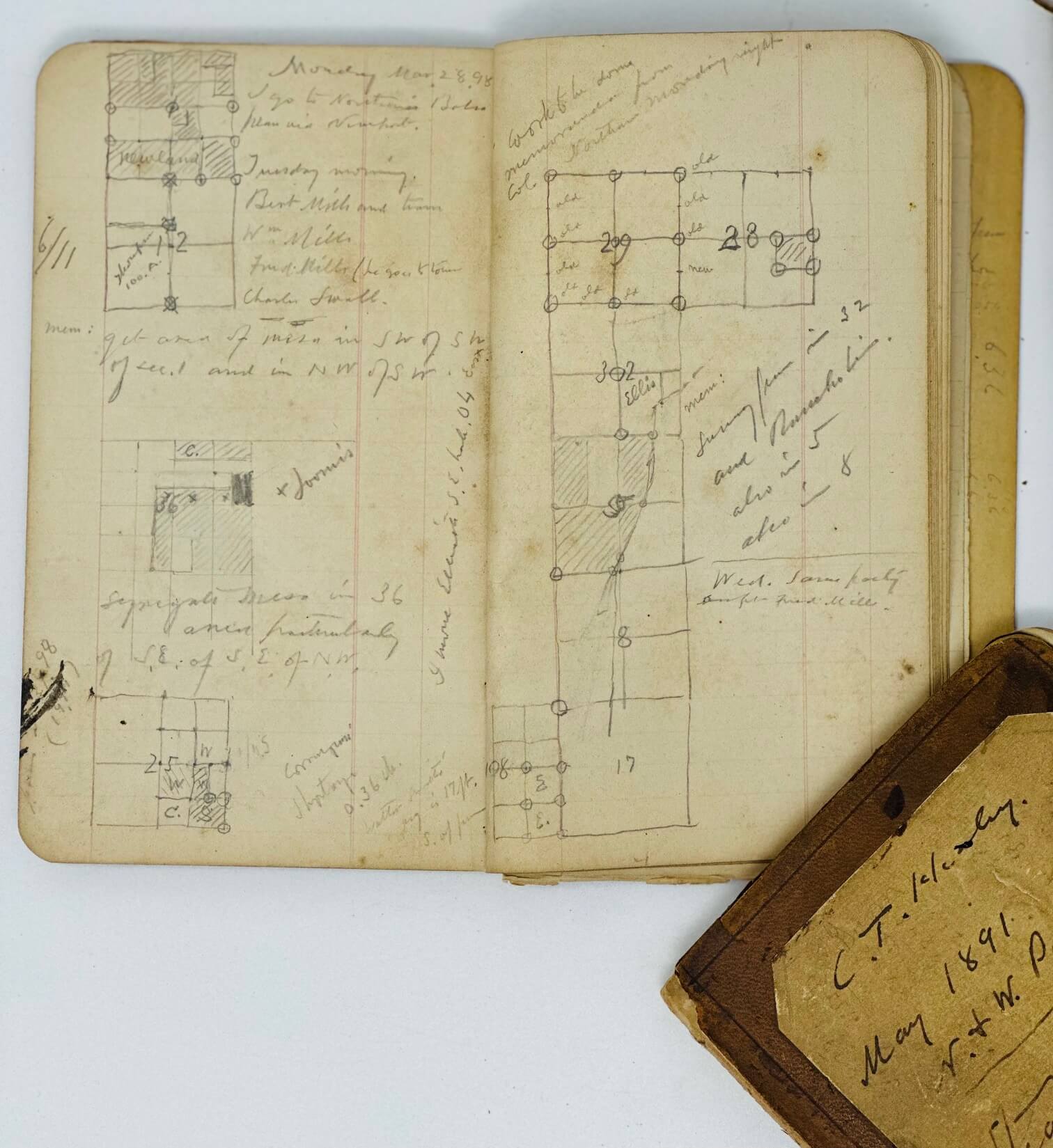


#MB63
Ca. 1882-1904
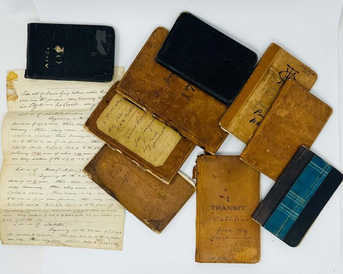
Nine original notebooks, from ca. 20x13 cm (7 ¾ x 5 in) to ca. 9x15 cm (3 ½ x 5 ¾ in). From 83 to 30 leaves (in all over 850 pp of text). Pencil and ink on lined or graph paper, numerous calculations and graphs in text. All notebooks with Healey’s name and address written in pencil on the first leaves; six – with pencil or ink notes about the notebooks’ contents on the front cover. Five period brown full sheep, three period black cloth bindings and one period brown hardcover. Notebooks rubbed on extremities, several with occasional tears or losses on the spines, but overall a very good collection. Manuscript field notes: ca. 1893. Folio manuscript, 31,5x20,5 cm (12 ¼ x 8 in). 6 leaves (filled in on rectos). Brown and red ink on lined paper, occasional pencil notes in text. Fold marks, paper slightly age-toned, residue of old glue in the left upper corner of the first leaf, otherwise a very good manuscript.
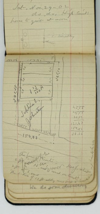
Historically significant, extensive collection of nine rare original manuscript notebooks and field notes by an outstanding pioneer land surveyor of California, Charles Terraine Healey, who gained prominence by his surveying and mining work in Santa Clara County in the 1850s-1860s, and in the Los Angeles area in the 1870s-1900s. In 1882, Healey became the first resident of Willmore City (modern-day Long Beach) and created its first map the same year. The notebooks contain Healey’s notes on early land surveys in various parts of modern-day Greater Los Angeles, including the first mapping of Willmore (Long Beach) in 1882, survey for the partition of Narbonne and Weston’s land in Rancho Los Palos Verdes (near modern-day Lomita), road on the Santa Catalina Island, a portion of the Southern California Railway from South Riverside to Olive, detailed notes on Long Beach and its environs, his participation in the early oil drilling in the Puente Hills near Whittier (with the data on over forty oil wells Healey got involved with) &c. The manuscript map in Notebook [1] (July 26 – November 17, 1882), drawn under the entry from October 10, 1882, is a survey of the lot in Willmore (modern-day Long Beach), where Healey built his house (Ocean Park Avenue, between Locust and American Avenues). The notebooks contain a mine of personal names of land owners, government officials and public workers in the Greater Los Angeles area at the time (Aurelio and Juan Sepulveda, Jotham Bixby, Nathaniel Narbonne, Ben Weston, Don Abel Stearns, Captain William Banning, Judge Pierce, Colonel Robert Northam, and many others).
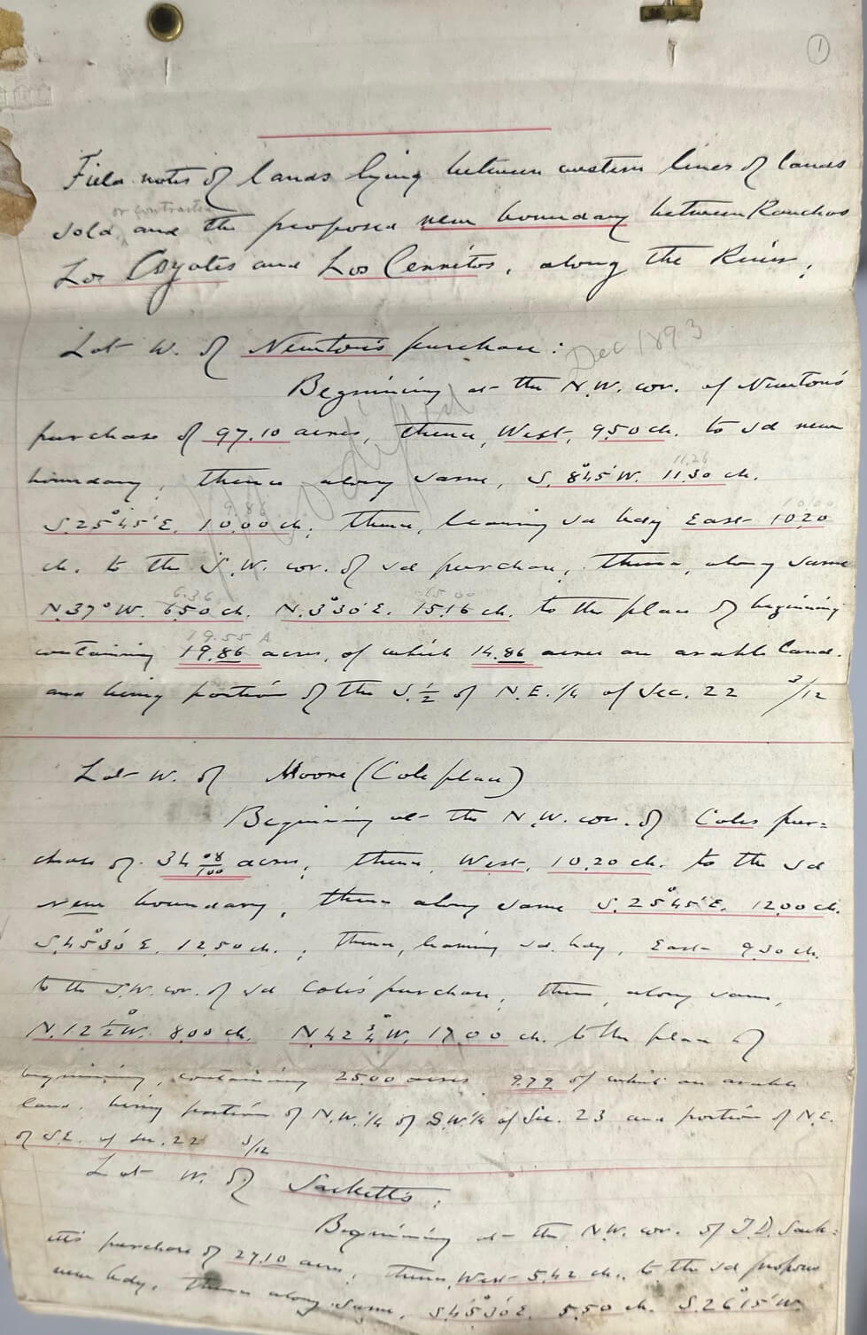
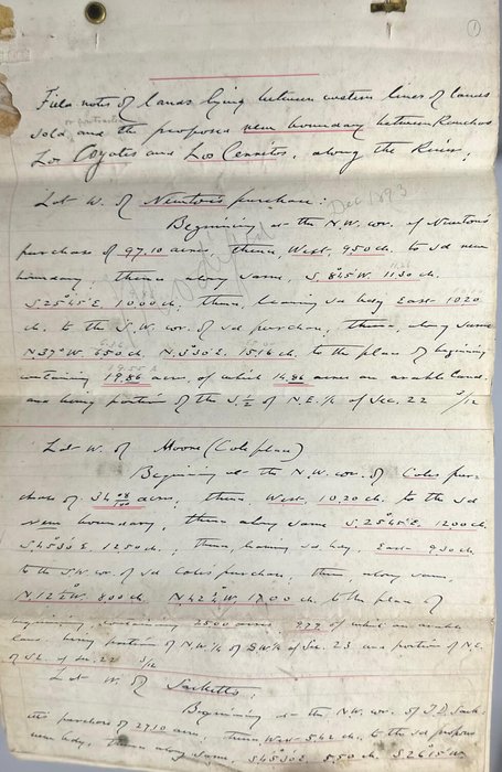
The Folio manuscript is titled “Field notes of lands lying between western lines of lands sold or contracted and the proposed new boundary between Ranchos Los Coyotes and Los Cerritos, along the River” and defines the size and borders of the lots west of the properties by “Newton,” “Moore,” “Sackett,” “M.B. Pages,” “McGaugh,” “Goodwin,” “Walderman,” “Alexander,” “Freeman,” “Dodson,” and “Oliver Davis” (all in the Greater Los Angeles area). The text on p. 5 describes the land in “T.3 S. R.12 W. R.B.M.” (Township 3 South, Range 12 West, San Bernardino Meridian) – the area of modern-day cities of Paramount, Bellflower and Downey (Greater Los Angeles).
Overall historically important, content-rich collection of early rare original materials on the land survey, oil drilling and mapping of the Greater Los Angeles area.
A list of notebooks:
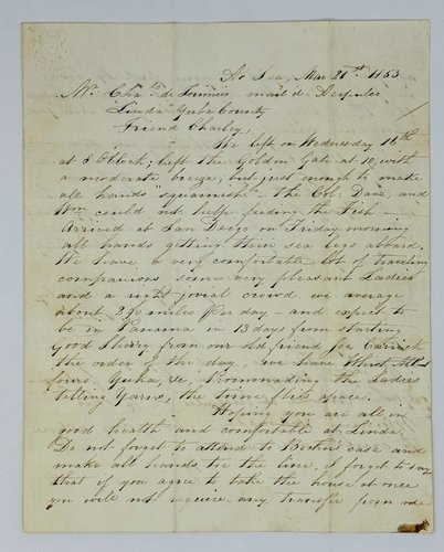
1. [July 26 – November 17, 1882. Wilmington, Los Angeles, Machado, Cerritos, Mapping of Willmore, &c.]. 46 leaves (ca. 79 pp. of manuscript text). Period brown full sleep binding. Healey’s name and address written in pencil on the first leaf. Ink manuscript date on the front cover.
The notes mention Aurelio Sepulveda, Juan Sepulveda, Bixby, Narbonne & Weston, McDonald, Downey, Lane, Bank, and others.
Notes include:
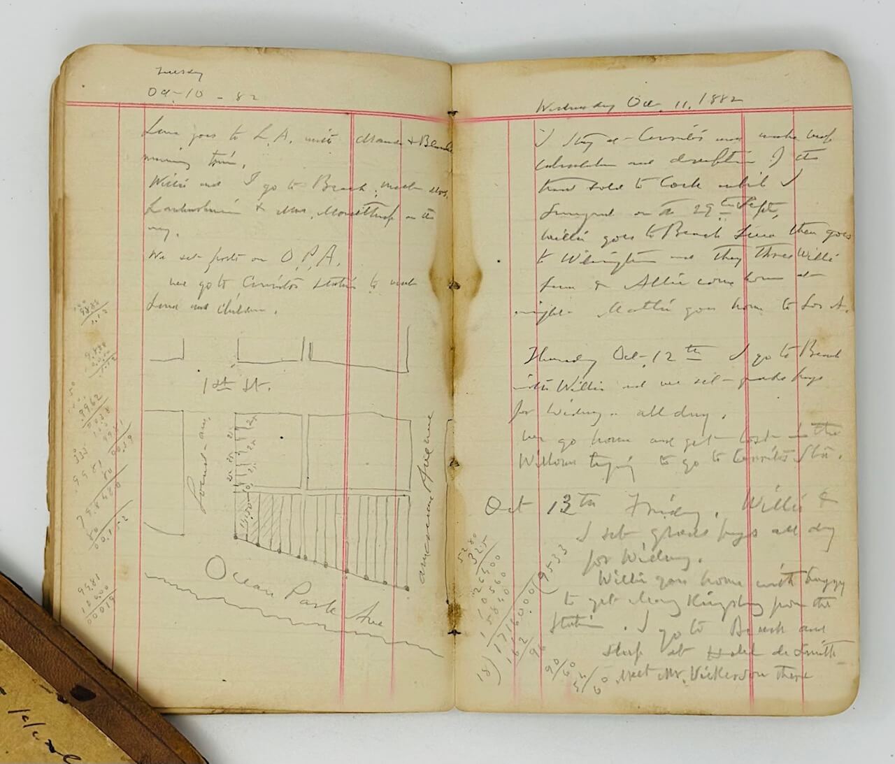
July 31, 1882. From 3x3 post east of Machado. The Machado house bears N871/2 W.
Aug. 3rd 1882. Survey with Knox for line of R.R. 200 ft. steep.
Aug. 21, 82. Do levelling at Cerritos.
Sunday, Sept. 10th 1882. I work in office in Wilmington all day making tracing of peak of San Pedro.
Oct. 10, 82. We set posts on O[cean] P[ark] A[venue].
Saturday, Oct. 14th 1882. A terrible sand storm today. I took down the tent. <…> I work on maps of Willmore in the office room of Smith’s hotel house.
Sunday 15th. Work on […?] map of country around Willmore at Cerritos.
2. [August 16 – October 20, 1887. San Fernando & environs]. 47 leaves (ca. 84 pp. of manuscript text). Period brown full sleep binding. Healey’s name and address written in pencil on the first leaf. Ink manuscript date and notes on the front cover.
Notes include:
August 16, 1887, Take morning train to San Fernando. <…> We travel westerly, and note the distance of each of […?] mile post along the Van Neys line…
Monday, Sept. 12, 1887. Stearns. W.F.S., W.S.H. and I do with Geo. […?] & team from Long Beach to Las Bolsas <…>. They commence at […?] S.E. cor. (at New Hope school house N.W. cor. thereof) <…> to center of new channel of Santa Ana River.
Sept. 27th. Take morning train for San Fernando. Go out on Wright teams and Mrs. Wright drives me over to our camp at Ben Smith’s. <…>
Wednesday, Sept. 28. I go out and start the [boys?] and go back to camp and work on map. Flies very bad and it is also very hot. Our cook goes to town and has not yet come back.
The notes mention the properties of Don Abel Stearns, Captain William Banning and others.
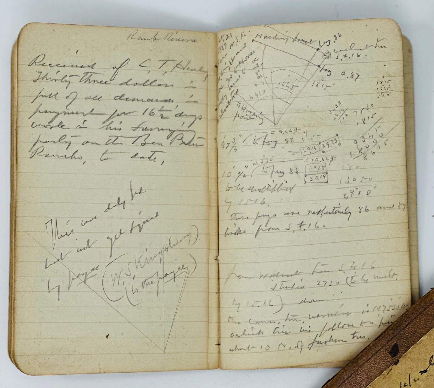
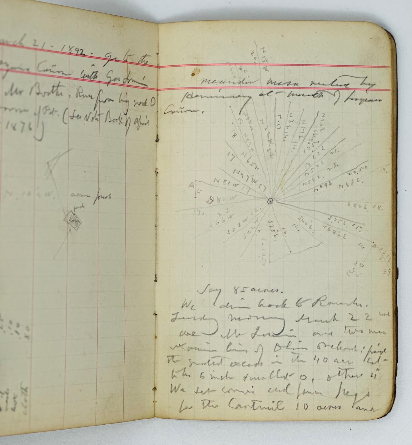
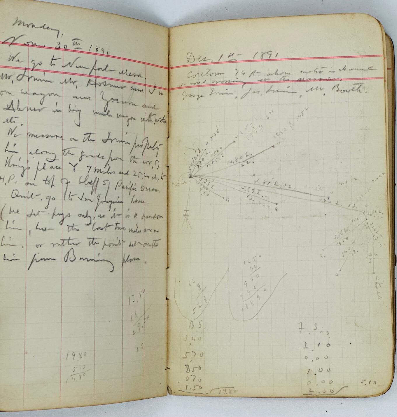
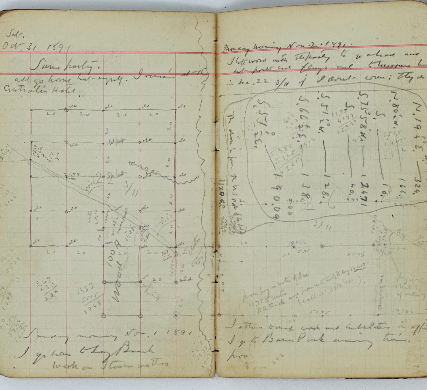
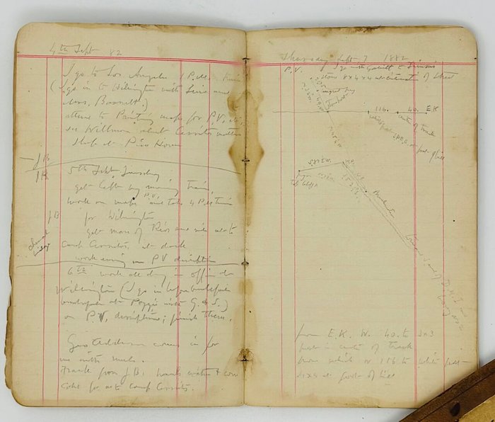
3. [May 24, 1891 – April 17, 1892. Narbonne & Weston Partition. Stearns Ranches. San Joaquin. Long Beach (Terminal Railway)]. 40 leaves (80 pp. of manuscript text). Period brown full sleep binding. Healey’s name and address written in pencil on the first leaf. Ink manuscript date and notes on the front cover.
Notes include:
May 24, 1891. I make a map of the property at home at Long Beach.
May 25, 1891. I do to P.[alos] V.[erdes]. <…> We drive out to Juan Ignacio’s near P.V. Lake. Find no vestige of our things we left there in 1887 of course. <…> [Next page]. Begin at S.W> cor. [Jimenes?] lot (A). Run N. 8.30 to B <…>.
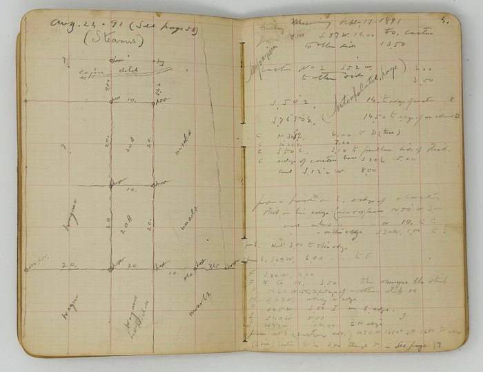
Wed. Sept. 17, 91. I go to town, attend to repair on San Gabriel River.
Thursday, Sept. 18th. John Verrable and Gibson resume N.+W. survey.
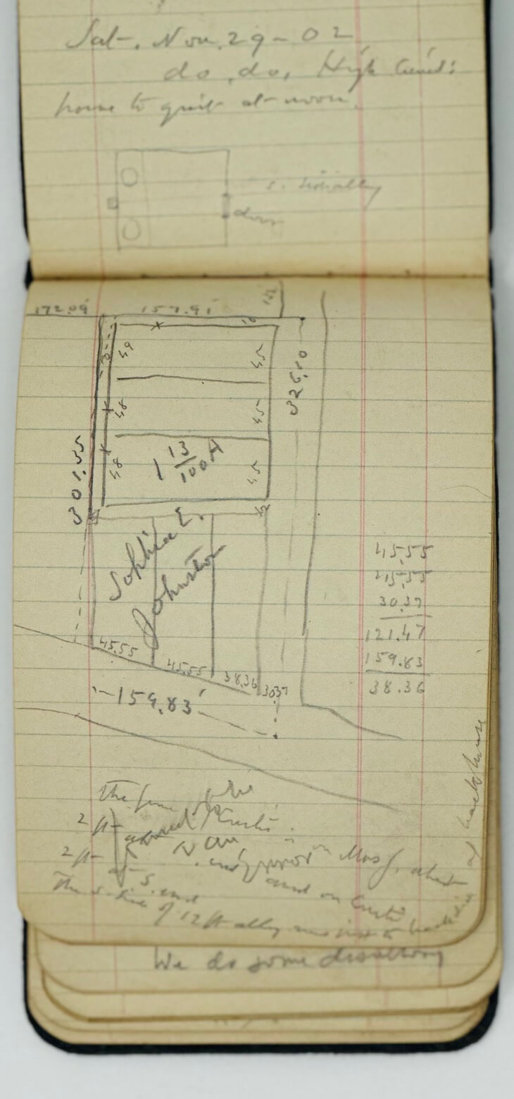
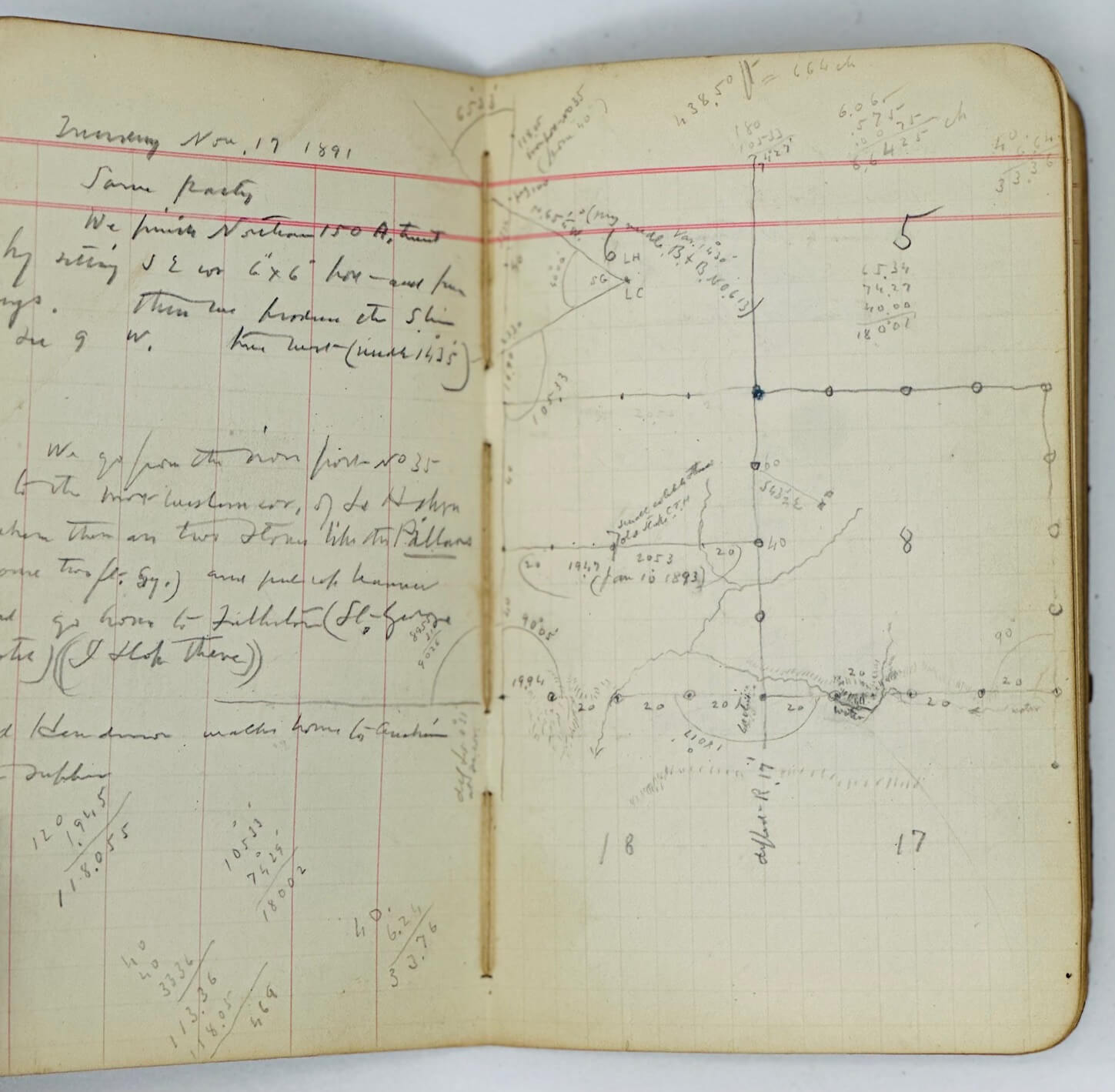
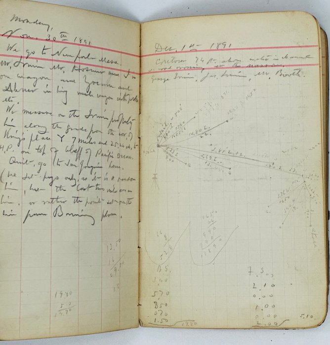
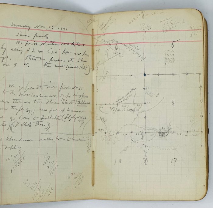
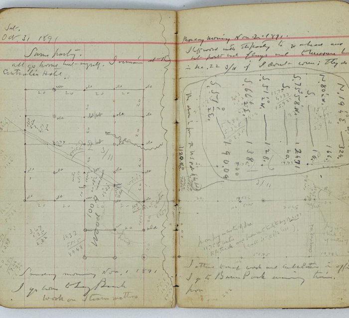
Sat., Nov. 7, 1891. I send the party to Fullerton to cut the brush on sec. line w. of town. I take 11 a.m. train at Northam station for Fullerton. Team meets me there. The boys have cut the brush on E. line of Sec. 32 3/11 and have measured the S. […?] of the Sec. from Bancroft cor. (Orange Thorp), east 80 comes to the culvert.
Sat. Nov. 14th, 1891. Levelling for Long Beach city [connect.?]: Golden to Magnolia, Mag. Ave to Chestnut Ave, [Chestnut?] to Pacific Ave., Pacific Ave. to Pine, Pine to American, Am. Ave. to […?].
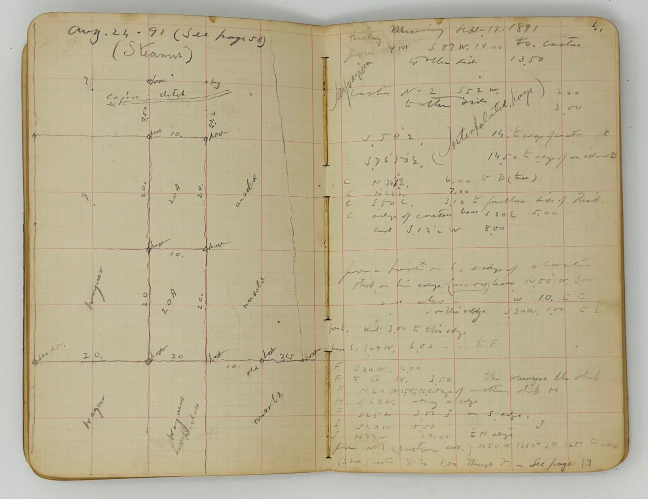
4. [April 6 – September 10, 1891. Stearns. San Joaquin.]. 30 leaves (60 pp. of manuscript text). Period brown full sleep binding. Healey’s name and address written in pencil on the first leaf. Ink manuscript date and notes on the front cover.
Notes include:
April 6, 1891. <…> I take the 9:37 train for Anaheim. We take train after lunch and go out to Bottsford’s at the old R.J. Northam place…
Monday, June 15th, 1891. I go up to Los A. preparatory to going to Anaheim for Stearn’s work <…>
Thursday afternoon, June 18. We go to [Stearns?] and finish that water district matter. Telegraph Judge Pierce to meet me tomorrow.
Monday, June 22, 1891. We finish subdivision of Sec. 27 4/10 afternoon (make new reel at noon).
Monday, July 6th. I go to Los A. <…> I fix my application for license surveyor.
13 July, Monday. Work on Stearns office work at Main St. office and upon the map of the Bolsa drainage matter.
July 24, 1891. Examine lots in San Pedro. Narbonne and Weston estate.
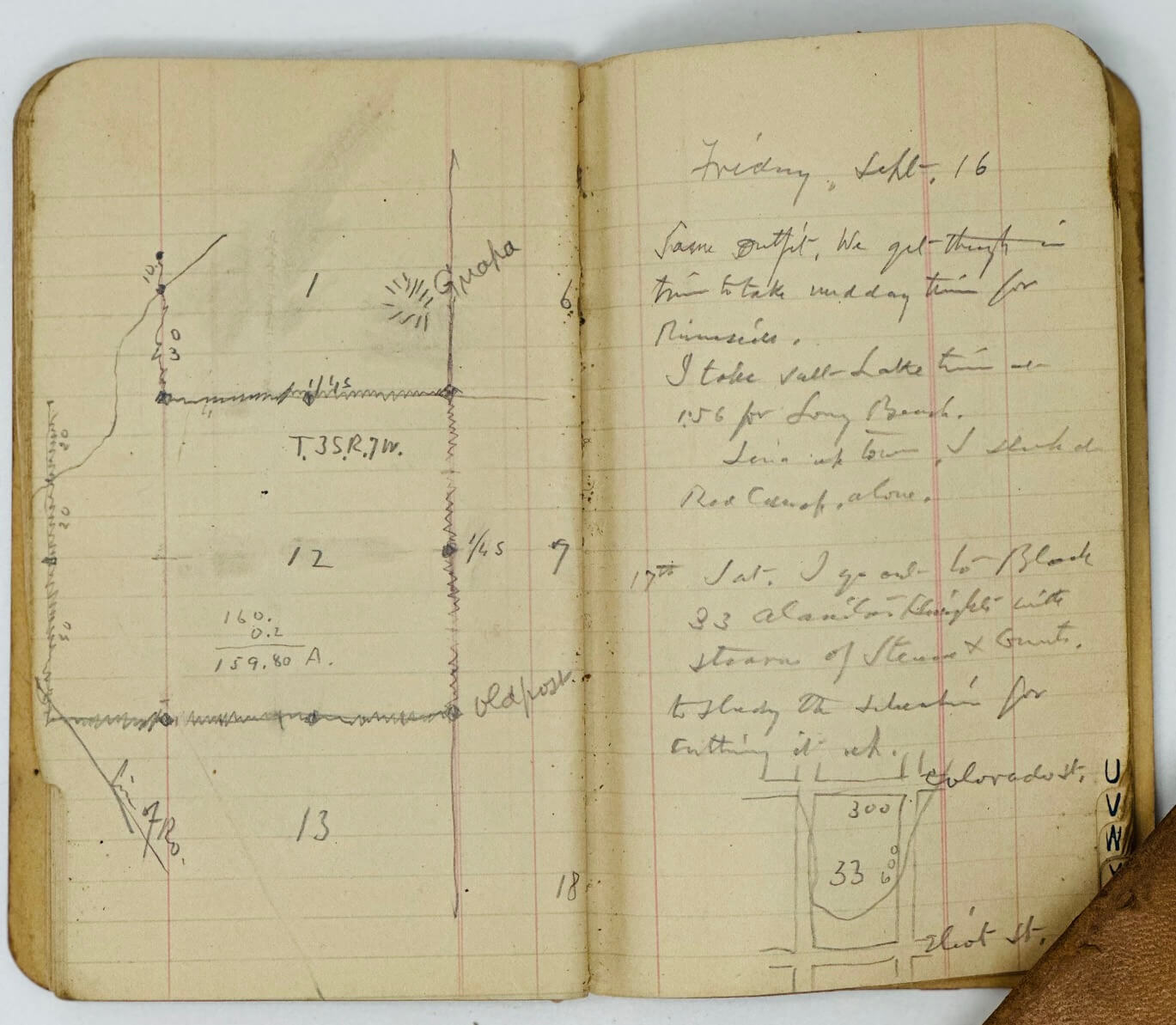
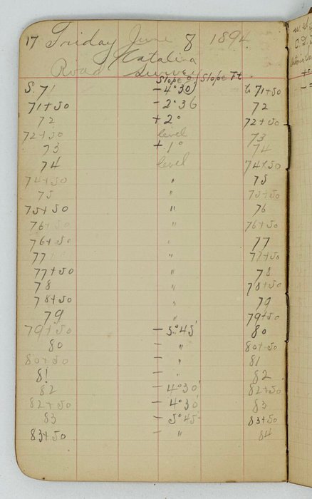
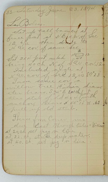
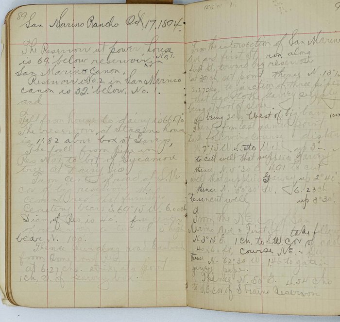
5. [June 5 – October 17, 1894. Santa Catalina Island Road Survey. Rancho Las Bolsas, Stearns Rancho, San Marino Rancho].30 leaves (60 pp. of manuscript text). Period brown full sleep binding. Healey’s name and address written in pencil on the first leaf. Ink manuscript date and notes on the front cover.
Notes include:
Catalina. June 5th, 94. Avalon. 6.00 a.m. Levels from high water mark (nail in pile at end of wharf) to well up Summer Ave.
Catalina Island. Thursday, June 7, 1894. C. From 2x2 on summit run road toward middle rancho…
Tuesday, June 19, 1892. Las Bolsas. From a 4x4 post at the N.W. cor. of Sec. 5. Run East through water, at 20. Ch 2x4 post 4” above ground.
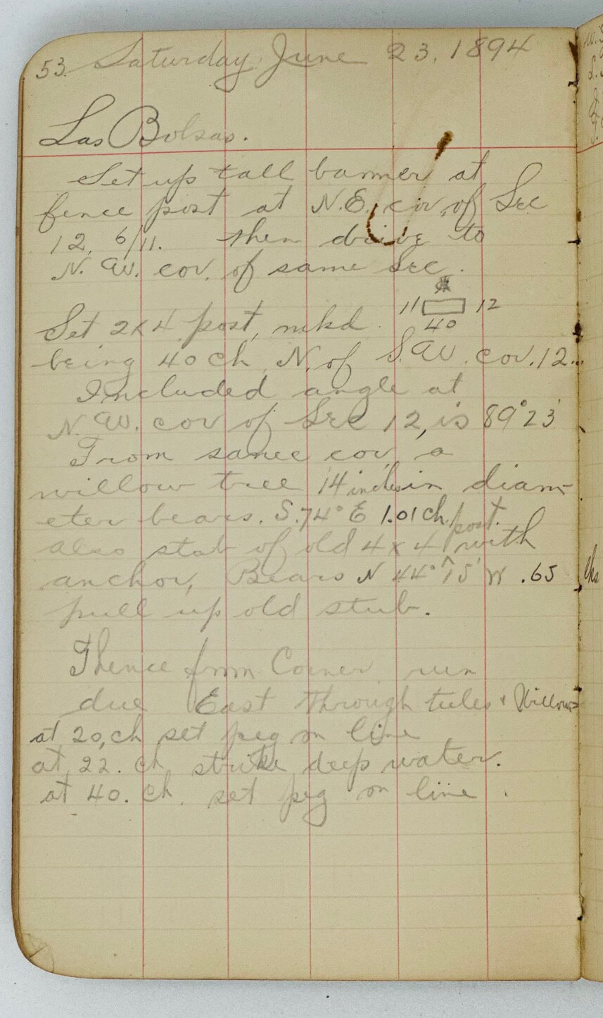
Saturday, June 23, 1894. Las Bolsas. Set up tall corner at fence post at N.E. cor. of Sec. 12 6/11. Then drive to N.W. cor. of same Sec.
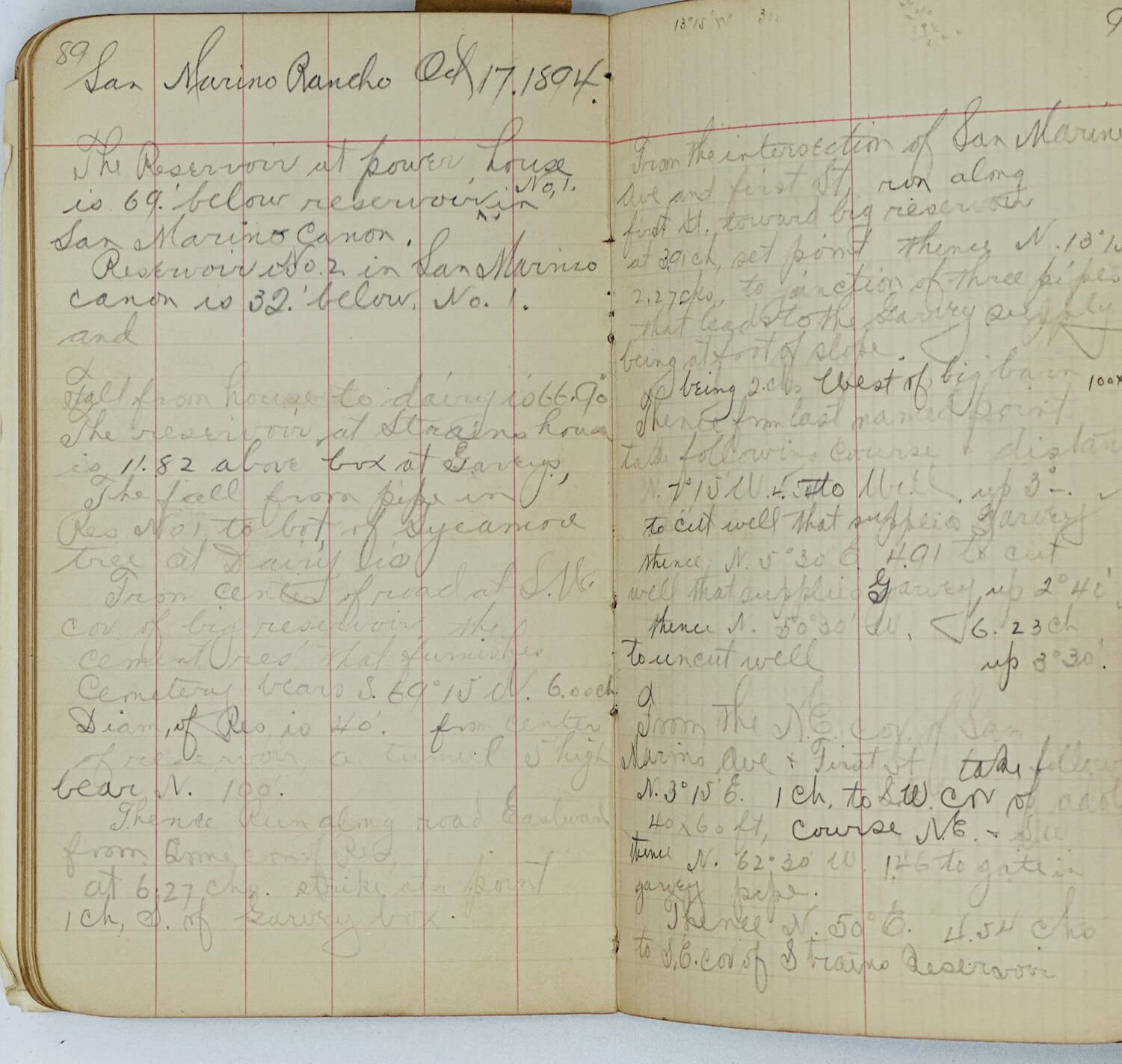
Monday, Sept. 24, 1894. San Marino Rancho. From the top of a box over well (which is cut 10’ below top of box) which the water in pipe flowed over before it was cut in the San Marino Canon being the highest water supply on place run contour.
San Marino Rancho. Oct. 17 1894. The reservoir at power house is 69’ below reservoir in No. 1 San Marino Canon. <…> From the intersection of San Marino Ave. and first St., run along First St. toward big reservoir at 3,91ch <…>
6. [August 10, 1895, 1899. Elevation of various points on line of Southern California Railway from South Riverside to Olive. San Bernardino to South Riverside, omitted in the foregoing pages].60 leaves (ca. 115 pp. of manuscript text). Period black full cloth binding. Healey’s name and address written in pencil and ink on the first leaf.
The first list includes the data for the elevation and distances and bridges between South Riverside, Rincon, Gypsum, Yorba, Olive, Orange, Santa Ana, Anaheim, Fullerton, Northam, La Mirada, Santa Fe Springs, Riviera, Bandini, Manhattan, Los Angeles, Aliso, Irvine, Modjeska, El Joro, Capistrano, San Juan by the Sea. The second list contains the data for the stretch of railroad from San Bernardino to Colton, E. Riverside, Riverside, Pachappa, Casa Blanca, Arlington, Aloora, and South Riverside.
Tuesday, Oct. 17, 99. Work on stretch of country through which Union Oil Co. pipe line will run.
Wed. Oct. 18, 99. I go to Fullerton with Burrows. We go with team and down to mouth of Brea Canyon. Measure from left bank of Brea creek…
7. [February 2 – June 2, 1898. Puente Whittier Oil Field, Bastanchury Ranch]. 78 leaves (ca. 150 pp. of manuscript text). Period brown hardcover binding. Healey’s name and address written in pencil on the first leaf. Ink manuscript date and notes on the front cover.
The notebook contains “memos” (characteristics of over forty oil wells, located in the Puente Hills).
Feb. 2, 1898 <…> We go to a stake <…> on steep south slope <…> This is east of Roger’s home near the San Juan Cajon line back of Fullerton near where the pipe line will run to Fullerton.
After Tuesday, Feb. 15, 1898. <…> Then we resume work on hill No. 7 our claim at oil wells.
Friday, Feb. 18, 98. Attend to the current work and map of Whittier, also map of Puente.
After Wed., March 2, 98. Mem. of wells: <…> No. 5: depth 1220. First oil 250’. Continues to 350’. At 430 regular […?] oil and gas. 445 to 500 oil formation. Gas at 460.
Thursday, March 10, 1898. Rain all day at Bastanchury’s. Jamie and I work on […?] of our work here and at Puente oil wells.
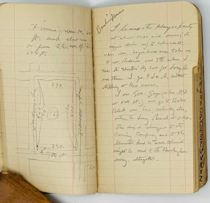
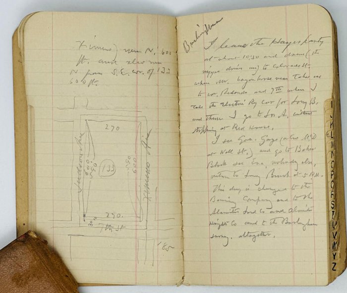
8. [August 10, 1902 – October 13, 1903. Los Angeles County, Long Beach, Union Oil Co. of California]. Ca. 83 leaves (ca. 155 pp. of manuscript text). Period black full cloth binding. Healey’s name and address written in pencil on the inner side of the front cover; notebook’s manuscript title written in pencil on the first leaf. The date of the first record cut out on the front cover.
Notes include:
Monday, 11th [August 1902]. I go to Proctor’s place on Am. Ave. and set the N.E. cor. and the north line of Proctor’s half of Farm. Cot. <…> This work is for the Union Oil Co. of Cal. for pipe line. The pipe (6 in) is distributed on the ground ready for the trench.
Monday, Aug. 18, 02. Mr. Schmidt and I with little Miss Meyer as driver go to the N.W. cor. of the Meyer place and commence the survey of the Meyer place [at Santa Fe Springs].
Wed. Aug. 20, 02. I go to Clearwater. Do some desultory levelling on the old River line just east of Gregory’s for R.C. Andrews. He drives me to Clearwater in time for the noon train. I go to Bixby Sta., walk up to the Union Oil Co.’s tank. I test my level at the pond near tank (the Bunning level) and walk down along oil pipe lines to Burnett sta. I examine the Bonton and L.B. Del. water reservoir on the way. It is perfectly squirrel proof.
Wed. Sept. 17. I go out alone to Bixby and change the route of the new […?] road under the railway.
Wednesday, Oct. 22, 02. We go to Los Angeles, attend Harry Bixby’s funeral [a son of Jotham’s Bixby].
9. [March 31 – October 3, 1904. Long Beach and vicinity]. 48 leaves (ca. 89 pp. of manuscript text). Period black full cloth binding. Healey’s name and address written in pencil on the first leaf; notebook’s manuscript title written in pencil on the inner side of the front cover.
Notes include:
Thursday, March 31, 04. I go with Mr. Hyde wagon and Harry Hyde and get […?] for posts on S. line of Palm Island […?] (N/e/ block, also on E. and W. sides of blocks 2-4, P. Island).
Aug. 2, 04. J. Bixby Co. I go with Mr. Mohrenstecher and Waller Brown to Los Alamitos (Sugar Town) to survey line for fence through sec. 28 4/11.
Tuesday, Aug. 9, 06. I call on Shaw and Stearns and Foster and Burlingham. Stearns & […?] had a fire Sat. night next door to them and it came in through their window at side. They now are at 116 E 1st St.
Charles Healey “was born in North Hartland, Vt., July 31, 1833, was educated at the Perkinsville Academy, and in young manhood took up the study of surveying. After a short time passed in New York he came to California in 1854, locating at San Jose, where he established himself as a surveyor, and made his home one of the characteristic and picturesque California adobe houses of that period, now the only one of its kind left standing in San Jose. While living in that town, he was city clerk from the year 1856 to 1858, and city engineer from 1862 to 1866, having been county surveyor of Santa Clara county from 1856 to 1858. For many years he was also mining engineer of two quicksilver mines, the New Almaden and the Guadalupe, near San Jose. He was the first licenced surveyor in California, and his work for the Banning, Rindge and Irvine families in this state included the building of the Conejo dam in Ventura county and the surveying for the building of the old stage road on Santa Catalina Island. Many times Mr. Healey was called upon to testify in litigation suits in court regarding boundary lines, and his testimony was never questioned, his word being law in all such cases. Several glass models of mines made by him are now on exhibition in the Ferry Building at San Francisco, having been exhibited at the World’s Fair in Chicago. At the outbreak of the Civil war he organized and was made captain of the home guards at San Jose. In his great surveying enterprises it is said that every Spanish grant of land south of San Jose, Cal., was surveyed by him.
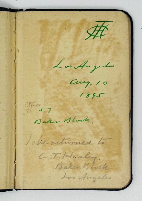
It was early in the ‘70s that Mr. Healey came to Los Angeles, where he at once made for himself a prominent place among the surveyors of this city, being engaged in the surveying of several great ranches for the Bixbys, extensive land owners in this county, and was engaged to survey the property covering four thousand acres which the Long Beach Land Company purchased from Jotham Bixby, where on the present city of Long Beach has sprung up. Mr. Healey has therefore been acquainted with Long Beach from the first, having staked out the sheep pastures of the old ranch into lots for the new city, and having camped at what is now the corner of Ocean and Pine avenues when there was no house in the place but a shepherd’s hut, and served as city engineer for Long Beach and San Pedro several years. Mr. Healey was appointed by the Los Angeles Water Company as arbitrator to represent their interests in the taking of the independent companies. In Los Angeles he continued the practice of his profession at an office in the Baker Block, being active in the surveying along the courses of the Los Angeles and San Gabriel Rivers, as well as in the regions given up to the cultivation of fruits” (Charles Terraine Healey// A History of California and an Extended History of Los Angeles and Environs: Biographical. Vol. II. Los Angeles: Historic Record Company, 1915, pp. 110-111).
“In 1884, the Healeys built a home on East Ocean Boulevard in Long Beach, between Locust Avenue and American Avenue (now Long Beach Boulevard)” (Krythe, M.R. The Man Who Plotted Long Beach// Independent (Long Beach, California), 10 February 1963, pp. 80, 95).